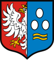
Gmina Kęty
| Gmina Kęty | ||
|---|---|---|

|
|
|
| Basic data | ||
| State : | Poland | |
| Voivodeship : | Lesser Poland | |
| Powiat : | Oświęcimski | |
| Geographic location : | 49 ° 53 ' N , 19 ° 13' E | |
| Height : | 275 m npm | |
| Residents : | s. Gmina | |
| Postal code : | 32-650 | |
| Telephone code : | (+48) 33 | |
| License plate : | KOS | |
| Economy and Transport | ||
| Street : | DK52 Bielsko-Biała - Andrychów | |
| DW948 Oświęcim - Żywiec | ||
| Next international airport : | Krakow-Balice | |
| Katowice | ||
| Gmina | ||
| Gminatype: | Urban-and-rural parish | |
| Gmina structure: | 6 school offices | |
| Surface: | 75.79 km² | |
| Residents: | 34,197 (Jun. 30, 2019) |
|
| Population density : | 451 inhabitants / km² | |
| Community number ( GUS ): | 1213043 | |
| Administration (as of 2012) | ||
| Mayor : | Tomasz Bąk | |
| Address: | Rynek 7 32-650 Kęty |
|
| Website : | www.kety.pl | |
The Gmina Kęty is an urban-and-rural municipality in the powiat Oświęcimski of the Lesser Poland Voivodeship in Poland . Its seat is the city of the same name with around 19,000 inhabitants.
geography
The municipality is part of the Beskydy Euroregion in southern Poland. The city of Bielsko-Biała is ten kilometers to the west. The state border with Slovakia runs about 40 kilometers south. The Soła is one of the waters .
structure
The urban-and-rural municipality (gmina miejsko-wiejska) Kęty has an area of 75.8 km², on which more than 34,000 people live. In addition to the city that gives it its name, the municipality also has six villages with school offices (sołectwa). These villages are (in brackets the number of inhabitants as of Jan. 1, 2008):
Bulowice (4,720), Bielany (1,878), Łęki (1,302), Nowa Wieś (3,209), Malec (1,250) and Witkowice (2,157).
Attractions
In the list of monuments of the province only buildings and the museum in Kety on this day.
Bielany Church is built in baroque style. In addition to the modern Maximilian Kolbe Church, there are also several chapels in Nowa Wieś.
Remains of the Jewish cemetery in Kęty
traffic
The state road DK 52 runs through the municipality and Kęty from Bielsko-Biała - about 12 kilometers to the west, to Andrychów - about 8 kilometers to the east. The nearest international airports are Katowice Airport - 40 kilometers to the north and John Paul II Airport Kraków-Balice - around 45 kilometers to the northeast.
Web links
- City and municipality website (Polish, English)
Individual evidence
- ↑ Julian Zinkow: Oswiecim i okolice. Przewodnik monograficzny . Wydawnictwo "PLATAN", Oświęcim 1994, ISBN 83-7094-002-1 , p. 97 (Polish).
- ↑ population. Size and Structure by Territorial Division. As of June 30, 2019. Główny Urząd Statystyczny (GUS) (PDF files; 0.99 MiB), accessed December 24, 2019 .
- ^ City website, Sołectwa , accessed April 12, 2009 ( WebCite ( April 11, 2009 memento on WebCite ))


