Chicken moor (Verden district)
|
Chicken bog
|
||
|
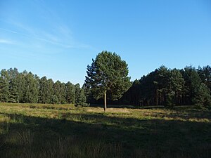
Clearing in the chicken moor |
||
| location | East of Verden (Aller) , Verden district , Lower Saxony | |
| surface | 145 ha | |
| Identifier | NSG LÜ 218 | |
| WDPA ID | 163816 | |
| Geographical location | 52 ° 56 ' N , 9 ° 22' E | |
|
|
||
| Sea level | from 24 m to 40 m | |
| Setup date | 2nd December 1997 | |
| administration | NLWKN | |
The Hühnermoor is a nature reserve in the Lower Saxony municipality of Kirchlinteln in the Verden district .
The nature reserve with the sign NSG LÜ 218 is around 145 hectares in size. It has been under nature protection since December 2nd, 1997. The "Wacholderheide bei Ramelsen" nature reserve, which was designated on May 4, 1930 and is located in the west of the newly designated nature reserve, was incorporated into it. The responsible lower nature conservation authority is the district of Verden.
The nature reserve is located southeast of Kirchlinteln between the Lintelner Stüh forest area on a Geest ridge and the Gohbach lowland. The Gohbach forms the southern border of the nature reserve. The area is a natural section of the Achim-Verden Geests under protection.
Different location conditions occur in the nature reserve. In the north, for example, in the higher area on the Geestrand, dry locations can be found, which are followed by an area with high pressure water from the slope, which sometimes emerges as a spring. In the Gohbachniederung are marshy and vermoorte areas to find. The eastern area of the protected area is predominantly characterized by open areas used as grassland and partly also as arable land. In the Gohbach lowlands, the grasslands are damp to wet. The western area is mostly forested. The forest communities are formed by beech and beech oak forests , as well as swamp forests, depending on the location . In the forested areas there are partially agricultural areas embedded.
The juniper heather in the west of the nature reserve is characterized by a residual heather area with juniper bushes as a relic of the historical cultural landscape, which is followed by wooded areas to the east. A path runs through this part of the nature reserve. The juniper heather is tended by the NABU group in Kirchlinteln.
The area drains to the Gohbach. In the northeast, the nature reserve borders on Kreisstraße 12. A section of the Stadtmusikantenweg runs along the edge of the nature reserve. The Aller-Heide-Radweg also touches the nature reserve in the southeast.
Web links
- "Hühnermoor" nature reserve in the database of the Lower Saxony State Office for Water Management, Coastal and Nature Conservation (NLWKN)
Individual evidence
- ^ NABU group Kirchlinteln , NABU district association Verden. Retrieved July 25, 2018.
- ↑ Stadtmusikantenweg , Verden district. Retrieved July 25, 2018.
- ↑ Thomas Hartmann: On the trail of donkeys and Co. , Rotenburger Rundschau, June 23, 2009. Accessed July 25, 2018.
- ↑ Aller-Heide-Radweg , Verden district. Retrieved July 25, 2018.
- ↑ Aller-Heide-Radweg , Verden district. Retrieved July 25, 2018.


