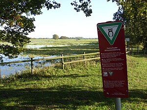
Fischerhuder Wümmeniederung
|
Fischerhuder Wümmeniederung
|
||
|
The raised groundwater level enables natural wet meadows on the banks of the Wümme |
||
| location | Northeast of Bremen, Verden district , Lower Saxony | |
| surface | 772.0 ha | |
| Identifier | NSG LÜ 270 | |
| WDPA ID | 378080 | |
| FFH area | 772.0 ha | |
| Geographical location | 53 ° 6 ' N , 9 ° 0' E | |
|
|
||
| Sea level | from 3 m to 8 m | |
| Setup date | April 13, 2006 | |
| administration | NLWKN | |
The Fischerhuder Wümmeniederung is a nature reserve in the district Fischerhude of Lower Saxony patch Otter mountain in the district of Verden .
The nature reserve with the sign NSG LÜ 270 is 772 hectares in size. It borders in the northwest directly to the nature reserve " Borgfelder Wümmewiesen ", with which it forms a nearly 1,400-hectare contiguous reserve, and otherwise almost entirely from the conservation area surrounded "Wümmeniederung with dunes and valleys." The nature reserve "Fischerhuder Wümmeniederung" is completely part of the FFH area "Wümmeniederung" and the EU bird sanctuary "Wümmeniederung bei Fischerhude". The area has been a nature reserve since April 13, 2006. The responsible lower nature conservation authority is the district of Verden.
The nature reserve is located northeast of Bremen in the western area of the Wümmen lowlands with the inland delta of the Wümme . It is characterized by extensively managed grassland with numerous ditches and still waters. The areas are often flooded in the winter months. Very wet areas remain unused and should develop into reed beds and alluvial forest areas.
The largest part of today's nature reserve was included in the measures to establish and secure parts of nature and landscape worthy of protection with national representative significance . The aim of the measures completed by the end of 2004 was to maintain or improve the ecological significance of the area. For this purpose, the groundwater level was raised to wet the grassland, and the flooding was extended over time. Agricultural use has been expanded. Through the creation of new still and flowing waters, the characteristics of the inland delta, which had been partially destroyed by straightening the arms of the river and filling in the backwaters, was partially restored. In order to give the river the opportunity to find its own bed , dikes were removed or relocated. Weirs have been converted into bottom slides in order to restore the passage for migratory fish .
A network of paths in the nature reserve may be entered. The Wümme may temporarily be used for water sports with non-motorized vehicles .
Web links
- Nature reserve "Fischerhuder Wümmeniederung" in the database of the Lower Saxony State Office for Water Management, Coastal and Nature Conservation (NLWKN)
- Aerial panorama of the Fischerhuder Wümmeniederung
Individual evidence
- ↑ a b Large-scale nature conservation project Fischerhuder Wümmeniederung , Verden district. Retrieved May 12, 2011.
- ↑ Fischerhuder Wümmeniederung , Federal Agency for Nature Conservation . Retrieved April 12, 2018.


