
High Cross (Stadtilm)
|
High cross
City Stadtilm
Coordinates: 50 ° 47 ′ 32 ″ N , 11 ° 3 ′ 3 ″ E
|
|
|---|---|
| Height : | 390–400 m above sea level NN |
| Residents : | 40 |
| Postal code : | 99326 |
| Area code : | 03629 |
 Through town
|
|
Hohes Kreuz is a small settlement near the city of Stadtilm and part of the same.
location
The hamlet of Hohes Kreuz is located north of the city of Stadtilm on Landesstraße 1048 between Stadtilm and Marlishausen . The demarcation is a slightly undulated level sloping northwards from the height of the atonement cross described below, which rises again on the northern edge of the village to the boundary of Marlishausen. It borders the southern border of the Thuringian Basin . The corridor of the hamlet encloses the corridor of the city of Stadtilm like a collar. At the northern edge of the village is the Töbsgraben , a ditch that drains the hills of Kleines Holz and Wüllerslebener Wald to the north and northeast and flows into the Wipfra in the southwest of Hohes Kreuz after 2.5 km of its course near Niederwillingen .
history
Hohes Kreuz belonged to Niederwillingen as a district until 1975. Then it was incorporated into Stadtilm by resolution of the district council of the Arnstadt district . In autumn 1993 the residents of Hohes Kreuz voted to move back to Niederwillingen, which took place on January 1, 1994. A curious thing on the side: Deutsche Post AG had apparently foreseen this and assigned the Arnstadt postcode 99310 to the new postcodes for Hohes Kreuz, which came into force on July 1, 1993, while Stadtilm and its other districts received 99326. From June 1, 1996 Niederwillingen together with other municipalities formed the new municipality of Ilmtal , in which Hohes Kreuz was run as a district and was represented by a local mayor for Niederwillingen, Oberwillingen , Behringen and Hohes Kreuz (currently Hans-Ulrich Ziemer, last elected on 7th June 1996) . June 2009). 40 people live in the hamlet. Ilmtal was incorporated into Stadtilm on July 6, 2018.
etymology
The place takes its name from a reconciliation cross that stands on the hill between Stadtilm and Marlishausen , about 300 meters from the Hohes Kreuz settlement . This atonement cross, already mentioned in 1480 as Hochkrüz , has a comparatively unusually high height of three meters. According to a local legend, a knight killed his wife and her lover at this point. On the other hand, it could be a memorial stone, because the Schwarzburg fork and the year 1552 are carved on it. The year indicates the date of death Günther des Reichen von Schwarzburg.
An information board on the cross, which identifies this as a protected ground monument , bears the following text:
- Erected around 1552. Legend: a long time ago the wife of a Count von Gleichen was kidnapped by an abbot of the Paulinzella monastery . The returning count pursued the kidnapper. Before Stadtilm there was a fight, whereby the abbot was defeated. A large stone cross was erected at the point where the blow was struck. The fork represents the coat of arms of the Schwarzburger.

Atonement Cross
( Location → )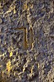
The Schwarzburg fork


Web links
Individual evidence
- ↑ Thuringian Law and Ordinance Gazette No. 7 2018 of July 5, 2018 , accessed on July 6, 2018
- ^ HE Müllerott: Legends, fables and romantic stories from the central Thuringian Forest and its foreland ... Thuringian Chronicle-Verlag, Arnstadt 1996/1997, pp. 210/211
Behringen | Cottendorf | Dienstedt | Döllstedt | Dörnfeld an der Ilm | Ehrenstein | Geilsdorf | Gösselborn | Griesheim | Großhettstedt | Great love | Hammersfeld | High cross | Kleinhettstedt | Little love gifts | Local winds | Niederwillingen | Oberwillingen | Oesteröda | Singing | Stadtilm with Oberilm | Traßdorf