
Oberwillingen
|
Oberwillingen
City Stadtilm
Coordinates: 50 ° 45 ′ 59 ″ N , 11 ° 1 ′ 26 ″ E
|
|
|---|---|
| Height : | 380 m above sea level NN |
| Residents : | 200 |
| Incorporation : | July 1, 1950 |
| Incorporated into: | Niederwillingen |
| Postal code : | 99326 |
| Area code : | 03629 |
 Village church
|
|

Oberwillingen is a district of the city of Stadtilm in the Ilm district ( Thuringia ) with around 200 inhabitants.
geography
Oberwillingen is located in the west of the community of Ilmtal, but not in the catchment area of the Ilm , but on the Wipfra , which is part of the catchment area of the Unstrut . The place is 370 meters above sea level at the eastern foot of the 502 meter high Willinger Berg at the intersection of the Thuringian Basin in the north, Ilm-Saale-Platte in the southeast and the foreland of the Thuringian Forest in the southwest. The district of Oberwillingens is characterized by fields, only on Willinger Berg there is a mixed beech forest, which forms the Willinger Berg nature reserve . Neighboring towns are Niederwillingen, immediately to the east, and Behringen, immediately to the west . A little further south are Traßdorf and Griesheim .
geology
In Oberwillingen there is the Oberwillinger Spring , where the Ilm water seeped from Griesheim comes to light again.
history
Before 900, a village named Welehingin was mentioned for the first time in a document from the Fulda monastery . These are probably upper and / or lower wills. Separated according to Oberwillingen and Niederwillingen, the locations only appear in documents from 1429. Wolfgang Kahl shows that the place was first mentioned in a document in 1349. The village was in the Middle Ages in the sphere of influence of the Counts of Schwarzburg and was 1599-1920 part of the Office Arnstadt in the supremacy in Black-Sondershausen . On July 1, 1950, the place became part of the Niederwillingen community , which was added to the Ilmtal community on June 1, 1996 . This in turn was incorporated into Stadtilm on July 6, 2018.
Attractions
Oberwillingen is the seat of a Protestant parish to which the parishes of Behringen , Großliehaben , Kleinliehaben , Niederwillingen and Roda also belong. The village church is a massive building made of natural stone that was built in the 10th century and rebuilt in the 13th century. This makes the church one of the oldest in the region. However, today only the tower and choir to the east of the tower can be used. The larger western part of the nave has been a roofless ruin since the mid-1980s. The baroque spire was replaced by a simple roof.
Oberwillingen is also the seat of a New Apostolic congregation . Your church is a new building from the period after 1990.

Village church

Village church

Spring source

Information board about the jump
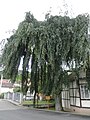
Weeping beech


Economy and Infrastructure
Oberwillingen is an agricultural village. Roads connect the village with Griesheim in the south, Niederwillingen in the east and Behringen in the west. The nearest train station is in Niederwillingen, about 1.5 kilometers northeast of Oberwillingen on the Arnstadt – Saalfeld railway line . Buses also connect the village with the surrounding areas.
Web links
Individual evidence
- ↑ Wolfgang Kahl : First mention of Thuringian Cities and Villages , Verlag Rockstuhl, Bad-Langensalza, 2010, ISBN 978-3-86777-202-0 , p. 211
- ↑ Thuringian Law and Ordinance Gazette No. 7 2018 of July 5, 2018 , accessed on July 6, 2018
Behringen | Cottendorf | Dienstedt | Döllstedt | Dörnfeld an der Ilm | Ehrenstein | Geilsdorf | Gösselborn | Griesheim | Großhettstedt | Great love | Hammersfeld | High cross | Kleinhettstedt | Little love gifts | Local winds | Niederwillingen | Oberwillingen | Oesteröda | Singing | Stadtilm with Oberilm | Traßdorf