Horkenberg (Ore Mountains Foreland)
| Horkenberg | ||
|---|---|---|
|
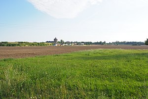
Horkenberg with the Malakow Tower and the pier of the Marienschacht |
||
| height | 334.7 m above sea level NN | |
| location | between Kleinnaundorf and Bannewitz ; District of Saxon Switzerland-Eastern Ore Mountains , Germany ( Saxony ) | |
| Mountains | Erzgebirge foothills | |
| Coordinates | 50 ° 59 '33 " N , 13 ° 42' 3" E | |
|
|
||
| Type | Ridges | |
| rock | Sandstone | |
| Age of the rock | chalk | |
The Horkenberg is 334.7 m above sea level. NN high elevation in the Erzgebirge foreland . It is located near Dresden between Kleinnaundorf and Bannewitz in the Saxon district of Saxon Switzerland-Eastern Ore Mountains .
The historic Dresden coal road and the route of the Windbergbahn, which was closed in 1951, run along the shoulder of the mountain . The Glückauf-Schacht (on the Kohlenstraße) and the Marienschacht (in Boderitz ) are evidence of the earlier hard coal mining on the Horkenberg .
geography
location
The Horkenberg rises 3.7 km east of the Freital core city and about 7 km south of the inner old town of Dresden. The districts of Cunnersdorf (north), Boderitz (northeast) and Bannewitz (east) as well as the locality of Neubannewitz (south) of the municipality of Bannewitz and the district of Kleinnaundorf (west) of the city of Freital extend on the gently sloping slopes of the elevation . On the west side of the mountain lies the source corridor of the Kaitzbach , which flows into the Elbe in Dresden. To the south runs the deeply cut valley of the Weißeritz tributary Poisenbach .
Natural allocation
The Horkenberg belongs to the main natural unit group Erzgebirgsvorland (No. 45) of the Eastern Erzgebirgsvorland . It lies in the transition area between the Freital and Kreischa basins and the Dohna loess plateaus .
geology
The summit of the Horkenberg consists of ashlar sandstones , as they are also known from the Elbe Sandstone Mountains . The base of the mountain, however, consists of gneiss - conglomerates from the Permian of Döhlener basin . The Wachtelberg - Porphyrtuff is exposed, especially in the western slope, as it covers the older rocks of the Rotliegend. In the 19th and 20th centuries , coal seams switched on in Rotliegend were the subject of lively mining, initially on hard coal and later (until 1989) on uranium ores.
Protected areas
To extend to the southwest and western slopes of the Horkenbergs parts of the protected landscape Windberg ( CDDA , reported in 1960; -No 325,900th 1.75 square kilometers in size). This is followed by parts of the fauna-flora-habitat area of the United and Wilder Weißeritz valleys (FFH no. 4947-301; 13.19 km²).
history
In the 19th century there were several stone quarries on Bannewitzer, Cunnersdorfer and Boderitzer Flur that extracted the ashlar sandstone of the summit area. Hard coal mining on Horkenberg began in 1867 with the sinking of the Glückauf Shaft by the Baron von Burgker hard coal and ironworks . From 1885 the Marienschacht was added. From 1928 until the cessation of operations in 1930, both shafts were connected by an overshot chain railway, which ran in a 340 m long tunnel under the Horkenberg. The Marienschacht later served the VEB Steinkohlenwerk "Willi Agatz" (VEB Steinkohlenwerk Freital) and the mining company "Willy Agatz" of the SDAG Wismut as a weather shaft. The preserved hothouse is today an important landmark and symbol of the region.
In the 19th century, the mines' need for labor led to the establishment of new settlements, initially on Cunnersdorfer Flur (Neucunnersdorf), later also in Bannewitz (Neubannewitz). The restaurant "Zur Prinzenhöhe" in Neucunnersdorf, which no longer exists today, was well known.
literature
- Between Tharandt forest, Freital and the Lockwitztal (= values of our homeland . Volume 21). 1st edition. Akademie Verlag, Berlin 1973.
Individual evidence
- ↑ a b measuring table sheet with the Horkenberg, Kleinnaundorf and Neubannewitz as well as coal pits , 1912, on wikipedia.org
- ↑ Research of the natural areas and natural area potentials of the Free State of Saxony (with map services) at the Landschaftsforschungszentrum e. V. Dresden, accessed on August 4, 2017, at naturraeume.lfz-dresden.de
- ↑ Map services of the Federal Agency for Nature Conservation ( information )


