
Kéked
| Kéked | |||||
|
|||||
| Basic data | |||||
|---|---|---|---|---|---|
| State : | Hungary | ||||
| Region : | Northern Hungary | ||||
| County : | Borsod-Abaúj-Zemplén | ||||
| Small area until December 31, 2012 : | Abaúj – Hegyköz | ||||
| District since 1.1.2013 : | Gönc | ||||
| Coordinates : | 48 ° 33 ' N , 21 ° 21' E | ||||
| Height : | 214 m | ||||
| Area : | 13.01 km² | ||||
| Residents : | 184 (Jan. 1, 2011) | ||||
| Population density : | 14 inhabitants per km² | ||||
| Telephone code : | (+36) 46 | ||||
| Postal code : | 3899 | ||||
| KSH kódja: | 15264 | ||||
| Structure and administration (status: 2018) | |||||
| Community type : | local community | ||||
| Structure : | Alsókéked, Felsőkéked | ||||
| Mayor : | Sándor László Hunkár (independent) | ||||
| Postal address : | Fő út 26. 3899 Kéked |
||||
| Website : | |||||
| (Source: A Magyar Köztársaság helységnévkönyve 2011. január 1st at Központi statisztikai hivatal ) | |||||


Kéked is a municipality in the county Gönc in Borsod-Abaúj-Zemplén County in northern Hungary .
Geographical location
Kéked is 76 kilometers northeast of the Miskolc county seat and 15 kilometers northeast of the nearest town of Gönc, right on the border with Slovakia . The Hernád flows to the west of the village ; the neighboring communities are three and four kilometers away, Pányok in the south and Abaújvár in the southwest.
history
Today's Kéked municipality was created in 1943 through the merger of Alsókéked and Felsőkéked.
Attractions
- Roman Catholic Church Szentháromság , built in 1729 (Baroque)
- Melczer Castle ( Melczer-kastély )
traffic
Road No. 3709 and No. 3719 meet in Kéked. The side road No. 37115 leads to the border crossing to the northwest and on to the Slovak municipality of Trstené pri Hornáde . The nearest train station is to the southwest in Zsujta .
photos
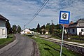
Fő utca

Béke utca

Melczer Castle
.jpg)
.jpg)
