Kankaanpää
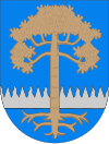
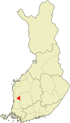
| coat of arms | map |
|---|---|

|

|
| Basic data | |
| State : |
|
| Landscape : | Satakunta |
| Administrative community : | North Satakunta |
| Geographical location | 61 ° 48 ′ N , 22 ° 25 ′ E |
| Surface: | 705.03 km² |
| of which land area: | 689.65 km² |
| of which inland waterways: | 15.38 km² |
| Residents : | 11,471 (Dec. 31, 2018) |
| Population density : | 16.6 inhabitants / km² |
| Municipality number : | 214 |
| Language (s) : | Finnish |
| Website : | www.kankaanpaa.fi |
Kankaanpää [ ˈkɑŋkɑːmˌpæː ] is a town with 11,471 inhabitants (as of December 31, 2018) in western Finland . It is located around 55 km northeast of the port city of Pori in the Satakunta landscape .
The first settler known by name in today's Kankaanpää was a certain Åkar Olav Kontti, who built the Oukari farm named after him around 1560 , which still exists today and is inhabited by his descendants. The settlement grew rapidly due to its location on Kyrönkankaantie , the old main road from Pori to the interior. In the 19th century, in addition to agriculture, forestry also gained in importance; many forests in the region have been cleared to meet the needs of the shipyards in Pori. Furthermore, Kankaanpää developed into a center of the brick kiln; unlike in most other Finnish places, masonry houses predominate over wooden ones. The more recent official buildings were also built from bricks in accordance with this tradition. In addition to the construction industry, the textile industry is particularly important today.
The settlement, which initially belonged to the parish of Ikaalinen , became an independent parish in 1759, while the classicist parish church was built by Carl Ludwig Engel in 1834–39 . As a political municipality, Kankaanpää became independent in 1865, it has had town charter since 1972. In addition to the parish of Kankaanpää, the municipality includes the places Ala-Honkajoki, Jämiänkeidas, Karhoismaja, Karhusaari, Korvaluoma, Kyynärjärvi, Leppäruhka, Luomajärvi, Niinisja, Venesulunjärvi, Venesulunjärvi Verttuu, Vihteljärvi, Vihusaari and Vuorenmaa.
The place Niinisalo is important as one of the largest military bases in Finland. Around 5,000 recruits are trained annually in the barracks of the 400-man artillery brigade stationed here, and the Finnish blue helmets are also prepared here for their deployment abroad.
Town twinning
-
 Bollnäs , Sweden
 -
 Flekkefjord , Norway
 -
 Gagra , Georgia
 -
 Misburg (Hannover) , Germany
 -
 Morsø , Denmark
Personalities
- Taisto Kangasniemi (1924–1997), wrestler
- Tuomas Kantelinen (* 1969), composer and musician
- Toni Vilander (* 1980), racing driver
Web links
Individual evidence
- ↑ Maanmittauslaitos (Finnish land surveying office): Suomen pinta-alat kunnittain January 1, 2010 . (PDF; 199 kB)
- ↑ Statistical Office Finland: Table 11ra - Key figures on population by region, 1990-2018