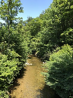
Kempt
|
Kempt Luppmen, Chämt |
||
|
The Kempt in Kemptthal |
||
| Data | ||
| Water code | CH : 602 | |
| location | Switzerland | |
| River system | Rhine | |
| Drain over | Töss → Rhine → North Sea | |
| source | in Grabenriet in the municipality of Bäretswil 47 ° 20 ′ 55 ″ N , 8 ° 50 ′ 47 ″ E |
|
| Source height | 821 m above sea level M. | |
| muzzle | near the riding arena in the Töss coordinates: 47 ° 28 ′ 21 ″ N , 8 ° 42 ′ 24 ″ E ; CH1903: 695 598 / 258 756 47 ° 28 '21 " N , 8 ° 42' 24" O |
|
| Mouth height | 441 m above sea level M. | |
| Height difference | 380 m | |
| Bottom slope | 17 ‰ | |
| length | 22.5 km | |
| Catchment area | 62.51 km² | |
| Discharge at the gauge in front of Töss A Eo : 62.5 km². Location: 170 m above the mouth |
MQ Mq |
1.3 m³ / s 20.8 l / (s km²) |
| Right tributaries | Huenerbach | |
| Reservoirs flowed through | Luppmenweiher , Tobelweiher , ( Kemptweiher ) | |
The Kempt is a left tributary of the Töss . Along with the Eulach , it is one of the largest tributaries of the Töss.
Surname
Kempten ZH , a district of Wetzikon , is named after the Kempt, but is not traversed by it; it rises about one and a half kilometers away. The ancient, Gallo-Roman name of Kempten is Cambodunum after a Celtic or at best pre-Celtic water name Kambā , "the crooked" .
The Kempt should not be confused with the Chämtnerbach named after Kempten , the largest tributary of the Pfäffikersee .
course
The river rises in its furthest arm north of Bäretswil in the Grabenriet wetland on the western slope of the Höchi . This arm is called a luppmen . As such, it flows through the village of Hittnau, merging with other streams coming from the Stoffel , and then runs north of Pfäffikon ZH past to Fehraltorf . From there, the Kempt continues northwest to Illnau and crosses the village to continue flowing towards Kemptthal . The Kempt flows north through the narrow Kempttal and flows into the Töss at the foot of the Eschenberg in Winterthur's municipality after around 20 kilometers.
Water quality
Around 1977-79 the water of the Kempt still had too high levels of ammonium , nitrite , phosphate , total phosphorus , BOD5 and DOC . This improved, however, so that today (2012/13) almost all values are good or sufficient for nitrate.
Varia
In 1861 Michael Maggi bought the hammer mill in Kemptthal. His son Julius Maggi founded the Maggi factory there in 1869 .
Individual evidence
- ↑ a b individual records of the geographic information system of the canton of Zurich
- ↑ Geoserver of the Swiss Federal Administration ( information )
- ↑ Topographical catchment areas of Swiss waters: sub-catchment areas 2 km². Retrieved June 9, 2019 .
- ↑ a b Kempt before Töss. (PDF) Position 903: monthly samples. In: Office for Waste, Water, Energy and Air, Department of Water Protection. Retrieved December 20, 2015 .
- ^ Reallexikon der Germanischen Altertumskunde, Volume 16, Academy of Sciences in Göttingen, Walter de Gruyter, 2000, pages 424-429 .
- ^ Charles Knapp, Maurice Borel, Victor Attinger, Heinrich Brunner, Société neuchâteloise de geographie (editor): Geographical Lexicon of Switzerland . Volume 2: Emmenholz - Kraialppass . Verlag Gebrüder Attinger, Neuenburg 1904, p. 734, keyword Kempt or Kemptbach ( scan of the lexicon page ).

