
Bäretswil
| Bäretswil | |
|---|---|
 |
|
| State : |
|
| Canton : |
|
| District : | Hinwil |
| BFS no. : | 0111 |
| Postal code : | 8344 Bäretswil 8345 Adetswil |
| Coordinates : | 707 252 / 243 868 |
| Height : | 705 m above sea level M. |
| Height range : | 615-1077 m above sea level M. |
| Area : | 22.19 km² |
| Residents: | 5029 (December 31, 2018) |
| Population density : | 227 inhabitants per km² |
|
Proportion of foreigners : (residents without citizenship ) |
10.5% (December 31, 2018) |
| Mayor : | Teodoro Megliola ( independent ) |
| Website: | www.baeretswil.ch |
 Bäretswil from the south |
|
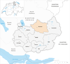
| Location of the municipality | |
  |
|
Bäretswil , in the Zurich German local dialect Bääretschwiil [ˌbæːrətʃˈʋiːl] , is a political municipality in the district of Hinwil in the Swiss canton of Zurich .
coat of arms
- In gold, an upright black, red-tongued bear
geography
The village of Bäretswil is located on the north-western edge of the Allmens , on a saddle between Glatt and Tösstal in the Zurich Oberland . The town's train station is 696 m above sea level. M. The highest point of the community is on the Allmen at 1077 m above sea level. M. , the deepest below the pumping station (former sewage treatment plant) at 616 m above sea level. M.
The municipal area are located next to the main town and the now greatly expanded former hamlet Adetswil, the outer Wachten Bettswil, Wappenswil, Tisenwaldsberg, Neuthal , courtyard, Hinterburg, fir, Ghöch , Fehr forest mountain and Kleinbäretswil and over a hundred individual farms. It covers an area of 2219 ha, of which 872 ha are forest (39%). In terms of area, Bäretswil ranks seventh among the rural communities in Zurich.
The municipality of Bäretswil borders in a clockwise direction on the municipalities of Bauma , Fischenthal , Hinwil , Wetzikon , Pfäffikon and Hittnau .
population
Residents
On December 31, 2015, 4,958 people lived in Bäretswil, 10.6% of whom were foreigners.
| Population development | |
|---|---|
| year | Residents |
| 1629 | 494 |
| 1723 | 1'216 |
| 1771 | 2,698 |
| 1810 | 3,549 |
| 1850 | 3,237 |
| 1900 | 2,698 |
| 1941 | 2,317 |
| 1970 | 2,733 |
| 1990 | 3,782 |
| 2000 | 4,144 |
| 2010 | 4,803 |
From the first tax collection by the people of Zurich, who used it to finance the city of Winterthur , which was acquired in 1467, a figure of 45 households has come down to us for 1470. In 1629 the community lost over 60% of its population to the plague . Of the 1,244 inhabitants, only 494 survived. 100 years later, the population loss was balanced again. Between 1723 and 1771 the population more than doubled. The reason for this was the new earning potential through Heimtextil processing ( professionals ). Around 1810 the community had a proud 3,549 inhabitants, a number that was not reached again until the end of the 20th century.
religion
On December 31, 2011, 51% of the population belonged to the Evangelical Reformed Church , 20% to the Roman Catholic Church and 0.04% to the Christian Catholic Church . The Reformed Church is a classicist transverse church that was built in 1826–1827 in place of a late Gothic building. The Catholic Church of Brother Klaus dates from 1990 and is consecrated to Niklaus von Flüe .
Bäretswil is a center of conservative Protestantism. The local section of the Evangelical Alliance therefore also includes the local parishes of the Evangelical Reformed Regional Church and the Evangelical Methodist Church .
politics
The mayor has been Teodoro Megliola (non-party) since 2014. From 1986 to 2014 Hans-Peter Hulliger ( FDP ) was mayor .
| Members of the Bäretswil Municipal Council (2018-2022) | |||
|---|---|---|---|
| Surname | Taking office | function | Political party |
| Megliola Teodoro | 2014 | Parish President / Presidential Affairs and Finance | independent |
| Dietrich Lisa | 2010 | 1st Vice President / Social Affairs | SVP |
| Schoch Gübeli Barbara | 2014 | 2. Vice President / Building Construction, Planning and Energy | FDP |
| Fuhrer beat | 2018 | Civil engineering, works and agriculture and forestry | SVP |
| Korrodi Marco | 2014 | Security and real estate | SVP |
| Meier Theo | 2002 | education | independent |
| Scherrer Stefan | 2018 | society | SVP |

economy
traffic
In 1901 Bäretswil was connected to the railway network ( Uerikon-Bauma-Bahn ), but in 1969 the railway ceased operations and was replaced by a Wetzikon - Bauma bus line . The former Hinwil - Bäretswil - Bauma railway line is now maintained and operated by the Zürcher Oberland Steam Railway Association .
The following bus lines exist, which are operated by the Zurich Lake and Oberland Transport Authority (VZO):
- 850 Wetzikon station - Kempten - Bäretswil - Adetswil - Bauma station
- 851 Wetzikon - Kempten - Bäretswil - Adetswil train station
job
Thanks to its fog-free location, Bäretswil has been a sought-after community since 1960. There was a lot of construction going on in Adetswil in particular. In 1990 there were 63% commuters among the employed, mainly to Wetzikon, Uster and the city of Zurich .
history


Emergency hiding places for Roman silver coins from the 1st to 3rd centuries have been found in Bäretswil . Perhaps one can deduce from this a pre-Alemannic settlement.
First documented evidence of Bäretswil is 741 as Berofovilare and 745 as Berolfeswilari . The place name means "at the Berolf homestead". The common names on -wil in this area indicate an Alemannic colonization from the 7th to 9th centuries. The St. Gallen Monastery has owned land in this area since the 8th century.
The Burg Greifenberg and the low court rights over Bäretswil were first the abbot of St. Gallen the counts of Rapperswil awarded. As Habsburg pledges, they passed to the Lords of Hinwil in 1321 , who held them until 1507. The border between the later Landvogteien Grüningen and Kyburg ran through the middle of today's municipal area.
The Bäretswil church was first mentioned in connection with the collection of the crusade tax in 1275. In 1827 a new building was built in the classical style. The collature was a fiefdom of the St. Gallen monastery and belonged to the Lords of Hohenlandenberg from 1279 to 1541 . In the late Middle Ages, the parish reached far beyond the Töss to the slopes of the Hörnli .
During the Reformation , the community joined this movement against the will of the then priest. Also Baptist had a long term presence: Their influence was from 1525 into effect until the 17th century, all government persecution notwithstanding. At times the Anabaptists lived in caves such as the Anabaptist Cave . In 1651 Bauma separated from Bäretswil in church.
Since the hamlets on the hills were not village communities and also had no tent economy, they were open to the onslaught of the poor without protection. In 1771, almost 500 inhabitants lived in Wappenswil, many of whom lived with a textile home industry and lived in the typical Flarz buildings .
The large population, which is heavily dependent on the textile industry, made the area of what is now the municipality of Bäretswil prone to crisis. The mechanization of yarn production in 1814–1816 gave home workers only the choice of switching from spinning to hand weaving . The renewed threat from the weaving factories was probably one of the reasons for the high number of rebels from Bäretswil who burned down a textile factory near Uster in 1832 ( Uster fire ). Later, weaving factories on Aabach brought earnings but also an industrial proletariat to the community - 55% of the population lived from the textile industry in 1880. Between 1850 and 1940 the community depopulated noticeably due to the economic situation and its location away from the traffic axes. The last weaving mill in the municipality stopped production in 1982.
Attractions
- Industrial path with the factory buildings of the former Adolf Guyer-Zeller spinning mill in Neuthal with a spinning mill, weaving mill, hand machine embroidery museum and water power plants.
- Stockrüti on the industrial nature trail
- The Zürcher Oberland Steam Railway Association (DVZO) carries out journeys on the former route of the Uerikon-Bauma Railway between Bauma-Bäretswil-Hinwil.
- Bäretswil vehicle museum of the Junod family
Personalities
- Johann Heinrich Heidegger (1633–1698), Reformed theologian
- Adolf Guyer-Zeller (1839–1899), entrepreneur and railway pioneer
- Peter Knapp (* 1931), fashion and art photographer
- Armin Sierszyn (* 1942), Swiss theologian
literature
- Julius Studer: The history of the parish Bäretswil. Zurich 1870. (digitized version)
- Armin Sierszyn: Our Bäretswil. Self-published, Bäretswil 1983, DNB 996809198 .
- Armin Sierszyn: 1250 years of Bäretswil. Edited by the political municipality Bäretswil, 1991, DNB 931434084
- Armin Sierszyn, Jörg Albrecht: Bäretswil. A home book. Edited by the political municipality of Bäretswil. Buchverlag Zürich Oberland, Wetzikon 2015, ISBN 97 838 5981 2734.
- Armin Sierszyn: Bäretswil. In: Historical Lexicon of Switzerland .
- Hermann Fietz: The art monuments of the canton of Zurich, Volume II: The districts of Bülach, Dielsdorf, Hinwil, Horgen and Meilen. (= Art Monuments of Switzerland. Volume 15). Edited by the Society for Swiss Art History GSK. Bern 1943. DNB 365803049 .
Web links
- Official website of the municipality of Bäretswil
- Website of the Chronicle Commission of the Bäretswil community
- Statistical data for the municipality of Bäretswil
Individual evidence
- ↑ Permanent and non-permanent resident population by year, canton, district, municipality, population type and gender (permanent resident population). In: bfs. admin.ch . Federal Statistical Office (FSO), August 31, 2019, accessed on December 22, 2019 .
- ↑ Data on the resident population by home, gender and age (community profile). Statistical Office of the Canton of Zurich, accessed on December 22, 2019 .
- ^ Linguistic Atlas of German-speaking Switzerland V 1b; see. also ortsnames.ch under Bäretswil . The stress on the first syllable in the lexicon of Swiss commune names s. v. is found is erroneous.
- ↑ https://map.geo.admin.ch/?X=241607&Y=709611&zoom=12&lang=de&topic=ech&bgLayer=ch.swisstopo.pixelkarte-farben&layers=ch.swisstopo-vd.geometa-gemeinde&layers_opacity=0.75&crosshair (at . = marker) 47.31623, 8.88843 an altitude of 1077.2 m is given, accessed on March 18, 2016)
- ↑ http://www.baeretswil.ch/de/portraitn/portrait/gemeindeinzahlen/ (accessed on March 18, 2016)
- ↑ http://www.web.statistik.zh.ch/cms_vis/karteBevoelkerung2015/index.html (accessed on March 18, 2016)
- ↑ http://www.web.statistik.zh.ch/cms_gp_neu/gpzh/content/vergleich.php?ind=133 (accessed on September 11, 2013)
- ↑ Archive link ( Memento of the original dated February 8, 2011 in the Internet Archive ) Info: The archive link was inserted automatically and has not yet been checked. Please check the original and archive link according to the instructions and then remove this notice. (accessed on February 27, 2012)
- ↑ http://www.each.ch/ea-b%C3%A4retswil.html (accessed on February 27, 2012)
- ↑ http://www.zol.ch/ Bezirk-hinwil/baeretswil/Teodoro-Megliola-will-Gemeindepraesident-haben/story/ 11874828
- ↑ http://zol.ch/ Bezirk-hinwil/baeretswil/Megliola-ist-neuer-Baeretswiler-Gemeindepraesident/story/13773922
- ↑ Lexicon of Swiss municipality names . Edited by the Center de Dialectologie at the University of Neuchâtel under the direction of Andres Kristol. Frauenfeld / Lausanne 2005, p. 121.
- ↑ Waterwheel Sagi