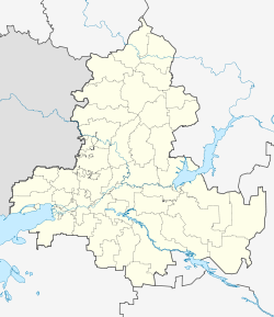
Krivyanskaya
| Staniza
Kriwjanskaja
Кривянская
|
||||||||||||||||||||||||||||||||||||
|
||||||||||||||||||||||||||||||||||||
|
||||||||||||||||||||||||||||||||||||
| List of large settlements in Russia | ||||||||||||||||||||||||||||||||||||
Kriwjanskaja ( Russian Кривянская ) is a Staniza in Rostov Oblast in Russia with 10,423 inhabitants (14 October 2010).
geography
The place is about 40 km as the crow flies northeast of the Rostov-on-Don Oblast Administrative Center on the right bank of the Don arm Aksai , immediately above the confluence of the right tributary Tuslow and south of the left Tuslow tributary Kadamowka . Krivjanskaya is surrounded by the Novocherkassk district except in the north : the actual city is located a few kilometers northwest of the Stanitsa, on the other side of the Tuslow, and about 5 km east of the district (mikrorajon) Donskoi, which was an independent urban-type settlement until 2004 .
Krivjanskaja belongs to Oktyabrsky district and is located 30 km south of its administrative center Kamenolomni . Stanitsa is the seat and only locality of the rural community Krivjanskoje selskoje posselenije.
history
The place was first mentioned as a hamlet in the middle of the 18th century, in 1778 under the name Krivoy Stan. The year of foundation is 1705. In 1790 the status of Staniza was given under its current name. From 1938 to 1944 Krivyanskaya was the administrative seat of a raion named after him.
Population development
| year | Residents |
|---|---|
| 1821 | 1,261 |
| 1897 | 4.185 |
| 1959 | 5,991 |
| 1979 | 8,617 |
| 2002 | 10,219 |
| 2010 | 10,423 |
Note: from 1897 census data
traffic
The nearest train station is on the outskirts of Novocherkassk from the direction of Krivyanskaya, on the Moscow - Voronezh - Rostov-on-Don route.
To the northeast, Krivyanskaya is bypassed by regional road 60N-37, which connects Novocherkassk with the neighboring district of Bagajewskaya on the other bank of the Don ( car ferry ) to the southeast . The road is followed by a freight connection line to the Novocherkasskaya GRES thermal power plant of OGK-2, which is located immediately east of Krivjanskaya and which was commissioned between 1965 and 1972 .
Sons and daughters of the place
- Stepan Bobrikov (1874–1931), major general
- Pyotr Polkownikow (1850–1906), major general
- Georgi Polkownikow (1883–1918), Colonel, Chief of the Petrograd Military District during the October Revolution of 1917
Web links
- Official website of the local government (Russian)
Individual evidence
- ↑ a b Itogi Vserossijskoj perepisi naselenija 2010 goda. Tom 1. Čislennostʹ i razmeščenie naselenija (Results of the All-Russian Census 2010. Volume 1. Number and distribution of the population). Tables 5 , pp. 12-209; 11 , pp. 312–979 (download from the website of the Federal Service for State Statistics of the Russian Federation)

