Le Peuchapatte
| Le Peuchapatte | ||
|---|---|---|
| State : |
|
|
| Canton : |
|
|
| District : | Franches-Montagnes | |
| Municipal municipality : | Muriaux | |
| Postal code : | 2345 | |
| former BFS no. : | 6755 | |
| Coordinates : | 564132 / 227473 | |
| Height : | 971 m above sea level M. | |
| Area : | 2.57 km² | |
| Residents: | 37 (December 31, 2007) | |
| Population density : | 14 inhabitants per km² | |
| map | ||
|
|
||
Until December 31, 2008, Le Peuchapatte was a municipality in the Franches-Montagnes district of the canton of Jura in Switzerland .
With effect from January 1, 2009, it merged with Muriaux to form the municipality of Muriaux.
geography
Le Peuchapatte was 1131 m above sea level. M. is the highest municipality in the canton and is located seven kilometers south-southwest of the district capital Saignelégier (as the crow flies). The farming village extends to the back of a Jura chain of Freiberge (French Freiberge ).
The area of the former municipality area of just 2.6 km² comprises a section of the gently undulating plateau of the Plateaujura, on which boggy, mostly above-ground drainage-free depressions alternate with limestone peaks . The northern part is taken by the ridge of the Point de Vue , which is 1184 m above sea level. M. forms the highest point of Le Peuchapatte. It has extensive Jura pastures with large spruce trees standing individually or in groups and forest areas in between. In the south the municipality extended into the valley of La Chaux-d'Abel . In 1997, 5% of the municipal area was accounted for by settlements, 35% for forests and trees and 60% for agriculture.
Some individual farms belong to Le Peuchapatte. Neighboring municipalities of Le Peuchapatte were Le Noirmont , Les Breuleux and Muriaux .
population
With 37 inhabitants (at the end of 2007), Le Peuchapatte was one of the smallest communities in the canton of Jura. 97.4% of the residents are French-speaking and 2.6% German-speaking (as of 2000). The population of Le Peuchapatte was 142 inhabitants in 1860, in 1900 only 84 inhabitants. Another significant decline was recorded during the 20th century.
economy
Le Peuchapatte is a strongly agricultural village with dairy farming and cattle breeding . There are no jobs in the village outside the primary sector. Employees who do not work in agriculture are therefore commuters and work in Les Breuleux or also accept longer commutes.
energy
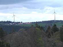
The Peuchapatte wind farm with three wind turbines is located north of Le Peuchapatte . They have a hub height of 108 m, a rotor diameter of 82 m and an installed capacity of 2.3 megawatts each.
traffic
The former municipality is located off the main thoroughfares and can be reached from the cantonal road that leads from Les Breuleux to La Ferrière . Le Peuchapatte has no connection to public transport.
history
Le Peuchapatte was the youngest municipality in the Franches-Montagnes. It was founded in 1530 by the Chapatte family from Les Breuleux. The village belonged to the dominion of Freiberge, which was subordinate to the Principality of Basel . From 1793 to 1815, Le Peuchapatte belonged to France and was initially part of the Département du Mont-Terrible , from 1800 connected to the Département Haut-Rhin . By decision of the Congress of Vienna , the place came to the canton of Bern in 1815 and on January 1, 1979 to the newly founded canton of Jura.
Attractions
The Notre-Dame-du-Sacré-Cœur chapel was rebuilt in 1972 using parts of the neo-Gothic predecessor building. Ecclesiastically, Le Peuchapatte belonged to the parish of Le Noirmont until 1923 , and since then to the parish of Les Breuleux . The center is characterized by typical farmhouses from the 16th and 17th centuries.
Web links
- François Kohler: Le Peuchapatte. In: Historical Lexicon of Switzerland .


