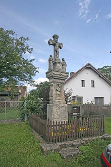
Licomělice
| Licomělice | ||||
|---|---|---|---|---|
|
||||
| Basic data | ||||
| State : |
|
|||
| Region : | Pardubický kraj | |||
| District : | Chrudim | |||
| Municipality : | Načešice | |||
| Area : | 401 ha | |||
| Geographic location : | 49 ° 56 ' N , 15 ° 36' E | |||
| Height: | 383 m nm | |||
| Residents : | 129 (March 1, 2001) | |||
| Postal code : | 538 03 | |||
| License plate : | E. | |||
| traffic | ||||
| Street: | Heřmanův Městec - Podhořany u Ronova | |||
Licomělice (German Litzomielitz ) is a district of the municipality Načešice in the Czech Republic . It is located five kilometers west of Heřmanův Městec and belongs to the Okres Chrudim .
geography
Licomělice is located on the left side of the Struha brook in the Iron Mountains ( Železné hory ). The Malá Struha rises to the west of the village.
Neighboring towns are Rašovy, V Kozi and Svojšice in the north, Stojice , V Pazderně and Dolní Raškovice in the Northeast, Načešice and Vlastějov the east, Habřiny and Vyžice the southeast, Slavkovice and Jetonice in the south, Licoměřice in the southwest, Březinka and Hošťalovice the west and Bukovina u Přelouče , Holotín and Na Skalkách in the northwest.
history
Wieczemělice was first mentioned in documents in 1382 together with the town of Heřmanův Městec and other villages as the property of Heřman von Mrdice. The access to the goods of the parties associated Mrdice village was at one with Vícemilice dolní leading from the Czaslauer pool on the Vicemilicer pass into the mountains and on to the nearby Strenitzer country Steig trade route through the festivals Stoupec was protected. Since the 15th century, the village called Vícomělice , Vícemilice , Vícemělice and Vícoměřice belonged to the estates of the Lichtenburg . To distinguish it from Vícemilice dolní , the village was called Vícemilice horní in the 16th century . Between 1572 and 1577 the village briefly belonged to the Bohemian Crown, after which it became part of the Stolany estate . Since the beginning of the 17th century the village was under the judge in Načešice. The current place name Licomělice has been used since the 17th century. In 1608, Emperor Rudolf II sold the Stolany estate to Ladislaus Berka von Dubá , who combined it with the Heřmanův Městec estate. In 1631 Johann Dietrich Berka von Dubá donated his portion of the village with 67 Bohemian lines of arable land to the hospital in Heřmanův Městec. At that time Licomělice consisted of eight properties, five of which belonged to the Choltitz estate and three to the hospital in Heřmanův Městec. Later, the part belonging to the hospital came back to the Heřmanův Městec rule.
In 1833 the village Litzomielitz or Licomělice in the Chrudim district consisted of 41 houses in which 257 people lived. Twelve of the houses with 72 inhabitants belonged to the Choltitz rule. The parish was Heřmanmiestetz , the Choltitz part was parish in Turkowitz . Until the middle of the 19th century, Litzomielitz remained partially subject to the allodial rule Heřmanmiestetz and the rule Choltitz.
After the abolition of patrimonial Licomělice formed from 1849 a municipality in the judicial district of Chrudim . From 1868 the municipality belonged to the political district of Chrudim . At the beginning of the 20th century, Habřiny was run as a district. In 1964 it was incorporated into Načešice. In 1979 a new syringe house was built.
Local division
Habřiny ( Habrina ) is part of Licomělice . The district forms a cadastral district.
Attractions
- Stone cross
- Fallen memorial
- Burgstall Stoupec , in the forest southwest of the village
Web links
Individual evidence
- ↑ http://www.uir.cz/katastralni-uzemi/701033/Licomelice
- ^ Johann Gottfried Sommer : The Kingdom of Bohemia; Represented statistically and topographically. Volume 5: Chrudimer Kreis. Prague 1837, p. 24


