Bukovina u Přelouče
| Bukovina u Přelouče | ||||
|---|---|---|---|---|
|
||||
| Basic data | ||||
| State : |
|
|||
| Region : | Pardubický kraj | |||
| District : | Pardubice | |||
| Area : | 171.2342 ha | |||
| Geographic location : | 49 ° 57 ' N , 15 ° 34' E | |||
| Height: | 344 m nm | |||
| Residents : | 83 (Jan. 1, 2019) | |||
| Postal code : | 535 01 | |||
| License plate : | E. | |||
| traffic | ||||
| Street: | I / 17 : Čáslav - Heřmanův Městec | |||
| structure | ||||
| Status: | local community | |||
| Districts: | 1 | |||
| administration | ||||
| Mayor : | Leona Turynová Fortelková (as of 2017) | |||
| Address: | Bukovina u Přelouče 16 535 01 Přelouč |
|||
| Municipality number: | 574821 | |||
| Website : | www.bukovinauprelouce.cz | |||
Bukovina u Přelouče , until 1980 Bukovina (German Bukowina ) is a municipality in the Okres Pardubice in the Czech Republic . It is located ten kilometers south of Přelouč .
geography
Bukovina u Přelouče is located in the Iron Mountains ( Železné hory ) by the Mlýnský creek. The Silnice I / 17 runs through the village between Čáslav and Heřmanův Městec .
Neighboring towns are Sovolusky , Sovoluská Lhota and Urbanice in the north, Myslivna, Rašovy, Svojšice and Stojice in the north-east, Na Kozovce, Na Skalkách and Holotín in the east, Licomělice and Hošťalovice in the south-east, Březinka in the south, Bílý Kámen and Novýwest in the south in the west and Turkovice in the northwest.
history
The first written mention of the village of Bukovina, which belongs to Lichtenburg , took place in 1400. The village was on the Kaiserstrasse, an important trade route. The oldest news about the mill comes from 1436. In 1556 Wilhelm Trčka from Lípa Bukovina sold together with Turkovice to the owner of the Choltitz estate , Georg von Gersdorff . In 1568 he ceded the Podhořany estate with the villages of Březinka, Turkovice, Bukovina, Hošťalovice and Rašovy to his brother Hendrich. After that, Bukovina always remained submissive to Podhorany.
In 1840 the village of Bukovina consisted of 27 houses, in which 157 people, including 13 Swiss and one Jewish family, lived. In the village there was a retreat on Chrudimer Strasse and a mill. To the northeast of the village there was an official zoo with white fallow deer and a hunter's house ( Myslivna ). The parish was in Turkowitz .
After the abolition of patrimonial Bukovina formed from 1849 with the district Rašovy a municipality in the judicial district of Časlau . From 1868 the municipality belonged to the Časlau district . The volunteer fire brigade was founded in 1895. In 1923 the bus service between Čáslav and Heřmanův Městec was started. Rašovy broke away from Bukovina in 1930 and formed its own community.
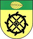
In 1949 Bukovina was assigned to the Okres Přelouč. This was lifted in the course of the territorial reform of 1960, since then the community has belonged to Okres Pardubice. In 1971 the community bought the mill and converted the property into a restaurant with a dance hall and grocery store. To distinguish it from the other municipality of Bukovina , the municipality has had the name affix u Přelouče since 1980 . The community has had a coat of arms and a banner since 2010.
Community structure
No districts have been identified for the municipality of Bukovina u Přelouče. Bukovina u Přelouče includes the one-layer Myslivna.
Web links
Individual evidence
- ↑ http://www.uir.cz/obec/574821/Bukovina-u-Prelouce
- ↑ Český statistický úřad - The population of the Czech municipalities as of January 1, 2019 (PDF; 7.4 MiB)
- ^ Johann Gottfried Sommer , Franz Xaver Maximilian Zippe: The Kingdom of Böhmen. Statistically and topographically presented, vol. 11 Caslaver Kreis , Prague 1843, p. 312


