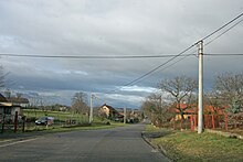
Pravy
| Pravy | ||||
|---|---|---|---|---|
|
||||
| Basic data | ||||
| State : |
|
|||
| Region : | Pardubický kraj | |||
| District : | Pardubice | |||
| Area : | 380 ha | |||
| Geographic location : | 50 ° 8 ' N , 15 ° 37' E | |||
| Height: | 265 m nm | |||
| Residents : | 100 (Jan. 1, 2019) | |||
| Postal code : | 533 41 | |||
| License plate : | E. | |||
| traffic | ||||
| Street: | Rohovládova Bělá - Nechanice | |||
| structure | ||||
| Status: | local community | |||
| Districts: | 1 | |||
| administration | ||||
| Mayor : | Lada Jiřičková (as of 2019) | |||
| Address: | Pravy 47 533 41 Lázně Bohdaneč |
|||
| Municipality number: | 572853 | |||
| Website : | www.pravy.cz | |||
Pravy ( German Praw ) is a municipality in the Czech Republic . It is located 15 kilometers northwest of the city center of Pardubice and belongs to the Okres Pardubice .
geography
Pravy is located on a hill between the valleys of the Bukovka and Rohoznický potok on the Dobřenická plošina ( Dobrzenitzer plateau ). State road II / 323 runs through Pravy between Rohovládova Bělá and Roudnice ; Dálnice 11 / E 67 runs north of the village . In the north rises the Velká Dorota (292 m nm), northeast of the Na Víně (267 m nm), in the west of the Soudný (288 m nm) and northwest of the Medenec (281 m nm). To the southwest are the Kamenec and Durasko ponds.
Neighboring towns are Ovčín and Kratonohy in the north, Kuklínky, Dobřenice , Osičky and Osice in the north-east, Rohoznice in the east, Dolany and Křičeň in the south-east, Habřinka , Bukovka and Rohovládova Bělá in the south, Kasalice and Kasaličky in the south-west, and Vý Austrálii and Chýšlii in the west Stará Voda , Chudeřice , Káranice and Michnovka in the northwest.
history
The village was first mentioned in 1402 as the seat of Vladiken Přibík von Prav. The following owners were Prokop von Prav and from 1451 Martin and Jan von Prav. After reversion belehnte King Ladislaus the Posthumous in 1457 Vratislav of Mitrowitz with the parties Prav. From 1500 the manor belonged to Mikoláš Rohovlád von Bělá. After 1551 Vojtěch von Pernstein acquired the estate and gave it to his rule Pardubice . The festivals then lost their importance and went out in the 16th century. Under the Lords of Pernstein , the Pustý rybník, Pravka, Vomlinka, Nový rybník, Kamenec, Pekelec, Táborský rybník, Na díťátku, Obecník, Návesník and Durázka fish ponds were established in the Pravy area. On March 21, 1560 Jaroslav von Pernstein sold the rule of Pardubitz to King Ferdinand I. His successor Maximilian II transferred the administration of the royal lords to the court chamber . In 1776, 168 people lived in the 20 houses in Pravy.
In 1835 the village of Praw or Prawy , located in the Chrudim district on the border with the Bijov district , consisted of 26 houses in which 174 people, including a Protestant family, lived. The parish was Dobřenitz . Until the middle of the 19th century Praw remained subordinate to the kk camera rule Pardubitz.
After the abolition of patrimonial Prav formed from 1849 a municipality in the judicial district of Přelauč . From 1868 the community belonged to the Pardubitz district . In 1869 Prav had 202 inhabitants and consisted of 32 houses. At the end of the 19th century the village was called Právy . In 1900 there were 231 people in Pravy, in 1910 there were 241. In 1921, an underground cable was laid from Hradec Králové to Sopřeč , which also electrified Pravy. Between 1923 and 1924 a waterworks was built for Pravy and Michnovka. In 1927 a rainwater drainage system was built. In 1930 Pravy had 212 inhabitants and consisted of 42 houses. On August 6, 1946, a windpipe left severe damage in the village.
In 1949 Pravy was assigned to the Okres Přelouč, since 1960 the municipality has belonged again to the Okres Pardubice . The JZD was formed in 1952. In 1964 it was incorporated into Kasalice . The municipality of Pravy has existed again since November 24, 1990. In the 2001 census, 83 people lived in the 40 houses in the community.
Attractions
- Sandstone cross on the village square, created in 1859
- Michnovka-Pravy natural monument, northwest of the village behind the highway
literature
- Historický lexikon obcí České republiky 1869–2005 , part 1, p. 526
Web links
Individual evidence
- ↑ Obec Pravy: Územně identifikační registr ČR. In: uir.cz. Retrieved February 24, 2019 (Czech).
- ↑ Český statistický úřad - The population of the Czech municipalities as of January 1, 2019 (PDF; 7.4 MiB)
- ^ Johann Gottfried Sommer , Franz Xaver Maximilian Zippe: The Kingdom of Böhmen. Represented statistically and topographically. Volume 5: Chrudimer Kreis. Prague 1837, p. 84


