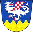
Chudeřice
| Chudeřice | ||||
|---|---|---|---|---|
|
||||
| Basic data | ||||
| State : |
|
|||
| Region : | Královéhradecký kraj | |||
| District : | Hradec Králové | |||
| Area : | 216 ha | |||
| Geographic location : | 50 ° 9 ' N , 15 ° 33' E | |||
| Height: | 230 m nm | |||
| Residents : | 259 (Jan. 1, 2019) | |||
| Postal code : | 503 51 | |||
| License plate : | H | |||
| traffic | ||||
| Street: | Nové Město - Káranice | |||
| Railway connection: | Chlumec nad Cidlinou – Międzylesie | |||
| structure | ||||
| Status: | local community | |||
| Districts: | 1 | |||
| administration | ||||
| Mayor : | Miloš Veselý (as of 2019) | |||
| Address: | Chudeřice 31 503 51 Chlumec nad Cidlinou |
|||
| Municipality number: | 570125 | |||
| Website : | www.chuderice.cz | |||
Chudeřice (German Chuderzitz , 1939-1945 Kuderschitz ) is a municipality in the Czech Republic . It is located seven kilometers east of Chlumec nad Cidlinou and belongs to the Okres Hradec Králové .
geography
Chudeřice is located at the foot of the Dobřenická plošina ( Dobrzenitzer plateau ) on the Chlumecká tabule ( Chlumetzer board ). On the northern outskirts running railway line Chlumec nad Cidlinou-Międzylesie , behind the state road I / 11 between Nove Mesto and Hradec Králové . Dálnice 11 / E 67 runs two kilometers south of the village . In the southeast the Lhotáček (290 m nm) and the Soudný (288 m nm) rise, south the Jitra (272 m nm) and the Kačerový kopec (271 m nm). To the southeast are the ponds Lhotáček and Běloveské rybníčky, southwest of the Kněžský rybník and the Starovodský rybník. To the east of Chudeřice is the Haškova Lhota desert , and to the southeast is the Nedabylice desert .
Neighboring towns are Kosice , Třesice and Kosičky in the north, Babice , Požáry and Káranice in the northeast, Ovčín and Michnovka in the east, Pravy , Kasaličky , V Austrálii and Na Obci in the southeast, Voleč , America, Žáravice and Chýšť in the south, Klamoš and Rtanov in the South-west, Stará Voda in the west and Nová Hospoda, Oktaviánov and Přestavecko in the north-west.
history
The first mention of Chuderzicz took place in 1318 in the country table , as the Good the Zemanen was attributed Vseslav of Zachrašťany. At that time there was a festival in town . In 1386 Chuderzicz belonged to the Přestavlky Fortress , owned by Unka von Přestavlk. The family, which also used the predicate de Chuderzicz , was mentioned for the last time in 1430 and probably went out - like the Chudeřice fortress - during the Hussite Wars . In the middle of the 16th century, the Lords of Pernstein acquired the desert fortress Přestavlky with the associated villages and added them to the Chlumetz rule . Johann von Pernstein , who had acquired the dominions in 1533, sold them to King Ferdinand I , who united them in 1547 to form a chamberlain for Chlumetz. In 1611, King Matthias signed the Chlumetz Chamber of Commerce to Wenzel Graf Kinsky von Wchinitz and Tettau for loyal services in obtaining the Bohemian Crown. After Count Wenzel Kinsky invaded the parish church of St. Ursula in Chlumetz in 1620 to stop Hussite services, an uprising broke out in the area. In 1775 a great peasant uprising broke out in the manor.
In 1833 the village of Chuděřitz , located in the Bijov district , consisted of 16 houses in which 112 people lived. There was a farm with a sheep farm in the village. The village to the Dechanteikirche of St. Ursula in Chlumetz. Until the middle of the 19th century Chuděřitz remained subject to the Fideikommissherrschaft Chlumetz.
After the abolition of patrimonial Chudeřice formed from 1849 a municipality in the judicial district of Chlumetz . From 1868 the village belonged to the Neubydžow district and was incorporated into Káranice . In 1869 Chudeřice had 201 inhabitants and consisted of 25 houses. Between 1870 and 1873 the Chlumetz – Königgrätz railway line was laid north of the village ; however, the village was not given a breakpoint. In 1900 there were 178 people in Chudeřice, in 1910 there were 184. In 1913 the village broke away from Káranice and formed its own municipality. In 1923 the village was electrified. In 1930 Chudeřice had 201 inhabitants and consisted of 35 houses. A village school was built in the 1930s. In the course of the territorial reform of 1960 the Okres Nový Bydžov was dissolved, since then the municipality has belonged to the Okres Hradec Králové . In the 2001 census, 195 people lived in the 64 houses of the community.
Attractions
- Brick bell tree
- Sandstone cross in the center of the village
- Memorial to the fallen of the First World War
literature
- Historický lexikon obcí České republiky 1869–2005 , part 1, p. 460
Web links
- History of Chudeřice
- Chudeřice on the website of the district archive Hradec Králové
- Brief description at MAS Společná CIDLINA
Individual evidence
- ↑ http://www.uir.cz/obec/570125/Chuderice
- ↑ Český statistický úřad - The population of the Czech municipalities as of January 1, 2019 (PDF; 7.4 MiB)
- ^ Johann Gottfried Sommer : The Kingdom of Bohemia; Represented statistically and topographically. Volume 3 Bidschower Kreis. Calve, Prague 1835, p. 45.


