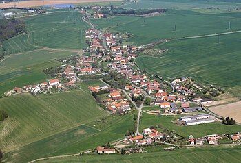
Habřina
| Habřina | ||||
|---|---|---|---|---|
|
||||
| Basic data | ||||
| State : |
|
|||
| Region : | Královéhradecký kraj | |||
| District : | Hradec Králové | |||
| Area : | 609 ha | |||
| Geographic location : | 50 ° 20 ' N , 15 ° 49' E | |||
| Height: | 264 m nm | |||
| Residents : | 298 (Jan. 1, 2019) | |||
| Postal code : | 551 01 | |||
| License plate : | H | |||
| traffic | ||||
| Street: | Rožnov - Lužany | |||
| structure | ||||
| Status: | local community | |||
| Districts: | 1 | |||
| administration | ||||
| Mayor : | Zdeňka Sehnoutková (as of 2008) | |||
| Address: | Habřina 28 503 03 Smiřice |
|||
| Municipality number: | 569992 | |||
| Website : | www.habrina.cz | |||
Habřina (German Habrina , 1939-1945 hornbeam ) is a municipality in the Czech Republic . It is located seven kilometers southwest of Jaroměř and belongs to the Okres Hradec Králové .
geography
Habřina is located on the Velichovská tabule highlands on the right bank of the river between the Jordán and Hustířanka brooks on a hill. To the north rises the hill Vražba (319 m). There is a larger substation to the northeast . To the east lies the Prašivka hill (301 m). The route of the state road 13 / E 67 from Hradec Králové to Jaroměř passes to the east; this is also where the planned route for the continuation of the D 11 motorway is located .
Neighboring towns are Hustířany and Velichovky in the north, Neznášov and Semonice in the northeast, Černožice in the east, Holohlavy in the southeast, Rodov in the south, Račice nad Trotinou in the southwest, Frantov, Vrchovnice and Žíželeves in the west and Lužany and Lhota in the northwest.
history
On October 8, 1110, a two-day bloody battle between the army of Vladislav I and that of his brother Soběslav I began on the Chloumek hill above the Elbe valley . The latter had been expelled to Poland by his brother and returned to Bohemia with the support of Polish troops to overthrow his brothers. This battle is recorded from the Chronicles of Cosmas of Prague and Martin Gallus .
Habřina was first mentioned in a document in 1357.
After the abolition of patrimonial Habřina formed a community in the Königinhof district from 1850 . Between 1949 and 1960 the village belonged to Okres Jaroměř and on January 1, 1961, after its dissolution, it became part of Okres Hradec Králové . Habřina has had a coat of arms since May 13, 2008.
Community structure
No districts are shown for the community of Habřina.
Attractions
- Remains of the Vražba fortress, archaeological site, north of the village. The fortress, which was built in the second half of the 13th century, was destroyed in the period between the Brandenburg invasion of 1278 and the extinction of the Přemyslids in 1306. It was the seat of the lords of Neznášov, who built Rothenberg Castle one kilometer north after the fortress was destroyed.
- Remains of the Rotemberk Castle ( Rothenberg ), north of the village
- Church of St. Wenceslas on the Chloumek, east of the village, commemorating the battle of October 8, 1110
- old footbridge over the Hustiřanka


