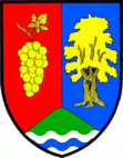
Převýšov
| Převýšov | ||||
|---|---|---|---|---|
|
||||
| Basic data | ||||
| State : |
|
|||
| Region : | Královéhradecký kraj | |||
| District : | Hradec Králové | |||
| Area : | 438 ha | |||
| Geographic location : | 50 ° 9 ' N , 15 ° 24' E | |||
| Height: | 229 m nm | |||
| Residents : | 335 (Jan 1, 2019) | |||
| Postal code : | 503 51 | |||
| License plate : | H | |||
| traffic | ||||
| Street: | Chlumec nad Cidlinou - Žiželice | |||
| Railway connection: | Velký Osek – Trutnov | |||
| structure | ||||
| Status: | local community | |||
| Districts: | 1 | |||
| administration | ||||
| Mayor : | Ladislav Steklý (as of 2008) | |||
| Address: | Převýšov 89 503 51 Chlumec nad Cidlinou |
|||
| Municipality number: | 570681 | |||
| Website : | www.prevysov.cz | |||
Převýšov (German Neudorf , also Przebeischow ) is a municipality in the Czech Republic . It is four kilometers west of Chlumec nad Cidlinou and belongs to the Okres Hradec Králové .
geography
Převýšov is located on the right side of the Cidlina at the foot of the Na Vinici hill ( Planina , 250 m) on the East Bohemian Table. To the east of the village, in the valley of the Olešnický potok, lies the Olešnický rybník pond, which is used as a bathing lake. The D 11 / European route 67 runs to the south , at which exit 62 Chlumec nad Cidlinou-západ is located near Levín. On the western edge of the village is the route of the Velký Osek – Trutnov railway .
Neighboring towns are Lišice in the north, Chlumec nad Cidlinou in the northeast, Krašov and Kladruby in the east, Olešnice and Levín in the southeast, Loukonosy and Žiželice in the south, Končice and Zbraň in the southwest, Bludy in the west and Lovčice in the northwest.
history
The first written mention of Przebegssow comes from the year 1386. Later the name Nová Ves / Neudorf was used. The inhabitants lived from agriculture and viticulture, which was operated on the southern slope of the Planina mountain. The place was surrounded by two stately hunting grounds. To the north of the village were the wooded areas of the Karlskron castle and to the west the large Žehuň zoo with the new hunting lodge was connected. In the 18th and 19th centuries, the different place names Přebejšov , Przebeischow , Nová Ves , Neudorf and Přivýšov were used alternately.
After the abolition of patrimonial formed Přivýšov and Nová Ves in 1850 a district of the political community Lučice in the district Nový Bydžov . With the construction of the line from Groß Wossek to Wostromer , Přivýšov was connected to the railway network in 1870. In 1878 an independent municipality was established, which had the three official names Převýšov , Nová Ves and Přebýšov . In 1890 the village consisted of 67 houses and had 427 inhabitants. The village has been called Převýšov since 1920 . On January 1, 1961, Převýšov came to Okres Hradec Králové. The village after Žiželice is parish .
Community structure
No districts are shown for the municipality of Převýšov.
Attractions
- Karlova Koruna Castle , northeast of the village
- Žehuňská obora nature reserve and Žehuňský rybník pond, west of the village
- Chapel of St. Ferdinand in the Žehuňská obora
- Hunting lodge Kněžičky ( new building ) in Žehuňská obora


