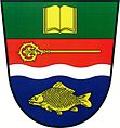
Žehuň
| Žehuň | ||||
|---|---|---|---|---|
|
||||
| Basic data | ||||
| State : |
|
|||
| Region : | Středočeský kraj | |||
| District : | Kolín | |||
| Area : | 910 ha | |||
| Geographic location : | 50 ° 8 ' N , 15 ° 17' E | |||
| Height: | 204 m nm | |||
| Residents : | 445 (Jan. 1, 2019) | |||
| Postal code : | 289 05 | |||
| License plate : | S. | |||
| traffic | ||||
| Street: | D 11 : Poděbrady - Chlumec nad Cidlinou | |||
| Railway connection: | Velký Osek – Trutnov | |||
| structure | ||||
| Status: | local community | |||
| Districts: | 1 | |||
| administration | ||||
| Mayor : | Václav Fišer (as of 2008) | |||
| Address: | Žehuň 136 289 05 Žehuň |
|||
| Municipality number: | 538035 | |||
| Website : | www.zehun.cz | |||
Žehuň ( German Zehun ) is a municipality in the Czech Republic. It is located 12 kilometers east of Poděbrady and belongs to the Okres Kolín .
geography
Žehuň is located on the left bank of the Cidlina on the embankment of the Žehuňský rybník pond on the East Bohemian Table. The railway line Velký Osek – Trutnov runs to the right of the river, and the railway station "Dobšice nad Cidlinou" is two kilometers to the northwest. The Kozí hůra (272 m) rises to the south. One and a half kilometers south of the village is bypassed by the D 11 / European route 67 , there is exit 50 "Žehuň".
Neighboring towns are Báň and Kněžičky in the north, Choťovice in the northeast, Dománovice in the southeast, Polní Chrčice and Hájky in the south, Sány in the southwest, Dobšice and Libněves in the west and Kolaje and Hradčany in the northwest.
history
Segun was first mentioned in a document in 1137 when the church of St. Gotthard through the Opatowitz monastery . In 1361 the monastery sold the place. This was followed by a festival. Hermann von Choustník became the owner of the village in 1380 and the Žehuně family can be traced back to the end of the 14th century. Between 1493 and 1499 Žehuň was attached to the Hradišťko rule. During this time, the feast, which for a long time was assumed to have stood on the site of the rectory, also went out. In 1953 during the renovation work on the Zehuner pond by the archaeologist Antonín Hejna on the drained ground, the location of the fortress could be determined. It was located a mile north of the village and is now in the pond.
After the Cidlina had been dammed by Štěpán Netolický for Vladislav II between 1492 and 1497 to form the Royal Zehuner fish pond, the place was located directly on the dam. In the 16th century, Žehuň became part of the Chlumetz estate . By Jakub Krčín the end of the 16th century were made of the pool of major repairs. In 1562 Archduke Ferdinand had an enclosure for mares and foals built by the pond. In 1629 Johann Octavian Graf Kinsky acquired the Chlumetz rule and the royal pond. In the berní rula of 1654, nine peasant positions, seven tenants and one kötter are shown for ten; six properties lay desolate. In the course of its history the village was mentioned as Zyhun , Zychun , Zahuna , Ziehunie , Ziehaun , Zehun , Žehunie , Žegúň , Segun , Žehauň , Žehúň and Schehun .
After the abolition of patrimonial Žehuň formed with the districts Báň , Stará Báň and Mírkovice from 1850 a municipality in the Poděbrady district . In 1870, the Groß Wossek - Wostromer railway started operating on the opposite bank of the Cidlina . On January 1, 1961 Choťovice was incorporated and the municipality Žehuň assigned to the Okres Nymburk. Since the beginning of 2007 it has belonged to the Okres Kolín.
Community structure
No districts are shown for the municipality of Žehuň.

Attractions
- Baroque Church of St. Gotthard, the structure with onion dome was built between 1753 and 1762 according to plans by Franz Kermer. The neighboring ossuary was built in 1765–1766, also according to Kermer's plans
- Pond Žehuňský rybník ( Zehun Pond ) with 254 hectares of water surface, since 1958 a national nature reserve
- Nature reserve Kněžičky and the forest Žehuňská obora ( Zehun zoo ), northeast by the pond
- Báň nature reserve around the hill Na Hřebínku, north of the village
- Chapel of St. Ferdinand, northeast on the edge of the Žehuňská obora
- Hunting lodge Kněžičky (new building) in Žehuňská obora
- Listed 600-year-old summer oak on the pond dam
- Statue of St. John of Nepomuk from 1796, surrounded by two listed winter linden trees
Individual evidence
- ↑ Český statistický úřad - The population of the Czech municipalities as of January 1, 2019 (PDF; 7.4 MiB)
- ↑ Antonín Profous : Místní jména v Čechách. Jejich vznik, původ, význam a změny. Volume 1-5. Česká akademie věd a umění, Prague 1947–1960.


