Volárna
| Volárna | ||||
|---|---|---|---|---|
|
||||
| Basic data | ||||
| State : |
|
|||
| Region : | Středočeský kraj | |||
| District : | Kolín | |||
| Area : | 406 ha | |||
| Geographic location : | 50 ° 6 ' N , 15 ° 14' E | |||
| Height: | 196 m nm | |||
| Residents : | 504 (Jan. 1, 2019) | |||
| Postal code : | 280 02 | |||
| License plate : | S. | |||
| traffic | ||||
| Street: | Velký Osek - Týnec nad Labem | |||
| structure | ||||
| Status: | local community | |||
| Districts: | 1 | |||
| administration | ||||
| Mayor : | Dana Bayerová (as of 2019) | |||
| Address: | Volárna 137 280 02 Kolín |
|||
| Municipality number: | 533882 | |||
| Website : | www.volarna.cz | |||
Volárna (German Freudenek , 1939–45 Freudeneck ) is a municipality in the Czech Republic . It is located eight kilometers north of the city center of Kolín and belongs to the Okres Kolín .
geography
Volárna is located in the Středolabské tabule (table land on the middle Elbe ). The Bačovka brook flows north of the village. In the east rises the Vrch ( Friedrichsberg , 221 m nm). The TPCA plant extends to the south .
Neighboring towns are Opolany and Sány in the north, Dobšice , Žehuň , Hájky and Polní Chrčice in the Northeast, Ohaře and Jestřabí Lhota in the east, Bělušice , Eleonorov , Býchory and Písečný Mlyn in the southeast, Ovčáry and Sendražice in the south, Hradišťko I and Veltruby in the southwest, Karolín , Bačov and Velký Osek in the west and Libice nad Cidlinou and Kanín in the northwest.
history
In the Middle Ages, the village of Břežany, which died out during the Hussite Wars, was located in the corridors of Volárna . Around 1475 the Kolín lordship dammed the Bačovka brook and created the Bačovský rybník fish pond on the desert ; The Bačovský náhon ( Sánská Bačovka ) trench was created to feed water from the Cidlina near Sány . The silted up pond was abandoned in the second half of the 18th century and gradually drained.
In the course of the raabization , the kk chamber lord Kolín had the village of Freudenek built on the emphyteutized pond site in 1778 . The new settlement initially consisted of 20 houses; the residents were cattle herders who drove the cattle daily from the stately stables in the village to the pond on the pasture. The Czech settlers soon used the name Volárna, derived from the stable panská volárna , for their village instead of Freudenek .
In 1843 the Dominikaldorf Freudenek , also called Freydenek or Wolarna , in the Kauřim district , consisted of 56 houses in which 331 people, including six Protestant and one Jewish family, lived. The village was parish after Saan , the official place was Kaisersdorf . Until the middle of the 19th century Freudenek remained subject to the Kolín rule.
After the abolition of patrimonial Volárna formed from 1849 a district of the municipality Jestřabí Lhota in the judicial district Kolin . In 1862 acquired Franz Horsky the manorial Kolin from the heirs of Baron Wenceslas Veith. Horsky immediately initiated a modernization of agriculture and laid in the same year the west of the Volárna later after his wife Karoline Hartmann of Hartenthal named Mustergut Karolinenhof on. He had the village of Volárna extended by several rows of houses in parallel streets and allocated agricultural land to the settlers; The residents later paid the purchase price. Horsky had the village square planted with chestnuts. From 1868 the village belonged to the Kolin District . In 1869 Volárna had 530 inhabitants and consisted of 64 houses. In 1900 there lived 520 people in Volárna, in 1910 there were 581. In 1927 Volárna broke away from Jestřabí Lhota and formed its own community. In 1930 Volárna had 584 inhabitants and consisted of 124 houses.
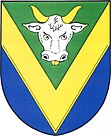
In the 2001 census, 458 people lived in the 176 houses of Volárna. The community has had a coat of arms and a banner since 2013.
Community structure
No districts are shown for the municipality of Volárna. The one-layer Karolín ( Karolinenhof ) belongs to Volárna .
Attractions
- Bell tree on the village square, erected in the 1920s
- Memorial stone for those who fell in World War II on the village square, unveiled in 2015
- 19th century sandstone cross on the village square
- Cast iron wayside cross on a high sandstone base, created in 1890, north of the village
- Remnants of the horse-drawn railway line Velký Osek - Karolín
- Natural monument Váha , the small tree-lined pond north of the village was placed under protection because of the abundance of the tender horn leaf .
literature
- Historický lexikon obcí České republiky 1869–2005 , part 1, p. 110
Web links
Individual evidence
- ↑ http://www.uir.cz/obec/533882/Volarna
- ↑ Český statistický úřad - The population of the Czech municipalities as of January 1, 2019 (PDF; 7.4 MiB)
- ^ Johann Gottfried Sommer : The Kingdom of Bohemia, Vol. 12 Kauřimer Kreis, 1844 pp. 232-233


