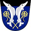
Neratov
| Neratov | ||||
|---|---|---|---|---|
|
||||
| Basic data | ||||
| State : |
|
|||
| Region : | Pardubický kraj | |||
| District : | Pardubice | |||
| Area : | 403 ha | |||
| Geographic location : | 50 ° 5 ' N , 15 ° 39' E | |||
| Height: | 222 m nm | |||
| Residents : | 165 (Jan. 1, 2019) | |||
| Postal code : | 533 41 | |||
| traffic | ||||
| Street: | Lázně Bohdaneč - Břehy | |||
| structure | ||||
| Status: | local community | |||
| Districts: | 1 | |||
| administration | ||||
| Mayor : | Jaroslav Pulkrábek (as of 2007) | |||
| Address: | Neratov 12 533 41 Lázně Bohdaneč |
|||
| Municipality number: | 573078 | |||
Neratov ( German Neratau ) is a municipality in the Czech Republic . It is located ten kilometers northwest of the city center of Pardubice and belongs to the Okres Pardubice .
geography
Neratov is located on the right bank of the Elbe in a pond landscape on Opatovický kanál .
Neighboring towns are Bukovka , Habřinka and Křičeň in the north, Dolany in the northeast, Novinska and Lázně Bohdaneč in the east, Dědek in the southeast, Živanice in the south, Nerad in the southwest, Přelovice and Vlčí Habřina in the west and Rohovládova Bělá in the northwest.
history
The first written mention of the village comes from 1436.
1972 Neratov was incorporated into Živanice together with Dědek and Novinsko . Since 1991 it has been an independent municipality again. Neratov belongs to the Bohdanečsko microregion. In 2005 a citizens' initiative for renewal and development was founded, which is currently the mayor with Jaroslav Pulkrábek.
Community structure
No districts are shown for the municipality of Neratov. The locality Novinsko belongs to the municipality.

