Spojil
| Spojil | ||||
|---|---|---|---|---|
|
||||
| Basic data | ||||
| State : |
|
|||
| Region : | Pardubický kraj | |||
| District : | Pardubice | |||
| Area : | 175 ha | |||
| Geographic location : | 50 ° 3 ′ N , 15 ° 49 ′ E | |||
| Height: | 221 m nm | |||
| Residents : | 515 (Jan. 1, 2019) | |||
| Postal code : | 530 02 | |||
| License plate : | E. | |||
| traffic | ||||
| Street: | I / 36 : Pardubice - Sezemice | |||
| structure | ||||
| Status: | local community | |||
| Districts: | 1 | |||
| administration | ||||
| Mayor : | Jan Křivka (as of 2018) | |||
| Address: | Na Okrajích 100 530 02 Spojil |
|||
| Municipality number: | 574198 | |||
| Website : | www.spojil.com | |||
Spojil is a municipality in the Czech Republic . It is located three kilometers east of the city center of Pardubice and belongs to the Okres Pardubice .
geography
Spojil is located in the Polabská rovina ( Elbe valley) on the Spojilský odpad drainage ditch. North of the village is the state road I / 36 between Pardubice and Sezemice . The Bělobranská dubina forest extends northeast and the Pipenec forest to the south. The Vesecký kopec (238 m nm) rises to the east.
Neighboring towns are Ráby , Kunětice and Počaply in the north, Počapelské Chalupy, Kladina and Velké Koloděje in the Northeast, Malé Koloděje and Veská the east, Na Hrázi and Staročernsko the southeast, Černá za Bory and Drozdice in the south, Slovany and Studánka in the southwest, sídliště Dubina in the west and Dubové návrší and Hůrka in the northwest.
history
In the course of the raabization , the administration of the Pardubitz cameramen decided in 1780 to divide up part of the fallow land and the unprofitable land as well as emphyteutically surrendering the plots to settlers. On the grounds of the dry fish ponds Staročernský rybník, Strejček, Spojil and Studánka, 52 settler parcels were allocated and the new villages Spojil, Gunstdorf and Studánka were founded.
The alley village Spojil was built in 1785 on the dam between the former Spojil and Strejček ponds. The 21 settlers received the divided pond floor of both ponds as agricultural land, the wood for building the houses they received free of charge from the surrounding stately forests. The original settlement sites have been preserved in houses no. 1 - 21.
In 1835 the village of Spogil , located in the Chrudim district , consisted of 23 houses in which 192 people, including an Israelite family, lived. The main source of income was agriculture. Parish was Pardubice. Until the middle of the 19th century Spogil remained subordinate to the Imperial and Royal Chamber of Commerce Pardubice.
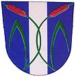
After the abolition of patrimonial Spojily formed from 1849 with the districts Staročernsko and Studánka a municipality in the judicial district of Pardubice . From 1868 the village belonged to the Pardubice district . In 1900 the village consisted of 30 houses and 193 inhabitants. Studánka broke up in 1909 and formed its own community; In 1914 Staročernsko also became independent. From the former barracks near Hůrka, a road to Spojil was built in 1920. After two houses burned down in 1921, a volunteer fire brigade was founded in 1922. The official municipality name was changed to Spojil in 1924 . In 1938 the development was extended to the pond north of the dam. The connection to the electricity network took place in 1941. In the course of the construction of Groß Pardubitz , Spojil was incorporated into the city in 1942. After the end of the Second World War, the administrative structures from the time before the German occupation were restored ; with this, Spojil also regained its independence in 1945. In 1947 it was again incorporated into Pardubice. In 1950 Spojil had grown to 48 houses and had 169 residents. After the Velké Pardubice project was abandoned in 1954 , Spojil and the other villages of the Speckgurtel were again excluded and assigned to the Okres Pardubice-okolí. This was lifted in the course of the territorial reform of 1960, since then Spojil has belonged again to Okres Pardubice. In 1961 Spojil was incorporated into Pardubice for the third time in 20 years. In 1980, 224 people lived in the 61 houses of Spojil. The municipality of Spojil has existed again since the beginning of 1992. Spojil has had a coat of arms and a banner since 2000.
Community structure
No districts are designated for the municipality of Spojil. Spojil forms an enclave within the Pardubice urban area.
Attractions
- Chapel of the Assumption of Mary, built in 1868
- Memorial cross, donated by the Spojiler women in thanks for the protection of God during both world wars
Web links
Individual evidence
- ↑ http://www.uir.cz/obec/574198/Spojil
- ↑ Český statistický úřad - The population of the Czech municipalities as of January 1, 2019 (PDF; 7.4 MiB)
- ^ Johann Gottfried Sommer : The Kingdom of Bohemia; Represented statistically and topographically. Volume 5: Chrudimer Kreis. Prague 1837, p. 53


