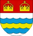
Čeperka
| Čeperka | ||||
|---|---|---|---|---|
|
||||
| Basic data | ||||
| State : |
|
|||
| Region : | Pardubický kraj | |||
| District : | Pardubice | |||
| Area : | 1133 ha | |||
| Geographic location : | 50 ° 8 ' N , 15 ° 46' E | |||
| Height: | 225 m nm | |||
| Residents : | 1,137 (Jan 1, 2019) | |||
| Postal code : | 533 45 | |||
| License plate : | E. | |||
| traffic | ||||
| Street: | Opatovice nad Labem - Staré Ždánice | |||
| Railway connection: | Pardubice – Liberec | |||
| structure | ||||
| Status: | local community | |||
| Districts: | 1 | |||
| administration | ||||
| Mayor : | Kristina Vosáhlová (as of 2018) | |||
| Address: | B. Němcové 1 533 45 Čeperka |
|||
| Municipality number: | 574856 | |||
| Website : | www.ceperka.cz | |||
Čeperka (German Czeperka , 1939–45 Tscheperka ) is a municipality in the Czech Republic . It is located ten kilometers southwest of the city center of Hradec Králové and belongs to the Okres Pardubice .
geography
Čeperka is located in the Pardubická kotlina ( Pardubice Basin ) on the Opatowice Canal . The Pardubice – Liberec railway runs through the village . The Dálnice 35 runs north of the village , east the state road I / 37 between Opatovice nad Labem and Pardubice . To the southeast is the Opatovice power plant. The Bažantnice forest extends to the south and the Kulhánov forest to the west.
Neighboring towns are Liščí, Pohřebačka and Opatovice nad Labem in the north, Vysoká nad Labem and Na Podlesí in the northeast, Borek and Bukovina nad Labem in the east, Zástava and Dříteč in the southeast, Hrobice , Hrobický Dvůr and Stéblová in the south, Malá Čepán andý Nové Ždánice in the southwest, Podůlšany and Krásnice in the west and Sedlice and Libišany in the northwest.
history
After Wilhelm von Pernstein united the dominions of Pardubitz and Kunburg in 1491 , he had the Čeperka pond created in 1496. From 1498 the ditch Velká strúha was created to feed the Elbe water into the Pardubice fish ponds. After purchasing a piece of land on the Elbe near Opatowitz in 1513, Wilhelm von Pernstein had the new Opatowitz Canal dug, which replaced the Velká Strouha as the main water supply to his ponds. After the pond was enlarged, Velká Čeperka was the largest of the Pardubice fish ponds in the middle of the 16th century and, with an estimated 1250 hectares of water, it was also one of the largest ponds in Bohemia. On March 21, 1560 Jaroslav von Pernstein sold the entire rule of Pardubitz to King Ferdinand I. His successor Maximilian II transferred the administration of the royal lords to the court chamber .
In the course of the raabization , the Pardubice Chamberlain had the village of Czeperka laid out in 1777 along the historical route from Opatovice to Podůlšany and Stéblová . The canal formed a natural axis for settlement.
In 1835 the village of Čeperka, located in the Chrudim district not far from the pond of the same name, consisted of 38 houses in which 290 people lived. There was a forester's house in the village. The parish was Opatowitz. Until the middle of the 19th century, Čeperka remained subordinate to the Imperial and Royal Chamber of Commerce Pardubice.
After the abolition of patrimonial Čeperka formed from 1849 a municipality in the judicial district of Pardubice . Between 1856 and 1857, the south-north German connecting railway built the railway between Pardubitz and Josefstadt , which crossed the Velká Čeperka pond on a dam and passed Čeperka to the west. From 1868 the community belonged to the Pardubitz district . In 1869 Čeperka had 453 inhabitants and consisted of 52 houses. The Velká Čeperka was drained in the second half of the 19th century; the pond was converted into arable land and the Hrobický Dvůr was created. At the end of the 19th century, the districts Hrobický Dvůr and V Koutech belonged to Čeperka. In 1900 551 people lived in the village, in 1910 there were 592. In 1930 Čeperka had 709 inhabitants. In 1949 Čeperka was assigned to the Okres Pardubice-okolí. Since 1960 the community has belonged again to Okres Pardubice . The Opatovice coal-fired power station was built between 1959 and 1960. In the 2001 census, 927 people lived in the 295 houses of Čeperka. A large number of the residents of the village are employed in the power station.
Community structure
No districts are shown for the municipality of Čeperka. Basic settlement units are Čeperka, Malá Čeperka ( Klein Czeperka ) and Opatovice-elektrárna.
Attractions
- Opatowice Canal
- Memorial stone for the fallen of the First World War
- Quarry ponds Oplatil I, Oplatil II, Malá Čeperka, Mácháč and Gigant near Malá Čeperka, they were created in gravel pits on the pond of the Oplatíl fish pond
literature
- Historický lexikon obcí České republiky 1869–2005 , part 1, p. 522.
Web links
Individual evidence
- ↑ http://www.uir.cz/obec/574856/Ceperka
- ↑ Český statistický úřad - The population of the Czech municipalities as of January 1, 2019 (PDF; 7.4 MiB)
- ↑ Územní plan Čeperka
- ^ Johann Gottfried Sommer , Franz Xaver Maximilian Zippe: The Kingdom of Böhmen. Represented statistically and topographically. Volume 5: Chrudimer Kreis. Prague 1837, p. 71.
- ↑ http://www.uir.cz/zsj-obec/574856/Obec-Ceperka


