Limbach (Probstzella)
|
Limbach
Probstzella municipality
Coordinates: 50 ° 32 ′ 43 " N , 11 ° 19 ′ 23" E
|
|
|---|---|
| Height : | 397 m |
| Area : | 3.63 km² |
| Residents : | 70 |
| Population density : | 19 inhabitants / km² |
| Incorporation : | 1st January 1974 |
| Incorporated into: | Marktgölitz |
| Postal code : | 07330 |
| Area code : | 036735 |
|
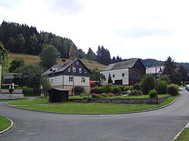
Village square
|
|
Limbach is a district of Probstzella in the Saalfeld-Rudolstadt district in Thuringia .
geography
Limbach is located southwest of Marktgölitz and has 70 inhabitants in a side valley of the Loquitzgrund . The hamlet was built in a valley basin. The district of the place covers 362.91 hectares.
history
The village was mentioned with several similar names before it was first mentioned in documents in 1386, so that an exact assignment was not possible. In 1386 the village was called Ludenbach . In 1394 Count Otto VII of Orlamünde gave the village of Limbach to the Landgrave and the Count of Pappenheim . The Limbach estate was loaned to a gentleman von Lengefeld from the Pappenheimers in 1621. The inhabitants were linen weavers, woodcutters, miners and carters. The dispossessed workers were so-called backpack farmers who mostly had only small livestock (goats, sheep and poultry).
In 1952 a community-owned tar oven and a potash boiler were operated. There was also a bad luck hut. Slate mining has been practiced for centuries. In 1860 they even went over to civil engineering. In 1902 there was a water supply. In 1911 the place introduced electrical energy. In 1953 the LPG unit was founded. Limbach came to Marktgölitz on January 1, 1974.
Individual evidence
- ↑ Limbach on the website of the community Probstzella ( Memento from May 26, 2017 in the Internet Archive )
- ↑ Federal Statistical Office (Ed.): Municipalities 1994 and their changes since 01.01.1948 in the new federal states . Metzler-Poeschel, Stuttgart 1995, ISBN 3-8246-0321-7 .
