List of cultural monuments in Görlitz old town, A – K
In the list of cultural monuments in Görlitz-Altstadt, A – K , all cultural monuments of Görlitz's old town are recorded that were recorded by the State Office for Monument Preservation of Saxony until November 2017 (excluding archaeological cultural monuments) and whose street names begin with the corresponding first letters. The notes are to be observed.
This list is a partial list of the list of cultural monuments in Görlitz .
List of cultural monuments in Görlitz old town, A – K
| image | designation | location | Dating | description | ID |
|---|---|---|---|---|---|
 |
Streets of the historic old town with sidewalks and granite paving | At the museum (map) |
19th century | Significant in terms of urban history and the appearance of the street (Annengasse, Apothekergasse, Bäckerstraße, Bei der Peterskirche, Breite Straße, Brüderstraße, Büttnerstraße, Demianiplatz, Elisabethstraße, Fischmarkt, Fischmarktstraße, Fleischerstraße, Hainwald, handicrafts, Helle Gasse, Hotherstraße, Jüdenstraße, Karpfengrund, Klosterplatz, Klosterstraße, Kränzelstrasse, Krebsgasse, Krischelstrasse, Langenstrasse, Neißstrasse, Nikolaistrasse, Nonnenstrasse, Obermarkt, Peterstrasse, Plattnerstrasse, Platz des 17. Juni, Rosenstrasse, Schwarze Strasse, Sporergasse, Steinstrasse, Untermarkt, Weberstrasse, Verrätergasse) |
09302847 |
 More pictures |
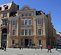
Museum of the Natural Research Society of Görlitz | Am Museum 1 (map) |
1859–1860 new building | Built for the "Ornithological Society in Görlitz", which was founded in 1811 and renamed itself in 1823 as the "Natural Research Society in Görlitz", it is of great architectural and local significance.
On April 10, 1811, JG Kretzschmar founded the “Ornithological Society in Görlitz”, which on May 13, 1823 was renamed “Naturforschende Gesellschaft zu Görlitz” in order to identify the expansion of those interested by name. It is the predecessor organization of today's museum. After moving the premises several times within the city, the Natural Research Society built a museum for its collections from 1855 to 1860. In 1860 the company moved into its own house, which is now the natural history museum, and began exhibiting and lecturing. Modifications in 1901–1902 by master builder August Kämpffer (also to enlarge the collection and exhibition area) gave the house its current appearance. |
09281354 |
 |
Residential house in closed development, corner house | Am Museum 2 (map) |
1862 | The builder was Otto Dreßler, a Gürtler, who was important in terms of building history and urban planning |
09281353 |
 |
All parts of the northern city fortifications, including the outer and inner city wall, the part of the city wall east of the Peterskirche to Neißstraße 12 as well as the green area in the Nikolaizwinger between Nikolaiturm and Peterskirche with floor relief, plants, retaining walls, stairs, gates, path system and fountain system | Am Nikolaigraben (map) |
From approx. 1300 (outer kennel wall and inner city wall); Late Middle Ages ( Hotherbastei ) | Green area 1953–1954 designed by the Görlitz horticultural director Henry Kraft with the four areas: front courtyard, perennial garden with four terraces, wall garden with Hotherbastei , fountain terrace, of importance in terms of urban history and garden art. Northern part of the city fortifications: two walls (outer and inner city wall), in between the bastion or the Zwinger, the inner wall is higher, eastern part of the city wall behind the choir of St. Peter's Church to Neißstraße 12.
Description of the garden monument:
|
09282372 |
 |
Streets of the historic old town with sidewalks and granite paving | Annengasse (map) |
19th century | Significant in terms of the history of the city and the appearance of the streets |
09302847 |
 |
Residential house in closed development, corner house on Elisabethstrasse | Annengasse 3 (main address: Steinstraße 10) (map) |
1845 | Significant in terms of building history and urban development. Belonged to Seifensieder Dobschall in 1862, building at least from 1675 to 1750 old blacksmiths and armory, then Böttcherhaus, demolished in 1845 and rebuilt around 1850. Facade changed around 1910. Original front door. |
09282176 |
 More pictures |
Annenkapelle , adjoining the neighboring Annenschule on the west side, as well as the fence and the fountain with an angel, with time running through his fingers, by Veronika von Appen | Annengasse 4 (map) |
1508-1512 | Relic of the historical water supply, recorded as Rohrbütte on the map in 1794, of architectural, art-historical and local significance. Chapel as a monument to the piety of a rich Görlitz citizen. Unusually built by a patrician, Hans Frenzel (1563–1526). Half-length portrait of Albrecht Stieglitzer on a corbel. Inside 1503–1559 the Anne Altar by Hans Olmützer. Plastered smooth around 1900. LKD and LKG |
09282185 |
 More pictures |
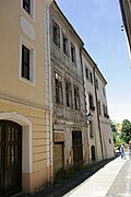
Annenschule and enclosure | Annengasse 4 (map) |
1901/03 new building, original building 1723 to 1730 | Structurally connected with the Annenkapelle, of importance in terms of architectural history, local history and the street scene. Originally built as an orphanage, neo-Gothic conversion as a school 1856–1863. 1900 demolition and new construction. Surrounded by Annengasse, Demianiplatz, Am Museum and Steinstraße. Catholic. |
09282184 |
 |
Streets of the historic old town with sidewalks and granite paving | Apothekergasse (map) |
19th century | Significant in terms of the history of the city and the appearance of the streets |
09302847 |
 |
Residential house in closed development, with Schwibbogen to the town hall wing | Apothekergasse 1 (Brüderstraße 6) (map) |
17th century | As a corner house two axes to the Brüderstraße, verifiably as a Nadlerhaus since 1675, of importance in terms of building history and house history. Schwibbogen to the town hall wing marked 1658. |
09282111 |
| Residential building in closed development | Apothekergasse 2 (map) |
17th century | Architecturally of importance, verifiable as the Nadlerhaus since 1675. Renovations in the 19th century. |
09282112 |
|
 |
Residential building in closed development | Apothekergasse 3 (map) |
18th century at its core | Architecturally important |
09282113 |
 |
Residential building in closed development | Apothekergasse 4 (map) |
17th century (ground floor vault); after 1717 (residential building) | Baroque facade, verifiable as Nadlerhaus in 1700 and 1725, since 1810 the house of the bookseller and editor of the “Görlitzer Anzeiger” Traugott Ferdinand Schirach, of architectural and local significance |
09282114 |
 |
Residential house in closed development, corner house | Apothekergasse 5 (main address: Langenstraße 1) (map) |
After 1525 | Renaissance portal and Gothic segmented arched window, of importance in terms of building history and house history |
09282456 |
 |
Archive wing as part of the Old Town Hall (Untermarkt 6, 7, 8), with a fountain basin in the wall niche and grating | Apothekergasse 7 (map) |
1534 (archive); 1st half of the 16th century (fountain); around 1900 (grid) | Building as archive wing in 1534. Erected by Wendel Roskopf , stone vat in a niche in the wall with a barricade, relic of the historical water supply, recorded on plan 1794 as a pipe vat, of architectural, artistic and socio-historical importance.
The two-storey courtyard facade consists of a band of four windows over a two-arched arcade, medallions each in an arched gusset. So-called Bütte as evidence of the water supply of the population in the late Middle Ages. Lattice of the deckle niche, fine wrought iron work. |
09302715 |
 |
Streets of the historic old town with sidewalks and granite paving | Backerstrasse (map) |
19th century | Significant in terms of the history of the city and the appearance of the streets |
09302847 |
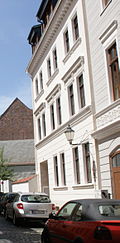 |
Residential house of the type in closed development | Bäckerstraße 3 (map) |
Around 1870 | Significant in terms of building history and urban development, original front door and window |
09282422 |
 |
Residential house in closed development, corner house | Bäckerstraße 4 (Weberstraße 20) (map) |
After 1852 | Significant in terms of building history and urban development. Large windows with segmental arches on the ground floor. Original windows and door. Building with a late classical style. |
09282259 |
 |
Residential building with shop in closed development, corner house | Bäckerstraße 5 (Weberstraße 19) (map) |
1838/39 | Late classicist, with a shop, important in terms of building history and urban development. Angled corner to Weberstrasse. |
09282257 |
 More pictures |
Bakers guild house, to the left in a closed building and western little house with water trough | Backerstraße 6 (map) |
1838–1839 (guild house); 1844 (fountain house) | Classicist structure, parapet above the central entrance, with a gilded baker's emblem on it, a bucket as a relic of the historical water supply, a well recorded here on plan 1794, of architectural and local significance. A demolition permit from 07.11.2001 is available for the outbuildings in the courtyard, of which only remains have been received. |
09282426 |
 More pictures |
Peter and Paul Church | At the Peterskirche (map) |
1230 (west bar and tower substructure); 1423–1496 (ship) | Late Gothic hall church on the former castle hill, of architectural, art-historical and local significance.
Evangelical Peterskirche, originally St. Peter and Paul (at the Peterskirche), main church. Mighty late Gothic hall church in a dominant location on the former castle hill above the Neisse.
|
09282448 |
 |
Streets of the historic old town with sidewalks and granite paving | At the Peterskirche (map) |
19th century | Significant in terms of the history of the city and the appearance of the streets |
09302847 |
 More pictures |
Residential house in closed development, corner house on Krebsgasse, plus outbuildings and horse stable | At Peterskirche 1 (Krebsgasse 8) (map) |
16th century (residential house); 1854 (horse stable) | The latter building on Krebsgasse (without number), here on the far left as far as Kirchgasse a vaulted horse stable from 1854, of architectural and house-historical importance. Ground floor baroque portal in sandstone with segment arch. In the gusset at Bei der Peterskirche 3 is a new chute, it is parcel 310, i.e. a separate parcel. |
09282449 |
 More pictures |
Residential house, development closed to the right | At Peterskirche 3 (map) |
After 1525 | Number 2, adjacent to the left, is an old loss, of significant architectural significance |
09282450 |
 More pictures |
Residential building in closed development | At Peterskirche 4 (map) |
2nd quarter of the 18th century | Architecturally important |
09282451 |
 More pictures |
Residential house in closed development, corner house to Kirchgasse | At Peterskirche 5 (map) |
2nd quarter of the 18th century | Core older, important in terms of building history |
09282452 |
 More pictures |
Storage building, initially part of the Vogtshof, school, after 1529 stacking house for Waid ( Renthaus; Waidhaus ) | At the Peterskirche 8 (map) |
2nd half of the 15th century | Initially part of the Vogtshof, school, after 1529 stacking house for Waid, the oldest secular building in the city, of architectural and art historical importance
From Unser Görlitz, Internet portal: “Mentioned in the city books as a 'free court' since the first half of the 12th century, it belonged to the ruler's castle, the Vogtshof. According to the old council accounts, the building still had a spacious tower until 1426 (Eberhards tower). 1447–1530 school. Burned down in 1479, on the occasion of its inscription on the gable: 'Nil actum creades, cum quid restabit agendum 1479'. After 1529 a stacking house for the cloth dye woad, rebuilt and increased for this purpose. In 1908, during construction work in the Waidhaus, 50 stonemason's marks came to light, which were dated to the 15th century, the century in which the church was built. The gables were built in 1936 according to an old woodcut from 1565 and the mid-houses were reconstructed on the same basis and according to the findings made during the renovation in 1993/94. " |
09282454 |
 More pictures |
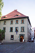
Rectory | At 9 Peterskirche (map) |
Around 1550 | Head building of the eastern development of the Hainwald, after the Reformation mostly the apartments of the now Protestant pastors with their families, therefore called Primariat, of architectural and local importance |
09282455 |
 |
Residential house in closed development, corner house | At Peterskirche 11, 12 (map) |
Around 1880 | Originally the rear building of Peterstrasse 8, of architectural significance |
08992224 |
 |
Streets of the historic old town with sidewalks and granite paving | Broad street (map) |
19th century | Significant in terms of the history of the city and the appearance of the streets |
09302847 |
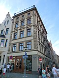 |
Apartment house in closed development, corner house with original corner shop | Breite Strasse 1 (Obermarkt 20) (map) |
1860s | Entrance on Breite Straße in the lower part, of importance in terms of building history and urban development |
09282529 |
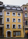 |
Residential house in closed development with a shop from the late 19th century | Breite Strasse 2 (map) |
After 1717 | Architecturally important |
09282531 |
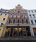 |
Apartment building in closed development, with shop with original front | Breite Strasse 3 (map) |
Marked 1891 | Clinker brick, important in terms of building history and urban development. Falls out of the street in terms of height and design. |
09282532 |
| Residential house in closed development, with shop | Breite Strasse 4 (map) |
2nd quarter of the 19th century | Architecturally important. In the core, definitely older High, narrow windows, stately format. |
09282533 |
|
 |
Residential building in closed development | Breite Strasse 5 (map) |
Marked 1735 | The building consists of a left three-axis house with a raised central axis and a two-axis house, which is important in terms of architectural history. Raised central axis with triangular gable. Facade stucco. Asymmetrical portal position and original front door. |
09282534 |
 |
Residential building in closed development | Breite Strasse 6 (map) |
1st half of the 19th century | Significant in terms of building history and urban development |
09285417 |
 More pictures |
Municipal school | Breite Straße 7 (main address: Langenstraße 23) (map) |
1846 | Stately classical building, with three wings enclosing a small courtyard, of architectural and local significance. Large structure, classical forms with some neo-Gothic elements. Original windows from the late 19th century. |
09282477 |
| Apartment building in closed development, corner house | Breite Straße 8 (main address: Langenstraße 30) (map) |
Around 1905 | Architecturally and urbanistically important, Art Nouveau decor |
09282484 |
|
| Apartment building in closed development | Breite Strasse 9 (map) |
Around 1900 | Significant in terms of building history and urban development |
09301646 |
|
| Residential building in closed development | Breite Strasse 10 (map) |
Core 18th century | Significant in terms of building history and urban development |
09282326 |
|
| Apartment building in closed development, with shops with original fronts | Breite Strasse 11 (map) |
3rd quarter of the 19th century | Elaborately structured plastered facade, of importance in terms of building history and urban planning. Rustic blocks. Plaster ornamentation on the upper floors. |
09282537 |
|
| Residential building in closed development | Breite Straße 12 (map) |
16th century (core) | Significant in terms of building history and urban development. Core 16th century, increased in the 19th century. Original front door. |
09285418 |
|
| Apartment building in closed development, corner house | Breite Strasse 13a (Hugo-Keller-Strasse 12) (map) |
Around 1850 | Architecturally important. Beveled corner. Cornice. Original windows. Beautiful arched staircase windows. Original interior. |
09282538 |
|
| Apartment building in closed development, corner house | Breite Strasse 13b (Hugo-Keller-Strasse 11) (map) |
Around 1870 | Significant in terms of building history and the appearance of the street. Bevelled and raised corner. Plaster grooves. |
09282540 |
|
| Residential building in closed development | Breite Strasse 14 (map) |
Around 1830 | Architecturally important. Rustic structure. Plaster grooves. Demolition permit 2008. |
09282542 |
|
| Two houses in closed development | Breite Strasse 16, 17 (map) |
Marked 1720 | Architecturally important |
09282487 |
|
 |
Residential building with shop in closed development, corner house | Breite Straße 18 (main address: Langenstraße 31) (map) |
Marked 1720 | Baroque house, historically important. The middle two axes of the facade are raised and crowned with a triangular gable. Shop installation after 1850. Inside there are still beautiful baroque stucco ceilings. Groin vaults in the hall. Front door 1st half of the 19th century. |
09282486 |
 |
Residential building in closed development | Breite Strasse 20 (map) |
After 1717 | Architecturally important |
09282545 |
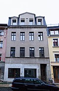 |
Residential building in closed development | Breite Strasse 21 (map) |
Around 1880 | Architecturally important. Smoothed facade, plaster scratches around the window. |
09285611 |
| Residential building in closed development | Breite Straße 22 (map) |
After 1717 | Architecturally important |
09282546 |
|
| Residential building in closed development | Breite Strasse 23 (map) |
1st quarter of the 19th century | Architecturally important. Ground floor disrupted plaster grooves. |
09282547 |
|
| Residential building in closed development | Breite Straße 24 (map) |
1st half of the 18th century | Architecturally important |
09282548 |
|
| Residential house in closed development, with shop | Breite Straße 25 (map) |
Around 1717 | Architecturally important |
09282549 |
|
| Residential building with shop in closed development, corner house | Breite Straße 26 (main address: Obermarkt 21) (map) |
After 1717 | Significant in terms of building history and urban development. Do not load an original front. Front to the Obermarkt with only 2 upper floors, the only example of the former eaves height on the Obermarkt. |
09282354 |
|
 |
Streets of the historic old town with sidewalks and granite paving | Brüderstrasse (map) |
19th century | Significant in terms of the history of the city and the appearance of the streets |
09302847 |
 |
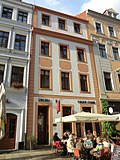
Residential house in closed development, with shops with original fronts, corner house | Brüderstraße 1 (Plattnerstraße 9) (map) |
16th Century | Basically renaissance and baroque, Schwibbogen to Obermarkt 33, of architectural and urban significance |
09282136 |
 More pictures |
Residential building in closed development | Brüderstraße 2 (map) |
Renaissance core; Late 18th century (facade) | Late baroque facade, of importance in terms of building history and urban development. The core of the Renaissance, late Baroque facade with plastered mirrors. |
09302517 |
 More pictures |
Residential building in closed development | Brüderstraße 3 (map) |
16th Century | Baroque three-part facade and baroque portal with keystone, of architectural and artistic importance. Inscription above entrance and coat of arms of Dr Julius Ernst Scholz von Schollenstern. Brauhof 1504 from two houses combined, 1665 eaves roof. Baroque renovation with a three-part facade (three axes each). Keystone from 1717. 3rd floor placed in the middle of the 19th century. |
09282138 |
 More pictures |
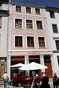
Residential house in closed development and two rear buildings | Brüderstrasse 4 (map) |
Around 1450 | Renaissance facade, of importance in terms of building history and house history. Brauhof, 3rd floor set up in 1923, at that time also shop fitting. Columns on the courtyard front on the 1st floor as in Brüderstraße 10, the front building with original shop fronts from the early 20th century. Rear buildings probably overformed at the beginning of the 19th century, including older plastered layers and on the western structure to the neighboring courtyard an added portal with a round arch, possibly still Romanesque like the surrounding masonry. |
09282139 |
 More pictures |
Residential house in closed development, with original shop | Brüderstraße 5 (map) |
After 1525 | With an original shop, significant building and house history. Medieval core. Four-story narrow building. Baroque facade. 1858 reconstruction. Stucco inside. |
09282140 |
 More pictures |
Residential house in closed development, with Schwibbogen to the town hall wing | Brüderstraße 6 (main address: Apothekergasse 1) (map) |
17th century | As a corner house two axes to the Brüderstraße, verifiably as a Nadlerhaus since 1675, of importance in terms of building history and house history. Schwibbogen to the town hall wing marked 1658. |
09282111 |
 More pictures |
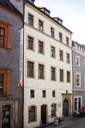
Schönhof ; Residential house in closed development and all outbuildings | Brüderstraße 8 (map) |
Marked with 1526 (house); 1st third of the 19th century (outbuilding) | Construction by Wendel Roskopf after Brand 1525 using three old house units, went through to Fischmarkt 5, the oldest bourgeois Renaissance house in Germany with a date, of architectural and art historical importance. One of the most important early Renaissance buildings in Germany. An important urban planning solution compared to the town hall tower with a grand staircase. Corner bay to the northwest as a focal point for Brüderstraße. Portal with the year 1617, Upper Saxon building tradition. Building with a large plot depth and two pitched roofs one behind the other (ditch roof?). |
09282142 |
 More pictures |
Residential building in closed development | Brüderstraße 9 (map) |
Late Gothic and Renaissance | Late Gothic central hall around 1480, Renaissance seat niche portal, two stucco ceilings around 1700, of architectural and art historical importance. Two eaves roofs with a ditch in between. |
09282143 |
 More pictures |
Residential house in closed development, with shop | Brüderstrasse 10 (map) |
Rebuilt as a Renaissance house after a fire in 1520 | Renaissance portal from the collapsed house at Peterstrasse 11, on the upper floor the “ancient column” from 1570 with the coat of arms of the Moller von Mollstain family, of architectural and art historical importance. Renaissance portal around 1530. Between two windows on the first floor there is a column decorated with leaves, women's heads, angels and Ionic capitals. Above, nicely drawn console with the Möller von Möllstain coat of arms. Baroque mansard roof. In the basement (the lowest basement level now filled in) there was once an ai cultivation (a cultivation, also an off-breeding, is an artificially created underground cavity that serves to drain water). |
09282144 |
 More pictures |
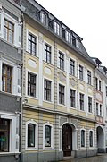
Residential house in closed development, with shop | Brüderstraße 11 (map) |
Marked with 1547 | Hall building with renaissance portal, builder Wendel Roskopf , of architectural and artistic importance. Predecessor built in 1415. The current building is an important Renaissance building, the gable was removed in the 18th century, but a mansard roof. Renaissance portal. Zwickelfelder the portal with inscription panels with monograms HS and WR, with the former house brand, with other year 1547 (HS: Hans Schmidt, WR: Wendel Roskopf). The only signed building by this renaissance master builder Hans Schmied (1522–1602). Noble family since 1575. The interior of the central hall and the Renaissance hall have been preserved. |
09282145 |
 More pictures |
Residential house in closed development, corner house with frontage to Brüderstraße, with a connecting passage to Brüderstraße 13 and three candle arches to Schwarzen Gasse 3, 4 | Brüderstraße 12 (main address: Schwarze Straße 5) (map) |
Around 1730, core older (house); 1730 (connecting corridor) | High-quality baroque facade, of importance in terms of building history and the street scene. Predecessor building from the late Middle Ages. Former brewery, connected to Brüderstraße13 (also brewery) since 1730 by a stone superstructure above Schwarzen Straße. Ground floor with shop. Mansard roof and loft extensions, 2nd half of the 19th century, arched passage to Brüderstraße 11. Inside, stucco ceilings. |
09282330 |
| Residential building in closed development (Schwarze Straße 4) | Brüderstrasse 13 (map) |
16th century at its core | Late medieval core, baroque façade, passage to Schwarzen Straße is under construction, of architectural significance. Former brewery (building has been around since 1400). Segment arch on the ground floor, groin vault in the passage. Shop 2nd half of the 19th century. 1620 facade renovation. - 25.11.1999: Approval for the demolition of the courtyard extensions given. |
09282147 |
|
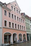 |
Residential house in closed development, with shop | Brüderstrasse 14 (map) |
Around 1730 | Formerly a brewery that ran all the way to Fischmarktstraße 2 and was of importance in terms of building history and house history. Baroque building. The building has been standing since around 1430. Shop with segment arch over shop window 20th century. |
09282148 |
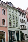 |
Residential house in closed development, with shop | Brüderstraße 15 (map) |
Core building 18th century | Shop with front around 1900, important in terms of building history. Formerly called the Höfchen, Brauhof until around 1670 (the building has been around since 1415). 1875 Reconstruction of the older house, facade from the 19th century over the core building from the 18th century. |
09282149 |
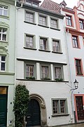 More pictures |
Residential house in closed development, with shop | Brüderstrasse 16 (map) |
Marked with 1566 | Renaissance building with seat niche portal, of architectural and artistic importance. Eaves facing the street. Small Görlitz hall house with little courtyard space. Inscription on the portal with the year 1566. |
09282150 |
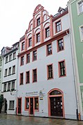 More pictures |
Residential house in closed development, with shop | Brüderstrasse 17 (map) |
Around 1650 | With the shop, in the Renaissance gable from the 17th century that was preserved after the roof was turned, the old gable house reveals itself, historically important |
09282151 |
 More pictures |
Schwibbogenhaus; Residential house in closed development, corner house, in addition building with passage arch and residential house to the monastery square | Brüderstraße 18 (main address: Obermarkt 34) (map) |
1st half of the 16th century (house); around 1880 (residential building); older in core (connecting passage) | Significant in terms of building history and the appearance of the street. Obermarkt residential building: origin possibly medieval, parts of the 1st half of the 16th century. Large structure with a late Gothic pointed archway to the monastery square, vaulted as a pointed barrel. Gable side facing the Brüderstraße with the inscription 1819, concerns the interior renovation while maintaining the surrounding walls. 1819 Renaissance gable removed and main house rebuilt. First floor two shops. Building with a passage arch and residential floors above it from 1533. Residential building facing the monastery square. |
09282318 |
 |
Streets of the historic old town with sidewalks and granite paving | Büttnerstrasse (map) |
19th century | Significant in terms of the history of the city and the appearance of the streets |
09302847 |
 |
Residential house in closed development, corner house | Büttnerstrasse 1 (map) |
After 1717 | Corner house to Langenstraße, in the fire wall to Langenstraße 43 a very wide and high pointed arch is built, which is certainly a city gate of the former city around the Untermarkt, historically important, through the gate unique in the history of the city. Renaissance building, facade to Langenstrasse changed in baroque style. Originally there were two houses with gables facing Langenstrasse. Formerly Bierhof. Portal with basket arch. Main front to Langenstrasse. |
09282118 |
 |
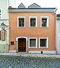
Residential building in closed development | Büttnerstrasse 2 (map) |
After 1717 | Architecturally important. Original construction after 1717. With pike dormers and cornices |
09282119 |
 |
Residential building in closed development | Büttnerstrasse 3 (map) |
After 1717 | Architecturally important. Beautiful cross-vaulted ground floor corridor. |
09282120 |
 |
Residential building in closed development | Büttnerstrasse 4 (map) |
After 1717 | Architecturally important. Arched ground floor corridor, Biedermeier front door. |
09282121 |
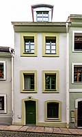 |
Residential building in closed development | Büttnerstrasse 5 (map) |
After 1717 | Architecturally important |
09282122 |
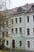 |
Residential building in closed development | Büttnerstrasse 6 (map) |
After 1717 | Architecturally important, with the original front door |
09282123 |
 |
Residential building in closed development | Büttnerstrasse 7 (map) |
After 1717 | Architecturally important. Beautiful cross-vaulted hallway to the garden. Original front door. |
09282124 |
 More pictures |
Residential building in closed development | Büttnerstrasse 8 (map) |
After 1717 | Groin vaults in the entrance hall over three bays and painted wooden beam ceiling on the 1st floor, of architectural and art historical importance |
09282125 |
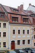 |
Residential building in closed development | Büttnerstrasse 9 (map) |
After 1717 | Architecturally important. 18th century mansard roof |
09282126 |
 |
Residential building in closed development | Büttnerstrasse 10 (map) |
Marked 1726 | Inscription "CBD1776", arched portal, mansard roof, of architectural significance |
09282127 |
 |
Residential building in closed development | Büttnerstrasse 11 (map) |
After 1717 | Architecturally important |
09282128 |
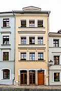 |
Residential building in closed development | Büttnerstrasse 12 (map) |
Around 1850 | Architecturally important. Previous building after 1717. Quite large house for Handwerkerstrasse. Stucco decoration in ribbons. Charming Biedermeier renovation in the middle of the 19th century. |
09282129 |
 More pictures |
Residential building in closed development | Büttnerstrasse 13 (map) |
After 1717 | Architecturally important |
09282130 |
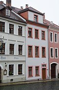 |
Residential building in closed development | Büttnerstrasse 14 (map) |
After 1717 | Architecturally important. Roof extensions of the 20th century. Construction marked on the keystone. |
09282131 |
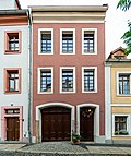 |
Residential building in closed development | Büttnerstrasse 15 (map) |
After 1717 | Architecturally important |
09282132 |
 |
Residential building in closed development | Büttnerstrasse 16 (map) |
After 1717 | Architecturally important |
09282133 |
 More pictures |
City square with stairs and retaining walls with attached balustrade, wall between Kaisertrutz and theater, lanterns, green area with their paths, divisions and wooded areas, driveway and tropic at the theater as well as the sidewalks and streets surrounding the square with their fortifications, the monument to Gottlob Ludwig Demianis , the Toilets far below the theater and the tram booth in the southeast corner |
Demianiplatz (map) |
1850 (beginning of the square design); 1852 (outside staircase); 1862 (Demiani Monument); 1920s (public lavatory) | Until 1846, Platz was called Rademarkt, a new development after 1840, which was of artistic, urban and historical significance. Town square with stairs and supporting walls on both sides with attached balustrade, the flat wall between the Kaisertrutz and the theater made of cyclopically laid quarry stone masonry, lanterns, the driveway in various granite stones in front of the entrance of the theater and the surrounding streets and surfaces in granite and basalt from the crown of the country. The green area in its paths, divisions (with access to the theater with a turning loop as well as the sidewalks and streets surrounding the square with their fortifications) and woody stock, the monument to Gottlob Ludwig Demianis (bronze with sandstone pedestal) by Johannes Schilling (first stood on Marienplatz), the toilet house far below the theater and the tram house in the southeast corner.
Description of the garden monument:
|
09282327 |
 More pictures |
Streets of the historic old town with sidewalks and granite paving |
Demianiplatz (map) |
19th century | Significant in terms of the history of the city and the appearance of the streets |
09302847 |
 |
Residential and commercial building with shops in closed development, corner house | Demianiplatz 3 (Obermarkt 11) (map) |
Marked 1852 | Significant in terms of building history, urban development and the street scene. Ground floor with large store openings. |
09282189 |
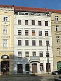 |
Residential house in closed development, with shop | Demianiplatz 4 (map) |
Around 1870 | Architecturally important. Central balcony on the 1st floor. 4th floor attached. Original front door. Small shop on the ground floor with partly original front. |
09282188 |
 |
Rautenkranz pub; Inn in development closed to the left | Demianiplatz 5 (map) |
Around 1870 | With an inner courtyard and a curved staircase, important in terms of urban planning. Facade changed around 1910, attached 4th floor. Partly original windows and original front door. Curved staircase. Balcony is missing. |
09282187 |
| Residential house of the type in closed development, with open space on Annengasse with a comprehensive wall | Demianiplatz 7 (map) |
1862/63 | Representatively shaped by Ignaz Friedländer, of architectural significance. The narrow number 6 attached to the left was probably torn down in 2013. With high arched windows on the ground floor. Representative stucco in the entrance area and interiors. Marble stairs and tiles. |
09282186 |
|
 More pictures |
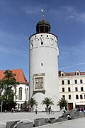
Frauenturm as part of the city fortifications, with city arms on the south side | Elisabethstrasse (map) |
Around 1250 | Coat of arms formerly on the outer Frauentor, of importance in terms of building history, town history and shaping the townscape. Tower built during city expansion, simple cylindrical construction. Upper part late Gothic, in brick with wall panels. Tower dome with octagonal structure, changed in the Renaissance style in 1564. The town's coat of arms (sandstone) has been attached to the south side since 1856, is surrounded by stone images of Maria and Barbara, with the inscription “Invia virtuti nulla est via 1477” (heraldic panel formerly on the southern city gate). |
09282183 |
 |
Elisabethstrasse; Square-like widened promenade instead of the looped city fortifications, built in classical style, with a double avenue of horse chestnuts and summer lime trees and a promenade in the middle, with lawn strips, streets and footpaths to the side | Elisabethstrasse (map) |
1850–1855 (Promenade); 1862 (double avenue planted with horse chestnuts) | Significant in terms of urban history, urban planning and gardening. Until 1840 double city wall ring and city moat in the area of the later Elisabethstrasse. 1843 Decision of the city council to develop the area into a promenade. In 1844 the Prussian King Friedrich Wilhelm IV elevated Görlitz to the rank of a city, in thanks to the naming of the new street after the wife of the monarch, Elisabeth. From 1850 leveling work. Since 1855, the new promenade almost got its current shape, probably the model of Berlin's Unter den Linden promenade. 1862 with a four-row avenue, planted alternately with horse chestnuts and summer linden, originally 175 trees. Already in 1864 the center of the weekly market for agricultural and horticultural products. Elisabethstraße is one of the most distinctive streets in Görlitz due to its diverse facades.
Description of the garden monument: Square-like widened promenade with a centrally arranged footpath and double avenue, strips of grass to the left and right of the middle path, streets and footpaths at the edges of the square, crossing through Klosterstrasse
|
09282979 |
 |
Streets of the historic old town with sidewalks and granite paving | Elisabethstrasse (map) |
19th century | Significant in terms of the history of the city and the appearance of the streets |
09302847 |
 |
Residential and commercial building in closed development, corner house on Steinstrasse | Elisabethstrasse 1 (Steinstrasse 9) (map) |
After 1863 | Significant in terms of building history and urban development. The previous building was a brewery, including an inscription from 1474. The building was demolished for the current one. |
09282211 |
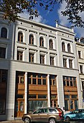 |
Residential and commercial building in closed development with original shops on the ground floor and mezzanine | Elisabethstrasse 2 (map) |
Around 1860 | Flat roof with parapet, important in terms of building history and urban development. Original front door around 1860. Ground floor and 1st floor converted into a shop around 1900. |
09282212 |
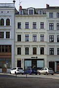 |
Residential house in closed development, with shop | Elisabethstrasse 3 (map) |
Around 1860 | Significant in terms of building history and urban development. Facade coarsened with new plaster. Ground floor badly disturbed by shop burglary |
09282213 |
 |
Residential house in closed development, with original shop front | Elisabethstrasse 4 (map) |
Around 1860 | Significant in terms of building history and urban development. Original front door. |
09282214 |
 |
Residential house in closed development, with shop | Elisabethstrasse 5 (map) |
Around 1850 | Baroque façade, of architectural and urban significance. Shop with original front. Original front door. |
09282215 |
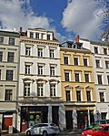 |
Residential house with shop in closed development and rear building | Elisabethstrasse 6 (map) |
Around 1850 | Significant in terms of building history and urban development. Shop front around 1890. Original front door. |
09282216 |
 |
Residential building in closed development | Elisabethstrasse 7 (map) |
Around 1850 | Architecturally important. Unadorned, smooth facade with original windows. Ground floor disfigured by shop break-ins. |
09282217 |
 |
Residential house in closed development, with shop | Elisabethstrasse 8 (map) |
Around 1850 | Significant in terms of building history and urban development. Unadorned, smooth facade. Shop front around 1870. Original front door. House too. |
09282218 |
 |
Residential house in closed development, with shops | Elisabethstrasse 9 (map) |
Around 1905 | Significant in terms of building history and urban development. Shops with the original front. Middle bay on the 1st and 2nd floor. |
09282219 |
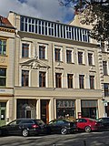 |
Residential building in closed development | Elisabethstrasse 10 (map) |
Around 1880 | Above the main cornice, a studio with a glass front, of importance in terms of building history and urban planning. Burglaries from the 1920s affect the neo-baroque facade decor. |
09282220 |
 |
Residential house in closed development, with the original shop front from the 1920s | Elisabethstrasse 11 (map) |
Around 1860 | Significant in terms of building history and urban development. Front door around 1900, shop front on the ground floor and 1st floor. |
09282221 |
 |
House in closed development, with shop with original front | Elisabethstrasse 11a (map) |
Around 1850 | Architecturally important. Original front door. |
09282222 |
 |
Residential and office building in closed development, corner house | Elisabethstraße 12 (main address: Klosterstraße 2) (map) |
1853/54 (residential and office building) | Palazzo-like building, of historical and urban importance. Palazzo-like building with many plaster grooves. According to Jecht, the collapse of the old Marstall in 1853 offered the opportunity to open the Klosterplatz to Elisabethstrasse. |
09282210 |
 More pictures |
Boys middle school; Elisabeth School, on the corner of Klosterstrasse, with a passage to the fish market | Elisabethstrasse 13 (Klosterstrasse 1, Klosterplatz 16) (map) |
Marked 1873 | Stately building with a rich neo-renaissance facade, design: Berlin architect Cremer and Görlitzer master builder Barth, of significance in terms of architectural history, building art and shaping the plaza. Three-storey building with a flat roof. Heavy neo-renaissance forms from the Wilhelminian era. Round window. Passage: Passage area vaulted. Belt arches, pilasters with composite capitals, cranked profiles. |
09282223 |
 |
Apartment building in closed development, with original shop front | Elisabethstrasse 14 (Elisabethstrasse 15) (map) |
Around 1900 | A building with number 15, of architectural and urban significance. With beautiful original shop fronts and “Eduard Bischoff” writing. Art Nouveau facade decoration, floral motifs. The core of the house was also around 1850. |
09282224 |
 |
Tenement house with shop with original front in closed development | Elisabethstrasse 15 (map) |
Around 1900 | A building with no. 14, of architectural and urban significance |
09282225 |
 |
Apartment building in closed development, with original shop front | Elisabethstraße 15 (main address: Elisabethstraße 14) (map) |
Around 1900 | A building with number 15, of architectural and urban significance. With beautiful original shop fronts and “Eduard Bischoff” writing. Art Nouveau facade decoration, floral motifs. The core of the house was also around 1850. |
09282224 |
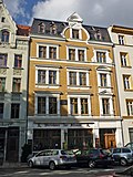 More pictures |
Apartment building in closed development, with restaurant "Am Wochenmarkt" | Elisabethstrasse 16 (map) |
1880s | Restaurant with colored leaded glass windows, of importance in terms of urban planning and local history. Restaurant "Am Wochenmarkt", original front door. With memorial plaque for Gustav von Moser . |
09282227 |
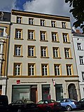 |
House in closed development, with shop with original front | Elisabethstrasse 17 (map) |
Around 1850 | Of importance in urban planning. Entrance through the house with belt arches on consoles with ornament. Original home furnishings. |
09282228 |
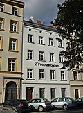 |
Residential building in closed development | Elisabethstrasse 18 (map) |
Around 1850 | Of importance in urban planning. Smooth facade, only three medallions with relief heads on the 3rd floor. Original front door. |
09282229 |
 |
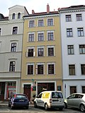
Residential house in closed development, with a historic shop front | Elisabethstrasse 19 (map) |
1857 | Client Dr. Klefeld, important in terms of urban planning. Original front door and window. Central balcony on the 1st and 2nd floors. Loft extensions. Shop on the right with Art Nouveau window displays. |
09282230 |
 |
Residential building in closed development | Elisabethstrasse 20 (map) |
1850s | Of importance in urban planning. Original windows with winter attachment windows and front door. First to third floors straight window canopies. Ground floor changed. The courtyard wing is not a monument as it has been largely demolished and the rest changed. |
09282231 |
 |
Residential building in closed development | Elisabethstrasse 21 (map) |
1849/50 | Master shoemaker Deutsch built it as a rear building at Krischelstrasse 13, which is of importance in terms of urban development. Original front door. |
09282232 |
 |
Residential house in closed development, with shop | Elisabethstrasse 22 (map) |
Around 1870 | Façade with neo-baroque decor, important in terms of building history and urban planning. Facade with neo-baroque stucco, pilasters and original windows. Shop front and window dressing 1920s. |
09282233 |
 |
Residential building in closed development | Elisabethstrasse 23 (map) |
Around 1850 | Of importance in urban planning. Facade slightly smoothed. Original front door. |
09282234 |
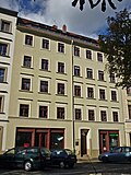 |
House in closed development, with two shops with the original front | Elisabethstrasse 24 (map) |
Around 1850 | Of importance in urban planning. Facade slightly smoothed. Original front door. |
09282235 |
 |
Apartment building in closed development, with shops with original fronts | Elisabethstrasse 25 (map) |
Around 1850 | Of importance in urban planning. Front door and house equipment. Spiral staircase. 1930s stencil painting in the entrance area. |
09282236 |
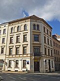 |
Residential house in closed development, corner house on Elisabethstrasse | Elisabethstraße 26 (main address: Weberstraße 12) (map) |
1851 | Classicist facade, important in terms of building history and urban development. Corner balcony on the 1st floor with a beautiful grid. Original front door. Small atrium. According to Lemper, Görlitz topography, the first construction of the new street completely with new apartment buildings. |
09282237 |
 |
Advertising pillar | Elisabethstrasse (corner of Weberstrasse) (map) |
Around 1920 | Of cultural and historical importance |
09281932 |
 |
Streets of the historic old town with sidewalks and granite paving |
Fish market (map) |
19th century | Significant in terms of the history of the city and the appearance of the streets |
09302847 |
| Public toilet | Fish market (passage to Elisabethstrasse) (map) |
1920s | Clinker brick, of social and historical importance |
09284985 |
|
| Open-air bank building with a large gable | Fish market (passage to Elisabethstrasse) (map) |
Late 19th century | Clinker brick construction, of local and economic importance |
09284984 |
|
| Slaughterhouse side hall | Fish market (passage to Elisabethstrasse) (map) |
Late 19th century | So-called clinker hall, clinker brick building, of local and economic importance |
09284983 |
|
| Residential house in closed development, corner house | Fischmarkt 1 (main address: Schwarze Straße 8) (map) |
16th Century | Architecturally important |
09285391 |
|
| Residential building in closed development | Fish market 2, 3 (map) |
1860s | Significant in terms of building history and urban development. Original courtyard gate. Beautiful arched staircase windows. Cast iron banister. |
09282431 |
|
| Residential building in closed development | Fish market 4 (map) |
Around 1840 | Significant in terms of building history and urban development. Ground floor disturbed by shop fitting around 1920. Original courtyard gate and window. Bakers Guild House? |
09282430 |
|
 More pictures |
Parish hall of the Baptist parish Parish hall with auditorium in closed development | Fish market 5 (map) |
After 1817 | Belonged to Schönhof Untermarkt and Brüderstraße 8, conversions to the brewery and malt house and for the Baptist congregation, of architectural and local significance. Central projection, left part of the house with dining club, right the hall. On the courtyard side, symmetrically developed rear front with two wings protruding at right angles. Western wing in connection with the middle house of the Schönhof property. Courtyard gate is missing. A bat dormer and two pikes. Building burned down in 1817 and shortly afterwards rebuilt as a brewing and malt house, taken over by the Baptist church in 1832 and rebuilt with parts from the 18th century. Jecht writes on p. 354 that the first letters of the ten names can be read above the exit to the fish market, which in 1832 “expanded the back building at the fish market into a contemporary brewing and malting house”. |
09282428 |
 More pictures |
Girls 'Citizens' School (Community School V); music school | Fish market 6 (map) |
1836-1838 | Classicist building, built under Ferdinand Wilhelm Kaumann, whom Demiani commissioned with the development of the Görlitz education system, original equipment, music school since around 1950, of architectural, local and social history |
09282429 |
 More pictures |
Residential house in closed development, with shop | Fish market 8 (map) |
1840s, core older | Originally consisting of two houses, historically important. The house may be older at its core. |
09282436 |
 More pictures |
Residential building in closed development | Fischmarkt 9 (map) |
Around 1850 | Architecturally important |
09282435 |
 |
Residential building in closed development | Fish market 10 (map) |
1st half of the 18th century | Architecturally important. Signet keystone above the portal, marked 17 (?) 7, baroque door around 1730. |
09282434 |
 More pictures |
Catholic parish school (No. VI) and gym | Fischmarkt 11, 12 (map) |
1895/96 | Clinker brick, drafts by government master builder Paul Schröder and master carpenter and bricklayer Adalbert Rothenburger, of architectural, local and social historical importance. Red clinker facing. Large original windows and doors. - As of 2003 at address “Fischmarkt 11/12” in the list of monuments. City Planning Director Schröder, executed by Rothenburger. According to Jecht (p. 443), an old house has been built in here, in which the town councilor of Milziz lived. |
09282433 |
| Streets of the historic old town with sidewalks and granite paving | Fischmarktstrasse (map) |
19th century | Significant in terms of the history of the city and the appearance of the streets |
09302847 |
|
| Apartment building in closed development with shops | Fischmarktstrasse 1 (map) |
Around 1885 | Right store with the original front, important in terms of building history and urban planning. Ground floor clad with green tiles. |
09282443 |
|
| Residential building in closed development | Fischmarktstrasse 2 (map) |
Around 1850 | Of importance in urban planning |
09282442 |
|
 |
Residential building with shops in closed development, corner house | Fischmarktstraße 3 (main address: Schwarze Straße 1) (map) |
Marked 1845 | Significant in terms of building history and urban development. Ground floor shops and shutters. Original plaque above the entrance. Original front door and modern windows. |
09282440 |
 |
Residential house in closed development and right adjoining gate passage | Fischmarktstrasse 4 (map) |
On the ground floor remains from the 16th century | Architecturally important. WBG wanted to tear down in 2003, according to ALK data only number 4. |
09282437 |
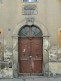 |
House three oaks; Residential house in closed development, corner house | Fischmarktstrasse 5 (Klosterplatz 2) (map) |
Marked 1818 | Significant in terms of building history and urban development. Name already burned down on the previous building in 1492, 1817. Rebuilt in 1818, the baroque portal with keystone was taken over (on it, the alliance coat of arms, above the coat of arms a sandstone tablet with three oaks and the inscription: Under the oaks, burned down on July 30th 1817, built in 1818 by JGL Weider). WBG wanted to tear down in 2001. |
09282331 |
 |
Streets of the historic old town with sidewalks and granite paving | Fleischerstrasse (map) |
19th century | Significant in terms of the history of the city and the appearance of the streets |
09302847 |
 |
Residential house in closed development, corner house | Fleischerstraße 1 (main address: Obermarkt 31) (map) |
1953/54 | New building instead of two burned down baroque buildings, architect Albert Mayer, Görlitz, of importance in terms of building history and urban planning. Cautiously historicizing building fits in with urban development and is therefore of monumental value. Until 2009 also under Obermarkt 30 in the list of monuments. According to the Görlitz Building Regulations Office, the address Obermarkt 30 has been omitted. |
09282363 |
 |
Residential building in closed development | Fleischerstrasse 2 (map) |
1953/54 | Of importance in urban planning. Until 2009 listed under Obermarkt 30, 31 / Fleischerstraße 1, 2 in the list of monuments. According to UD Görlitz, Fleischerstraße 2 is its own property. Fleischerstraße 1 see Obermarkt 30, 31. Fleischerstraße 2 also new building instead of two burned down baroque buildings, architect Albert Mayer, Görlitz. The house fits in with urban planning and is therefore of monumental value. |
09282515 |
 |
Residential house in closed development, corner house | Fleischerstrasse 3 (map) |
After 1717 | Baroque house, of importance in terms of building history and urban development. Reshaping of the baroque facade after 1900. |
09282517 |
 |
Residential house in closed development, corner house | Fleischerstraße 4 (main address: Langenstraße 42) (map) |
After 1717 | Portal with keystone and mirror monogram, significant in terms of building history and the street scene. Remodeling in the middle of the 19th century gave the building a late Classicist character. |
09282496 |
| Residential building in closed development | Fleischerstrasse 5 (map) |
1726 | Architecturally important. Small baroque house. 1930 dormer. Keystone with house brand. |
09282519 |
|
 |
Residential building in closed development | Fleischerstrasse 6 (map) |
1854 | Builder tailor Lippke, medieval cellar, historically important |
09282520 |
| Residential building in closed development | Fleischerstrasse 7 (map) |
After 1717 | Architecturally important. Charming craftsman's house. Biedermeier door. |
09282521 |
|
 |
Residential building in closed development | Fleischerstrasse 8 (map) |
18th century | Reconstruction after fire in 1875 under Heinrich Wilhelm Holz, of importance in terms of building history and urban planning. Baroque basement, ground floor and 1st floor. Internal staircase and black kitchen. Plaster grooves, stucco decorations. |
09282522 |
| Apartment building in closed development | Fleischerstrasse 9 (map) |
Around 1900 | Clinker brick construction, of importance in terms of building history and urban development. Stairwell colored leaded glass windows. Original windows and doors. |
09282523 |
|
 |
Apartment house in closed development with shop, corner house | Fleischerstraße 10 (main address: Hugo-Keller-Straße 3) (map) |
1890s | With a store, of importance in terms of building history, urban planning and the street scene. Clinker construction. Elevated corner. Corner balconies are missing. Original windows and front door. |
09282552 |
 |
Residential building in closed development | Fleischerstrasse 15 (map) |
1718 | Inscription panel on the south-west corner of the firewall with the date 1720. Inscription on the portal cartridge with the date 1718, of architectural significance. |
09282525 |
 |
Residential house in closed development with extension on Fleischerstrasse, corner house | Fleischerstraße 17 (main address: Langenstraße 43) (map) |
1719 | Rich baroque facade, baroque portal with cartouche, significant in terms of building history and the street scene. Part of the building in Fleischerstraße: plaster grooves |
09282497 |
 More pictures |
Residential building in closed development | Fleischerstrasse 19 (map) |
Around 1525 | Two two-storey structures along the street, rear building from Obermarkt 32, of architectural significance. Breakthrough in Fleischerstraße to Obermarkt in 1852/53. |
09282528 |
| Old Latin school | Gottfried-Kiesow-Platz 1 (map) |
15th century | From 1529 to 1565 old Latin school, from 1573 general German boys' school, from 1565 to 1593 printing works Ambrosius Fritsch, then residential house for the church servants, the deacons of St. Peter's Church, of architectural and domestic history of importance. Originally no partition walls on the ground floor, enormous beamed ceilings. Facade changed somewhat in the 1920s. |
09282710 |
|
 More pictures |
Four-wing system of the former Vogtshof | Gottfried-Kiesow-Platz 2 (map) |
1811-1826 | Structurally and locally of importance. Round-arched passage in the middle of the south wing, stairwells, basement and ground floor rooms cross-arched. |
09282453 |
 |
Advertising pillar in cast concrete | Grüner Graben (corner of Hugo-Keller-Strasse) (map) |
Around 1912 | Of cultural and historical importance |
09282569 |
| Apartment building in closed development | Grüner Graben 22 (map) |
Around 1870 | Of importance in urban planning. Facade heavily smoothed. Central Risalit. |
09282565 |
|
| Residential house in closed development, house with a kink in the facade | Grüner Graben 23 (map) |
1770s | Of importance in urban planning. Facade heavily smoothed. 1992 renovation. |
09282502 |
|
| Apartment building in closed development | Grüner Graben 26 (map) |
Around 1860 | Of importance in urban planning. Classic facade structure with side projections and arched windows. |
09282566 |
|
| Apartment building in closed development | Grüner Graben 27 (map) |
1870s | Elaborate plastered facade with plaster structure, cartridges and garlands, of importance in terms of urban planning. Facade with side projections. |
09282567 |
|
| Residential house in closed development and behind it quarry stone wall with ogival window | Grüner Graben 28 (map) |
Around 1870 | Significant in terms of building history and urban development. Behind the house is a very old quarry stone wall with an ogival window. The two city walls ran at this point. The wall may belong to a structure between the walls or on one of the two walls. |
09282568 |
|
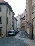 |
Streets of the historic old town with sidewalks and granite paving | Hainwald (map) |
19th century | Significant in terms of the history of the city and the appearance of the streets |
09302847 |
| Tenement house, to the right in a closed development | Hainwald 1 (Neißstraße 6) (map) |
1847/48 | First apartment building in the city, formerly for 44 parties, of architectural and local importance |
09282748 |
|
| Commercial building, presumably the former rear building on Peterstraße 15 | Hainwald 2 (map) |
17th century | Presumably the former rear building at Peterstraße 15, historically important |
09301370 |
|
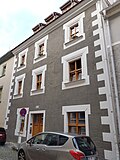 |
Residential building in closed development | Hainwald 7 (map) |
Marked with 1533 | Via portal dating, renaissance facade, building and house history of importance |
09282749 |
| Residential building in closed development | Hainwald 8 (map) |
Around 1723 | Architecturally important. House possibly with older parts. Probably long side wing to Neißstraße 7. Presumably part of the former castle complex. Built in 1220 and first mentioned in 1390 as a runner and messenger house. In 1565 the stone house was built from fragments of the house made of wood and clay. |
09282750 |
|
 More pictures |
Streets of the historic old town with sidewalks and granite paving | Craft (card) |
19th century | Significant in terms of the history of the city and the appearance of the streets |
09302847 |
| Residential house in closed development, corner house | Handwerk 1 (Weberstraße 3) (map) |
16th Century | Significant in terms of building history and urban development. Original front door. |
09282267 |
|
 More pictures |
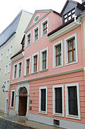
Residential building in closed development | Craft 2 (card) |
After 1726 | Formerly the rear building of the Ameisschen house at Neißstraße 30, Baroque keystone with mirror monogram on the client CA Christian Ameis, of architectural and urban significance. In 1853, however, the passage was walled up. Before that it was a walk-through. |
09282401 |
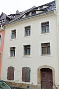 |
Residential building in closed development | Craft 3 (card) |
3rd quarter of the 18th century | Significant in terms of building history and urban development. Two bat dormers. Front door early 19th century. |
09282402 |
 |
Residential building in closed development | Craft 4 (card) |
After 1726 | Significant in terms of building history and urban development. Baroque front door, two wings in a small segment arch opening. House probably added in the 19th century. |
09282403 |
 |
Residential house in closed development, with courtyard wing | Craft 5 (card) |
16th century and after 1726 | Significant in terms of building history and urban development. Biedermeier front door, 2nd quarter of the 19th century. Common courtyard wing with number 6. |
09282404 |
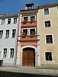 More pictures |
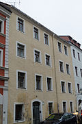
Residential house in closed development, with courtyard wing | Craft 6 (card) |
After 1726 | Significant in terms of building history and urban development. 2 axes. Ground floor torn wide open after the middle of the 19th century by the break-in of another entrance gate. Old passage with stitch caps, probably before the 18th century. |
09282405 |
 |
Residential building in closed development | Craft 7 (card) |
16th Century | Significant in terms of building history and urban development. Renovation from 1966 connects the house with number 8; the ceiling was probably suspended in the hall. Core sure 16th century. Front door 1730/40. |
09282406 |
| Residential building in closed development | Craft 8 (card) |
16th Century | Significant in terms of building history and urban development. Core possibly 16th century, changed after 1726, increased in mid-19th century. Ground floor on the left, formerly an entrance with a segmented arch and a Biedermeier house door, torn out at Reko in 1966. |
09282407 |
|
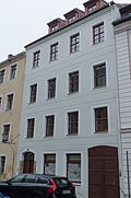 |
Residential building in closed development | Craft 9 (card) |
After 1726 | Significant in terms of building history and urban development. 3rd floor increased in the 19th century. Ground floor conversion and plastering probably at the same time. Ground floor probably originally the entrance on the left with a segmented lintel, on the right a higher lintel, in between was a shop with two simple windows. Front door 2nd quarter of the 19th century. |
09282408 |
 More pictures |
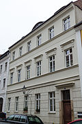
Residential building in closed development | Craft 10 (card) |
After 1726 | Significant in terms of building history and urban development. Fire in 1855 left the facade untouched. Renovation after 1855. Portal from the 2nd quarter of the 18th century. |
09282409 |
 |
Residential building in closed development | Craft 11 (card) |
After 1726 | Significant in terms of building history and urban development. Construction from the middle of the 19th century, probably using the masonry of a building after the fire of 1726. On the ground floor on the right, a fairly wide, arched front door with a plastic keystone, from the construction after 1726. Facade design 3rd quarter of the 19th century. Horizontal plaster cornice in the floor and sill position of the upper floors. |
09282410 |
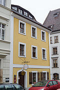 |
Residential house in closed development, corner house | Handwerk 12 (Kränzelstraße 6) (map) |
After 1726, rebuilt after 1824 | Significant in terms of building history and urban development. The house has an entrance to the craft. Biedermeier door. Former folding shutters on the ground floor facing Kränzelstrasse. Rebuilt after 1824 with older parts. |
09282411 |
 More pictures |
Residential house in closed development, corner house | Handwerk 13 (Kränzelstraße 5) (map) |
After 1726 | Vaulted ceilings with baroque stucco, of architectural and house-historical importance. Badly destroyed by fire in 1726 and rebuilt. 1489 made one of three gabled houses. 1874 simplified baroque street facade. |
09282413 |
 |
Residential building in closed development | Craft 14 (card) |
After 1726 | Significant in terms of building history and urban development. Eaves and roof shape from 18th century construction. Redesign of the facade after the middle of the 19th century, probably around 1860. |
09282415 |
 |
Residential building in closed development | Craft 15 (card) |
After 1726 core, especially the ground floor older | Increased in the middle of the 19th century, significant in terms of building history and urban development |
09282416 |
 |
Residential building in closed development | Craft 16 (card) |
After 1726 (older in essence) | At its core renaissance, craftsman's house, important in terms of building history and urban planning. Ground floor with gate and front door as well as plaster skin on the facade, probably around the middle of the 19th century. Front door from the 2nd quarter of the 19th century. Back building 1835 |
09282417 |
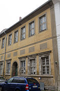 More pictures |
Residential building in closed development | Craft 17 (card) |
After 1525 | Significant in terms of building history and urban development. As number 18 rebuilt after 1726, same ledge, eaves and ridge height. From the renaissance building of the reconstruction after the fire of 1525 the ground floor zone with 6 windows and the entrance hall remained. |
09282418 |
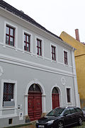 |
Cloth Makers Guild House | Craft 18 (card) |
Reconstruction after fire in 1726, core older | Hall house, of importance in terms of building history and local history. Entrance hall from the 16th century, front door in the 2nd quarter of the 19th century. |
09282419 |
 More pictures |
Residential building in closed development | Craft 20 (card) |
After 1726 (core older) | Expansion after bomb damage, important in terms of building history and urban development. Baroque house, older core. 3 annoying roof extensions in the 2nd half of the 19th century. Stucco ceiling from 1730. |
09282420 |
 |
Residential building in closed development | Craft 21 (card) |
After 1726 | Significant in terms of building history and urban development. Changed inside. |
09282421 |
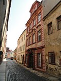 More pictures |
Residential building in closed development | Craft 22 (card) |
Marked 1717 | Magnificent baroque house, of architectural and artistic importance |
09280539 |
 |
Cross bakery; Residential house in closed development, corner house | Handwerk 23 (main address: Weberstraße 4) (map) |
16th Century; Reconstruction after fire in 1726 | At its core, it is renaissance, and has a significant architectural and domestic history. House three-zone. The most famous owner was Jorge the painter. |
09282268 |
 |
Streets of the historic old town with sidewalks and granite paving | Bright Alley (map) |
19th century | Significant in terms of the history of the city and the appearance of the streets |
09302847 |
 |
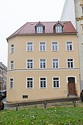
Residential house in closed development, corner house | Helle Gasse 15 (Rosenstrasse 1) (map) |
Around 1928 | Probably the first social housing construction, of importance in terms of urban development and social history. With a granite-framed portal. |
09282116 |
 |
Residential house in closed development, corner house on Rosenstrasse | Helle Gasse 16 (map) |
Around 1800 | Significant in terms of building history and urban development |
09282117 |
 |
Streets of the historic old town with sidewalks and granite paving | Hotherstrasse (map) |
19th century | Significant in terms of the history of the city and the appearance of the streets |
09302847 |
| Advertising pillar | Hotherstraße (opposite Neißstraße 13) (map) |
Around 1920 | Of cultural and historical importance |
09302688 |
|
| Residential building in closed development | Hotherstrasse 3 (map) |
After 1813 | Significant in terms of building history and urban development. 5 window axes, entrance with segmented lintel, gable roof with three pikes on top of each other. Facade restored in 1960. |
09282948 |
|
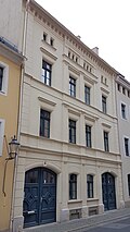 |
Residential building in closed development | Hotherstrasse 4 (map) |
After fire in 1845 | Significant in terms of building history and urban development. Classicist forms, ground floor wide gates with keystone and segmental lintel, eaves with console frieze. Original doors. Two pike. Reshaped in 1920s. |
09282949 |
| Residential building in closed development | Hotherstrasse 5 (map) |
18th century ground floor | Significant in terms of building history and urban development. Original windows. Front door around 1905. Two dormers over the entire width. |
09282950 |
|
| Residential building in closed development | Hotherstrasse 6 (map) |
18th century ground floor | Significant in terms of building history and urban development. Drag dormer over the whole. |
09282951 |
|
 |
Blue Angel; Brewery in closed development | Hotherstrasse 7 (map) |
Marked 1796 | Baroque facade with baroque portal, in the blown gable relief with angel, of architectural and local significance. Pike. Biedermeier front door. |
09282952 |
| Residential building in closed development | Hotherstrasse 8 (map) |
18th century | Significant in terms of building history and urban development |
09282953 |
|
| Residential building in closed development | Hotherstrasse 9 (map) |
Late 16th century, rebuilt after 1691 | House of a dyer-craftsman, exposed Gothic portal, painted vaulted room, of architectural and house-historical importance. House from two old houses united. Formerly two-storey. |
09282954 |
|
| Residential building in closed development | Hotherstrasse 10 (map) |
17th century, heightening and facade in the 1840s | Building with an early modern interior, doubled up with a new facade, builder steam pressure and dyeing master Weise, of architectural and urban significance. Filigree ornamentation. |
09282955 |
|
| Residential building in closed development | Hotherstrasse 11 (map) |
After 1691 | Structurally and historically important. One of the few houses that survived the fires on Hotherstraße in 1807, 1813 and 1845. There are even vaults on the upper floor. In Archivolte Spruch in Baroque fracture: "First come to your door and then come to me." The original baroque portal was hewn out. |
09282956 |
|
| Residential building in closed development | Hotherstrasse 12 (map) |
Around 1700 | Structurally and historically important. Remnants of Renaissance plaster, painted wooden beam ceilings, vaults also on the upper floor above the entrance. |
09282764 |
|
| Residential building in closed development | Hotherstrasse 13 (map) |
After 1691 | Structurally and historically important. Ground floor with older parts. 3 gate or door openings, front door with segmented lintel. 2 pike. Reko 1992. |
09282957 |
|
 |
Residential building in closed development | Hotherstrasse 14 (map) |
After 1800 | Architecturally and urbanistically important, segment arched door |
09282958 |
 |
Residential building in closed development | Hotherstrasse 15 (map) |
Around 1800 | Significant in terms of building history and urban development, simple plaster panels |
09282959 |
 |
Residential building in closed development | Hotherstrasse 16 (map) |
Around 1800 | Significant in terms of building history and urban development. No separate entrance. Mansard roof with three windows. |
09282960 |
 |
Residential building in closed development | Hotherstrasse 17 (map) |
18th century | Significant in terms of building history and urban development. Ground floor front door and a window with segmented arch. |
09282961 |
 |
Residential building in closed development | Hotherstrasse 18 (map) |
18th century | A mansard roof with number 19, of building and house history of importance |
09282962 |
 |
Residential house in development closed to the left | Hotherstrasse 19 (map) |
18th century | A mansard roof with number 18, of building and house history of importance |
09282963 |
 More pictures |
Turbine house as the successor to the four-wheel mill that existed from 1699 to 1928, with a Kaplan turbine and all weir systems, plus a polygonal bulwark between the river and the mill ditch, with access and pier | Hotherstrasse 21 (map) |
Probably around 1699 (bulwark); after 1928 (turbine house) | Significant in terms of building history, local history and technology history. Kaplan turbine in the building that still exists today supplied electricity for electric trams, today for street lighting, formerly also number 20. |
09284986 |
| Residential building | Hotherstrasse 25 (map) |
1st half of the 18th century | Architecturally important. Old brick formats, large window arches |
09282197 |
|
| Residential house in development closed to the right | Hotherstrasse 26 (map) |
Around 1820 | Significant in terms of building history and urban development |
09285385 |
|
| Residential building in closed development | Hotherstrasse 27 (map) |
18th century, later modified | Significant in terms of building history and urban development. Facade with baroque substance. Front door on the left with segmented lintel, Biedermeier door leaf. Boarded roof structure. |
09282964 |
|
| Residential building in closed development | Hotherstrasse 28 (map) |
18th century, later modifications | Significant in terms of building history and urban development. Ground floor with vaults |
09282965 |
|
| Residential building in closed development | Hotherstrasse 29 (map) |
Around 1850 | Significant in terms of building history and urban development. Gate with segmented lintel and small keystone. 2009 Disruptive flat roof. |
09282966 |
|
| Residential building in closed development | Hotherstrasse 30 (map) |
After 1800 | Significant in terms of building history and urban development. Right front door with segmental lintel. Pike. |
09282967 |
|
 |
Residential house in closed development and courtyard building | Hotherstrasse 31 (map) |
Marked 1822, older parts | Significant in terms of building history and urban development. 2 rows of bat dormers, beautiful ground floor vaults. Detached courtyard building with 2 pikes. |
09282968 |
| Residential building in closed development | Hotherstrasse 32 (map) |
18th century | Significant in terms of building history and urban development. Originally a baroque house, the upper floor was refined with plaster ornaments around 1910. Vault. Biedermeier front door. |
09282969 |
|
| Residential building in closed development | Hotherstrasse 33 (map) |
18th century, later rebuilt | Significant in terms of building history and urban development |
09282970 |
|
| Residential building in closed development | Hotherstrasse 34 (map) |
18th century, later modifications | Significant in terms of building history and urban development. Front door around 1800. |
09282971 |
|
| Residential building in closed development | Hotherstrasse 35 (map) |
18th century, later rebuilt | Significant in terms of building history and urban development. Mansard floor at the end of the 19th century. |
09282972 |
|
| Residential building in closed development | Hotherstrasse 36 (map) |
18th century | Significant in terms of building history and urban development |
09285603 |
|
| Residential building in closed development | Hotherstrasse 37 (map) |
18th century | Significant in terms of building history and urban development |
09284999 |
|
| Residential building in closed development | Hotherstrasse 38 (map) |
18th century | In 2009, only the ground floor and the wall up to the first floor remain, which are important for urban planning. Ground floor basket arch portal and plaster grooves. |
09282973 |
|
| Residential house in development closed to the left | Hotherstrasse 39 (map) |
First half of the 19th century | Significant in terms of building history and urban development |
09282974 |
|
 |
Golden angel; Guest house with extensions | Hugo-Keller-Strasse 1 (map) |
After 1717 | Structurally and locally of importance |
09302591 |
 |
Residential house, built to the right of the inn, with a small extension | Hugo-Keller-Strasse 2 (map) |
After 1717 | Architecturally important |
09282554 |
 |
Apartment house in closed development with shop, corner house | Hugo-Keller-Strasse 3 (Fleischerstrasse 10) (map) |
1890s | Significant in terms of building history, urban development and the street scene. Clinker construction. Elevated corner. Corner balconies are missing. Original windows and front door. |
09282552 |
| Apartment building in closed development | Hugo-Keller-Strasse 4 (map) |
Marked with 1903 | Simple facade based on Art Nouveau forms, important in terms of building history and urban planning. Ground floor plaster grooves. Original windows and front door. Belt cornices. |
09282555 |
|
| Apartment building in closed development | Hugo-Keller-Strasse 5 (map) |
Marked with 1903 | Elaborate clinker brick construction with sandstone surrounds, of importance in terms of building history and urban planning. Original windows and front door. |
09282556 |
|
| Apartment building in closed development | Hugo-Keller-Strasse 10a (map) |
Around 1880 | Significant in terms of building history and urban development. Profiled window frames, original windows, front door. |
09285379 |
|
| Apartment building in closed development, corner house | Hugo-Keller-Straße 11 (main address: Breite Straße 13b) (map) |
Around 1870 | Significant in terms of building history and the appearance of the street. Bevelled and raised corner. Plaster grooves. |
09282540 |
|
| Apartment building in closed development, corner house | Hugo-Keller-Straße 12 (main address: Breite Straße 13a) (map) |
Around 1850 | Architecturally important. Beveled corner. Cornice. Original windows. Beautiful arched staircase windows. Original interior. |
09282538 |
|
 |
Residential house with shops in closed development, corner house, plus the attached outbuilding at Jakob-Böhme-Straße 3 | Jakob-Böhme-Straße 2, 3 (main address: Weberstraße 11) (map) |
Gothic, 15./16. Century (Weberstrasse 11 / Jakob – Böhme-Strasse); 18th century (Jakob – Böhme – Straße 4) | Significant in terms of building history, house history and the street scene. Cancellation 2015 Jakob-Böhme-Straße 4, outbuilding, house hardly shows any original substance. Built from a late medieval brewery.
Residential house Weberstraße 11 / Jakob-Böhme-Straße 2: Portal maybe not until 1779. Shops in the 2nd half of the 19th century. Buttresses on the S side were created at this point after the demolition of the city wall in 1845. Inscription to the right of the house entrance. Gothic roof structure. Outbuilding at Jakob-Böhme-Strasse 3 and residential building at Jakob-Böhme-Strasse 4 (18th century) originally an outbuilding at Weberstrasse 11. These were certainly initially two gabled houses facing Weberstrasse, with the steep southern roof in the roof along Jakob-Böhme-Strasse had received. It was hipped forward into the new eaves roof, which now covers both of the former gabled houses on Weberstrasse. |
09282276 |
 |
Residential building in closed development | Jakob-Böhme-Strasse 5 (map) |
1st half of the 19th century | Significant in terms of building history and urban development |
09282066 |
 |
Apartment building in closed development | Jakob-Böhme-Strasse 6 (map) |
Around 1860 | Façade with stylistic elements of the neo-renaissance, important in terms of building history and urban planning. Nice original windows and portals. |
09282277 |
 |
Residential building in closed development | Jakob-Böhme-Strasse 7 (map) |
1850s | Façade with stylistic elements of the neo-renaissance, important in terms of building history and urban planning. Before the renovation, shop on the left with the original front. Finely worked stucco moldings. |
09282278 |
 |
Apartment building in closed development, corner house on Kränzelstrasse | Jakob-Böhme-Strasse 8 (map) |
Around 1895 | Late historical facade, of importance in terms of building history and the street scene. Beveled corner. Decoration with white facing bricks. |
09282279 |
 |
Streets of the historic old town with sidewalks and granite paving | Jüdenstrasse (map) |
19th century | Significant in terms of the history of the city and the appearance of the streets |
09302847 |
| Residential house in closed development, corner house | Jüdenstrasse 2 (Rosenstrasse 11) (map) |
1855/56 | Significant in terms of building history and urban development. Original windows and front door. |
09280768 |
|
| Residential building in closed development | Jüdenstrasse 3 (map) |
16th Century | Significant in terms of building history and urban development. Windows small and irregular. |
09282739 |
|
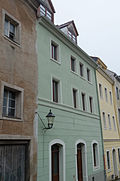 |
Residential house in closed development, with original shop front | Jüdenstrasse 4 (map) |
Core 16th century (residential house); around 1850 (shop) | Significant in terms of building history and urban development. Probably from two old house units. Shop around 1850. Interior fittings. |
09282740 |
 |
Residential building in closed development | Jüdenstrasse 5 (map) |
After 1717 | Significant in terms of building history and urban development. Original baroque front door. Entrance hall. |
09282741 |
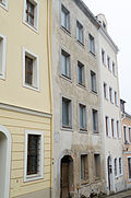 |
Residential building in closed development | Jüdenstrasse 6 (map) |
After 1717 | Significant in terms of building history and urban development, the building has been very redesigned |
09282742 |
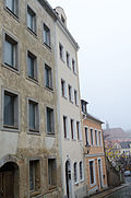 |
Residential building in closed development | Jüdenstrasse 7 (map) |
After 1717 | Significant in terms of building history and urban development, the building has been very redesigned |
09282743 |
 |
Residential building in closed development | Jüdenstrasse 8 (map) |
After 1717 | Significant in terms of building history and urban development |
09282744 |
 |
Residential building in closed development | Jüdenstrasse 11 (map) |
On the ground floor remains of the 16th century | Structurally and historically important. Inscription in the keystone of the baroque portal. Facade redesigned in the 2nd half of the 19th century. Central risalit with triangular gable. WBG wanted to break off in 2001. |
09282738 |
 |
Streets of the historic old town with sidewalks and granite paving | Karpfengrund (map) |
19th century | Significant in terms of the history of the city and the appearance of the streets |
09302847 |
 More pictures |
Residential building | Karpfengrund 1 (map) |
After 1691 | Two wings juxtaposed at an angle, was the rear building of Nikolaistraße 12, fountain with a figure by Gisela Mauermann 1993/1994, relic of the historical water supply, recorded on plan 1794 as Röhrbütte, building-historical value. Mansard roof, stitch caps on the ground floor. |
09282712 |
 |
Residential building | Karpfengrund 3 (map) |
After 1691 | Formerly the rear building of Nikolaistraße 7, historically important |
09282713 |
 |
Residential building, free-standing to the left, with a wall that leads to the city wall in an east-west direction | Karpfengrund 4 (map) |
After 1691 | Significant in terms of building history and the appearance of the street |
09282714 |
 |
Residential building in closed development | Karpfengrund 5 (map) |
After 1619 | Big barrel on the ground floor, of architectural significance |
09282715 |
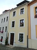 |
Residential building in closed development | Karpfengrund 6 (map) |
After 1691 | Architecturally important |
09282716 |
 |
Residential building in closed development | Karpfengrund 7 (map) |
After 1691 | Architecturally important |
09282717 |
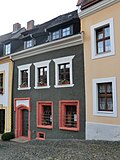 |
Residential building in closed development | Karpfengrund 8 (map) |
From the 15th century | Partly Gothic brick garments, part renaissance garments with incisions, of architectural and house history of importance |
09282718 |
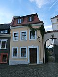 |
Residential house in closed development, corner house with Schwibbogen to Vogtshof | Karpfengrund 9 (map) |
After 1691 | Significant in terms of building history and the appearance of the street |
09282719 |
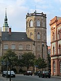 |
Klosterplatz around the former Franciscan monastery | Klosterplatz (map) |
19th century | On the square today the monastery school, fountain erected during the redesign of the monastery square in 1905, instead of the previous cistern now an octagonal fountain basin with richly decorated wrought iron grille, plants, flowers and gargoyles on the fountain column, artistically and historically significant. When the monastery square was redesigned around 1905, an octagonal fountain basin with a richly decorated wrought iron grille was installed here instead of the previous cistern. The magnificent fountain surround testifies to the long tradition of Görlitz blacksmithing - lush iron plants and artistically forged flowers decorate the corners. The gargoyles on the fountain column are also forged. |
09287184 |
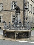 More pictures |
Ornamental fountain | Klosterplatz (map) |
After 1855 | Significant in terms of art and space. Granite basin with decorative wrought iron grilles. |
09282152 |
 |
Streets of the historic old town with sidewalks and granite paving | Klosterplatz (map) |
19th century | Significant in terms of the history of the city and the appearance of the streets |
09302847 |
| House three oaks; Residential house in closed development, corner house | Klosterplatz 2 (main address: Fischmarktstraße 5) (map) |
Marked 1818 | Significant in terms of building history and urban development. Name already burned down on the previous building in 1492, 1817. Rebuilt in 1818, the baroque portal with keystone was taken over (on it, the alliance coat of arms, above the coat of arms a sandstone tablet with three oaks and the inscription: Under the oaks, burned down on July 30th 1817, built in 1818 by JGL Weider). WBG wanted to tear down in 2001. |
09282331 |
|
 |
Residential building with shops | Klosterplatz 3 (map) |
1840 | Very wide street front, of importance in terms of building history and the appearance of the street. Built by Karl August Weider from the older side building at number 2 / Fischmarktstrasse 5 with 10 shops. Solid building with rough plaster, elongated building with a Biedermeier expression. Formerly folding shutters in front of the store openings. Original front door. |
09282154 |
| Residential house in semi-open development | Klosterplatz 4 (map) |
1850s | Significant in terms of building history and urban development. Plaster grooves, cornices, roofs on the windows. |
09282155 |
|
| Residential building in closed development | Klosterplatz 5 (map) |
Around 1850 | Significant in terms of building history and urban development. Facade plain and smooth. Original front door. |
09282156 |
|
| Boys' middle school, Elisabeth school, on the corner of Klosterstrasse, with passage to the fish market | Klosterplatz 6 (main address: Elisabethstraße 13) (map) |
Marked 1873 | Stately building with a rich neo-renaissance facade, design: Berlin architect Cremer and Görlitzer master builder Barth, of significance in terms of architectural history, building art and shaping the plaza. Three-storey building with a flat roof. Heavy neo-renaissance forms from the Wilhelminian era. Round window. Passage: Passage area vaulted. Belt arches, pilasters with composite capitals, cranked profiles. |
09282223 |
|
| Residential building with shops in closed development, corner house | Klosterplatz 7 (Klosterstrasse 3) (map) |
1853/54 | Significant in terms of building history and urban development. Original front door and window. |
09282159 |
|
| Residential building in closed development | Klosterplatz 8 (map) |
Around 1800 | Significant in terms of building history and urban development. Simple and smooth. |
09282160 |
|
| To the Klosterstübel | Klosterplatz 9 (map) |
Around 1800 | With a restaurant, of importance in terms of building history and local history |
09282161 |
|
| Residential house in closed development, with shop | Klosterplatz 10 (map) |
1st half of the 19th century | Significant in terms of building history and urban development. Shop with original front. Original windows. |
09282162 |
|
| Residential building in closed development | Klosterplatz 11 (map) |
1st half of the 19th century | Significant in terms of building history and urban development. House built on a narrow floor plan. Steep gable roof. |
09282163 |
|
| Residential building in closed development | Klosterplatz 12 (map) |
1st half of the 19th century | Significant in terms of building history and urban development. Simple house, gable roof. |
09282164 |
|
 |
Residential building in closed development | Klosterplatz 13 (map) |
1st half of the 19th century | Significant in terms of building history and urban development. Ground floor with shop front. |
09282165 |
 |
Residential house with shops with original fronts in closed development, corner house | Klosterplatz 14 (main address: Nonnenstraße 19) (map) |
1850s | Significant in terms of building history and the appearance of the street |
09282321 |
 |
Residential building in closed development | Klosterplatz 15 (map) |
1853 | Builder restaurateur Hennig, important in terms of building history and urban planning. Original front door. |
09282166 |
| Residential building in closed development | Klosterplatz 16 (map) |
Around 1850 | Significant in terms of building history and urban development. Empty old shop with the original front. Original front door. |
09282167 |
|
| Residential building in closed development | Klosterplatz 17 (map) |
Around 1850 | Significant in terms of building history and urban development. Ground floor disfigured by brickwork. Beautiful stucco facade. |
09282168 |
|
| Residential house in closed development, with shop | Klosterplatz 18 (map) |
Around 1850 | Significant in terms of building history and urban development. Beautiful stucco facade, original front door. |
09282169 |
|
 More pictures |
Monastery school | Klosterplatz 20 (map) |
1854-1856 | Erected above the former Franciscan monastery on a horseshoe-shaped floor plan, quarry stone building with sandstone ashlars of the buttresses, sandstone tracery, neo-Gothic in echoes of English colleges, design by Görlitz town planning officer HOW Martin under the influence of August Stühler, of architectural and local importance. Date of construction according to documents. Formerly Augusteum, old-language grammar school. School opened in 1565. Prepared future pastors, officers, lawyers, and teachers for college. |
09282157 |
 More pictures |
Trinity Church ; Franciscan monastery church | Klosterplatz 21 (map) |
1234 | The monastery was founded here in 1234, extension in 1380, reconstruction in 1450, extension of the Barbara chapel from 1420–1450, of importance in terms of architectural, art and local history.
Evangelical Dreifaltigkeitskirche or upper church, former Franciscan monastery church, Trinity church since the renovation of 1715 (Klosterplatz 21). The monastery was founded in 1234, consecrated in 1245. The Romanesque apse was replaced by the present choir in 1371–81, the Barbara chapel was added in 1420–50, connected to the northern cloister wing, and in 1508 the west gable and vault were redesigned. 1564 abolition of the monastery. High school since 1565. 1713 re-establishment of a parish, up to 1715 baroque interior design of the church. Restoration 1909–12 (and painting) and 1992.
|
09282158 |
 |
Streets of the historic old town with sidewalks and granite paving | Klosterstrasse (map) |
19th century | Significant in terms of the history of the city and the appearance of the streets |
09302847 |
 |
Boys' middle school, Elisabeth school, on the corner of Klosterstrasse, with passage to the fish market | Klosterstraße 1 (main address: Elisabethstraße 13) (map) |
Marked 1873 | Stately building with a rich neo-renaissance facade, design: Berlin architect Cremer and Görlitzer master builder Barth, of significance in terms of architectural history, building art and shaping the plaza. Three-storey building with a flat roof. Heavy neo-renaissance forms from the Wilhelminian era. Round window. Passage: Passage area vaulted. Belt arches, pilasters with composite capitals, cranked profiles. |
09282223 |
 |
Residential and office building in closed development, corner house | Klosterstrasse 2 (Elisabethstrasse 12) (map) |
1853/54 (residential and office building) | Palazzo-like building, of historical and urban importance. Palazzo-like building with many plaster grooves. According to Jecht, the collapse of the old Marstall in 1853 offered the opportunity to open the Klosterplatz to Elisabethstrasse. |
09282210 |
| Residential building with shops in closed development, corner house | Klosterstraße 3 (main address: Klosterplatz 7) (map) |
1853/54 | Significant in terms of building history and urban development. Original front door and window. |
09282159 |
|
 More pictures |
Streets of the historic old town with sidewalks and granite paving | Kränzelstrasse (map) |
19th century | Significant in terms of the history of the city and the appearance of the streets |
09302847 |
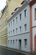 |
Residential building in closed development | Kränzelstrasse 1 (map) |
After 1726 | Baroque house, of importance in terms of building history and urban development. Construction after the city fire in 1726. Plastering, facade design and roof extensions after 1850. Staircase with skylight. |
09282280 |
 |
Residential building in closed development | Kränzelstrasse 2 (map) |
After 1726 | Baroque house, of importance in terms of building history and house history. Construction after the city fire in 1726. Reconstruction after the middle of the 19th century. Indoor hall. |
09282281 |
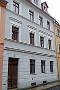 |
Residential building in closed development | Kränzelstrasse 3 (map) |
Around 1870 | Significant in terms of building history and urban development. Probably remains from the 18th century. New building around 1870. Original windows and front door. |
09282282 |
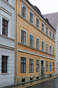 |
Residential building in closed development | Kränzelstrasse 4 (map) |
Around 1840 | Significant in terms of building history and urban development |
09282283 |
 |
Residential house in closed development, corner house | Kränzelstraße 5 (main address: Handwerk 13) (map) |
After 1726 | Vaulted ceilings with baroque stucco, of architectural and house-historical importance. Badly destroyed by fire in 1726 and rebuilt. 1489 made one of three gabled houses. 1874 simplified baroque street facade. |
09282413 |
 |
Residential house in closed development, corner house | Kränzelstraße 6 (main address: Handwerk 12) (map) |
After 1726, rebuilt after 1824 | Significant in terms of building history and urban development. The house has an entrance to the craft. Biedermeier door. Former folding shutters on the ground floor facing Kränzelstrasse. Rebuilt after 1824 with older parts. |
09282411 |
 |
Residential building in closed development | Kränzelstrasse 7 (map) |
After 1525; after 1726 | Structurally and historically important. Ground floor after the fire of 1525, Renaissance. First floor after a fire of 1726. New plastering in the 19th century. Original front door around 1800. |
09282288 |
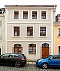 |
Residential building in closed development | Kränzelstrasse 8 (map) |
After 1726 | Baroque house, of importance in terms of building history and house history. Construction after the city fire in 1726. Remodeling in the middle of the 19th century. Original front door. |
09282289 |
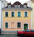 |
Residential building in closed development | Kränzelstrasse 9 (map) |
Marked 1717 | Baroque house, of importance in terms of building history and house history. Construction after the town fire in 1726. Portal in the soffit's soffit dated 1717. Monogram CW and 1726 in the keystone. Front door around 1850. |
09282290 |
 |
Residential building in closed development | Kränzelstrasse 10 (map) |
Around 1850 | Significant in terms of building history and urban development. Three-story, three window axes, high arched entrance. |
09282291 |
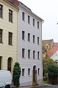 |
Residential building in closed development | Kränzelstrasse 11 (map) |
Mid 19th century | Significant in terms of building history and urban development. Ground floor almost square windows, remains from the 18th century. Plaster grooves. |
09282292 |
 |
Facades of four houses as fire ruins since 1726 | Kränzelstrasse 12, 13, 14, 15 (map) |
16th Century | Masonry only in the street. Rear houses of Neißstraße 24/25 with medieval license plates, of architectural significance. |
09282293 |
 |
To the golden apple; Residential house in closed development, corner house and Schwibbogen to Kränzelstraße 17 | Kränzelstraße 16 (main address: Neißstraße 24) (map) |
13-16 Century, remodeling after 1726 (house); marked 1727 (house); 1780 (Schwibbogen) | Baroque portal with blown triangular gable with three figures. Heraldic cartouche. Medieval core, baroque facade, of architectural and art historical importance. Supported by a Schwibbogen across Kränzelstraße, this was laid out in 1780. Baroque portal with blown triangular gable with three figures. Heraldic cartouche. Medieval core, constant "petrification" over the Renaissance, picture today baroque. |
09282295 |
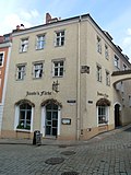 |
Jacobi dye works; Residential house in closed development, corner house, with courtyard building of an old black dye works | Kränzelstraße 17 (Neißstraße 23) (map) |
1525 (probably after Brand); 1st half of the 19th century | Significant in terms of building history, house history and local history. Several later modifications. On the corner of the front building, upstairs, a half-length portrait of two men with beer mugs. Original front door. From 1828 owner Jakobi, in the 20th century there was a laundry and steam dyeing plant, on the east gable of the courtyard building a crooked hipped roof with a large overhang, probably with an elevator, unusual old insulation with clay pegs in the roof structure. |
09282297 |
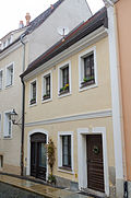 |
Residential house in closed development, with shop with original front from around 1850 | Kränzelstrasse 18 (map) |
After 1726 | Baroque house, of importance in terms of building history and urban development. Three-storey, small craftsman's house. Original front door. |
09282299 |
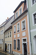 |
Residential building in closed development | Kränzelstrasse 19 (map) |
After 1726 | Baroque house, of importance in terms of building history and urban development. Construction after the city fire in 1726. Increase in the roof area in the middle of the 19th century. Modest craftsman's house. Biedermeier front door. |
09282300 |
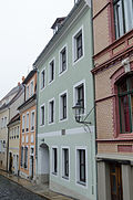 |
Residential house in closed development and courtyard building as an extension of Carl Jakobi's laundry and steam dyeing works from Kränzelstrasse 17 / Neißstrasse 23 and transition to this house | Kränzelstrasse 20 (map) |
Marked with 1727 (house); 1929 (outbuilding) | Structurally and locally of importance. Building after the town fire in 1726. Sandstone slab set in the middle above the ground floor with a cooper emblem and the year 1727. In the spirit of the Heimat style, based on the old rear building at Kränzelstraße 17 with a crooked hip roof to the east (and hipped roof to the west). |
09282301 |
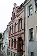 |
Apartment building in closed development | Kränzelstrasse 21 (map) |
Marked 1898 | Clinker brick facade in yellow and red, significant in terms of building history and urban planning |
09282302 |
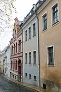 |
Residential building in closed development | Kränzelstrasse 22 (map) |
1717 | House moved together with number 23 when it was reconstructed in 1967, no own front door, important in terms of building history and house history |
09282303 |
 |
Residential house in closed development, corner house | Kränzelstrasse 23 (map) |
Marked 1717 | Building moved together with number 22 during reconstruction in 1967, baroque portal with Biedermeier door, of importance in terms of building history and house history |
09282304 |
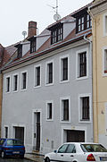 |
Residential building in closed development | Kränzelstrasse 24 (map) |
After 1717 | Baroque house, of importance in terms of building history and urban development. Construction after fire in 1717 or 1726 from two old buildings combined. Original front door and window. |
09282305 |
 |
Residential building in closed development | Kränzelstrasse 25 (map) |
After 1726 | Baroque house, of importance in terms of building history and urban development. Construction after the fire in 1726. The plaster was renewed in the 19th century. Simple construction. Original front door. |
09282306 |
 |
Residential building in closed development | Kränzelstrasse 26 (map) |
After 1726 | Baroque house, of importance in terms of building history and urban development. It was rebuilt from 1726 to the middle of the 19th century. Masonry up to the jamb still in proportions from the 18th century. Original courtyard door. |
09282307 |
 |
The golden anchor; Residential house in closed development, with house sign: Sign with "Golden anchor" on a blue background | Kränzelstrasse 27 (map) |
Around 1540/1545 | Arcades with vaults on the courtyard side, Renaissance portal, medieval wall paintings, of importance in terms of building history, art history and house history. Important renaissance building, grown together from two house units, still clearly recognizable in plan and facade, inside a beautiful vaulted hall. Baroque renovation. Fragments of a Gothic room painting. |
09282308 |
 |
Residential building in closed development | Kränzelstrasse 28 (map) |
After 1726 | Baroque house, of importance in terms of building history and urban development. Construction after the city fire in 1726, remodeling in the third quarter of the 19th century. Behind window windows in the middle of the 19th century, windows with baroque lattice arrangement. |
09282309 |
 |
Residential building in closed development | Kränzelstrasse 29 (map) |
After 1717 | Baroque house, of importance in terms of building history and urban development. Construction after fire of 1717. Three storeys, five window axes. |
09282310 |
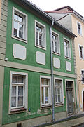 |
Residential building in closed development | Kränzelstrasse 30 (map) |
After 1717 | Baroque house with a much older core, hall, in the back of the property the city wall, of architectural and urban importance. Construction after fire in 1726. First and second floors, four window axes. Indoor hall. Front door around 1850. |
09282311 |
 |
Residential building in closed development | Kränzelstrasse 31 (map) |
After 1726 | Baroque house, of importance in terms of building history and urban development. Construction after the town fire in 1726. Top floor increased in 1878. Front door with two late baroque leaves, impaired by glass inserts. Four storeys on three axes. Original windows. |
09282312 |
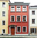 |
Residential building in closed development | Kränzelstrasse 32 (map) |
After 1726 | Baroque house, of importance in terms of building history and urban development. Construction after the city fire in 1726. Three floors, three axes. Baroque house. Portal sandstone. Original front door. |
09282313 |
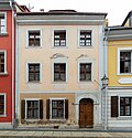 |
Residential building in closed development | Kränzelstrasse 33 (map) |
After 1726 | Baroque house, of importance in terms of building history and urban development. Construction after the city fire in 1726. Three floors, three axes. Original windows and front door. |
09282314 |
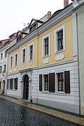 |
Residential building in closed development | Kränzelstrasse 34 (map) |
Marked 1720 | Baroque house, risalit projection with inscription: "If a poor man comes outside - think that Jesus is there with you himself.", Plus the year 1720, of architectural and urban significance. Nice baroque house. Original front door. |
09282315 |
 |
Residential house in closed development, two courtyard buildings and iron garden pavilion | Kränzelstrasse 35 (map) |
Inscribed with 1662 (residential house); marked 1720 (outbuilding) | Significant in terms of building history and urban development. Roof situation suggests the merging of two houses. Second facade around the corner. Rear exit to the Ochsenbasteizwinger, simple, molded facade. Endhaus, marked 1720 on the back. Renovation of plaster around 1920. Cast iron pavilion, according to an estimate by Anne Michel around 1850. Six load-bearing columns, a roof structure braced inside with iron struts, formerly six upper decorative arch fields with perforated ribbon and five parapet fields with tendrils with one Lyra in the middle. The roof was probably made of wooden boards. |
09282316 |
 |
Streets of the historic old town with sidewalks and granite paving | Krebsgasse (map) |
19th century | Significant in terms of the history of the city and the appearance of the streets |
09302847 |
 |
Residential house in closed development, corner house and four candle arches over Krebsgasse | Krebsgasse 1, 2 (main address: Nikolaistraße 14) (map) |
End of the 15th century, later reshaped | Ground floor with Gothic walls, of architectural significance. Gothic portal, Renaissance and Baroque elements. Impressive ground floor vault. |
09285423 |
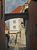 |
Residential house in closed development, corner house on Krebsgasse, plus outbuildings and horse stable | Krebsgasse 8 (main address: bei der Peterskirche 1) (map) |
16th century (residential house); 1854 (horse stable) | The latter building on Krebsgasse (without number), here on the far left as far as Kirchgasse a vaulted horse stable from 1854, of architectural and house-historical importance. Ground floor baroque portal in sandstone with segment arch. In the gusset at Bei der Peterskirche 3 is a new chute, it is parcel 310, i.e. a separate parcel |
09282449 |
 |
Streets of the historic old town with sidewalks and granite paving | Krischelstrasse (map) |
19th century | Significant in terms of the history of the city and the appearance of the streets |
09302847 |
 More pictures |
Residential building | Krischelstrasse 1 (map) |
1854 | The end of the street leading to the fish market, originally with a restaurant on the ground floor, classicist design, of importance in terms of building history and urban development |
09282246 |
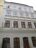 More pictures |
Residential building in closed development | Krischelstrasse 2 (map) |
Around 1850 | Significant in terms of building history and urban development. Original front door and window. |
09282247 |
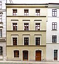 |
Residential building in closed development | Krischelstrasse 3 (map) |
Around 1850 | Significant in terms of building history and urban development. Original front door. |
09282248 |
 |
Residential building in closed development | Krischelstrasse 4 (map) |
Around 1850 | Significant in terms of building history and urban development. Ground floor changed, now used as a steam bakery. |
09282249 |
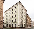 |
Residential house in closed development, corner house | Krischelstrasse 5 (Weberstrasse 13) (map) |
Around 1850 | Significant in terms of building history and urban development. The five-storey height of the street lines on Weberstrasse impaired. One of the first tenement houses in Görlitz old town (?). Late classical influence. Ground floor changed. Original front door. |
09282344 |
 |
Residential building with shops in closed development, corner house | Krischelstrasse 6, 7 (map) |
Around 1850 (older in essence) | Significant in terms of building history and urban development. Stores original. Before that there were two houses. |
09282238 |
| House in closed development, with shop with original front | Krischelstrasse 8 (map) |
1849 | Builder Jacob Niems, important in terms of building history and urban development. Finely worked stucco fields on the facade. Shop 2nd half of the 19th century. |
09282240 |
|
| Residential building in closed development | Krischelstrasse 9 (map) |
Around 1850 (older in essence) | Significant in terms of building history and urban development. Original windows and front door. |
09282241 |
|
| Residential building in closed development | Krischelstrasse 10 (map) |
Around 1850 (older in essence) | Significant in terms of building history and urban development. Original front door. |
09282242 |
|
| Residential building in closed development | Krischelstrasse 11 (map) |
Marked with 1847 (older in core) | Significant in terms of building history and urban development. Two beautiful round arches on the ground floor. Original windows and front door. |
09282243 |
|
| Residential house in closed development and courtyard building | Krischelstrasse 12 (map) |
Around 1850 (older in essence) | Significant in terms of building history and urban development. Very fine stucco moldings, medallions with heads. Original windows and front door. Newer store slump. |
09282244 |
|
| Residential building in closed development | Krischelstrasse 13 (map) |
1st half of the 19th century | The builder was master shoemaker Deutsch, which included Elisabethstrasse 21 as the rear building, which is of importance in terms of building history and urban planning. Original windows and front door. Various cornices, simple and classic construction. |
09282245 |
|
| Residential building in closed development | Krischelstrasse 14 (map) |
Around 1850 (older in essence) | Significant in terms of building history and urban development. Original front door. |
09282239 |
Remarks
- This list is not suitable for deriving binding statements on the monument status of an object. As far as a legally binding determination of the listed property of an object is desired, the owner can apply to the responsible lower monument protection authority for a notice.
- The official list of cultural monuments is never closed. It is permanently changed through clarifications, new additions or deletions. A transfer of such changes to this list is not guaranteed at the moment.
- The monument quality of an object does not depend on its entry in this or the official list. Objects that are not listed can also be monuments.
- Basically, the property of a monument extends to the substance and appearance as a whole, including the interior. Deviating applies if only parts are expressly protected (e.g. the facade).
swell
- List of listed monuments of the State Office for the Preservation of Monuments in Saxony, as of April 15, 2014
- Monument map of Saxony , accessed on November 10, 2017
- Görlitz district geoportal , accessed on November 10, 2017
Web links
Individual evidence
- ↑ Unser-Görlitz.de. (No longer available online.) Archived from the original on November 13, 2017 ; accessed on November 12, 2017 . Info: The archive link was inserted automatically and has not yet been checked. Please check the original and archive link according to the instructions and then remove this notice.