
List of places in the municipality of Ainaro

The list of places in Ainaro indicates which places are in each Suco of the East Timorese municipality of Ainaro and what geographical coordinates and altitude they have.
Maps

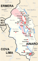
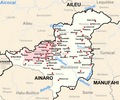
The municipality of Ainaro
The Ainaro Administrative Office

The Hatu-Builico Administration Office

The Hatu-Udo administration office
The Maubisse administrative office


list
Administrative office of Ainaro

Hatu-Builico administrative office
| Hatu-Builico administrative office | |||||||
|
|||||||
| Suco Mulo | |||||||
| places | position | height | places | position | height | ||
| Aituto | 8 ° 54 ′ 1 ″ S, 125 ° 35 ′ 34 ″ E | 1582 m | Bleheto | 8 ° 53 ′ 49 ″ S, 125 ° 33 ′ 10 ″ E | 2060 m | ||
| Dare | 8 ° 55 ′ 50 ″ S, 125 ° 33 ′ 40 ″ E | 1280 m | Ernaro | 8 ° 55 ′ 43 ″ S, 125 ° 34 ′ 17 ″ E | 1394 m | ||
| Hautio | 8 ° 54 ′ 38 ″ S, 125 ° 35 ′ 5 ″ E | 1520 m | Caraulun | 8 ° 55 ′ 41 ″ S, 125 ° 34 ′ 33 ″ E | 1394 m | ||
| Mano-Mera | 8 ° 53 ′ 59 ″ S, 125 ° 34 ′ 38 ″ E | 1689 m | Maulahulo | 8 ° 53 ′ 27 ″ S, 125 ° 33 ′ 58 ″ E | 1925 m | ||
| Mulo | 8 ° 55 ′ 50 ″ S, 125 ° 33 ′ 40 ″ E | 1280 m | Queorema | 8 ° 52 ′ 58 ″ S, 125 ° 32 ′ 10 ″ E | 2231 m | ||
| Queorudo | 8 ° 53 ′ 38 ″ S, 125 ° 31 ′ 22 ″ E | 2173 m | Suruhati | 8 ° 56 ′ 29 ″ S, 125 ° 32 ′ 54 ″ E | 1202 m | ||
| Tatiri Baru | 8 ° 55 ′ 12 ″ S, 125 ° 34 ′ 31 ″ E | 1467 m | Tatiri Lama | 8 ° 54 ′ 19 ″ S, 125 ° 34 ′ 14 ″ E | 1595 m | ||
| Suco Mauchiga | |||||||
| places | position | height | places | position | height | ||
| Goulora | 8 ° 56 ′ 14 ″ S, 125 ° 34 ′ 3 ″ E | 1331 m | Goulora | 8 ° 56 ′ 12 ″ S, 125 ° 34 ′ 8 ″ E | ? | ||
| Hato-Quero | 8 ° 55 ′ 46 ″ S, 125 ° 34 ′ 50 ″ E | 1719 m | Leotelo | 8 ° 57 ′ 55 ″ S, 125 ° 32 ′ 25 ″ E | 1290 m | ||
| Mauchiga | 8 ° 56 ′ 6 ″ S, 125 ° 34 ′ 16 ″ E | 1545 m | |||||
| Suco Nuno-Mogue | |||||||
| places | position | height | places | position | height | ||
| Hato-Seraquei | 8 ° 57 ′ 31 ″ S, 125 ° 31 ′ 48 ″ E | ? | Hatu-Builico | 8 ° 53 ′ 37 ″ S, 125 ° 31 ′ 7 ″ E | 2155 m | ||
| Lebulau | 8 ° 56 ′ 26 ″ S, 125 ° 32 ′ 29 ″ E | 1226 m | Leobutu | 8 ° 56 ′ 50 ″ S, 125 ° 32 ′ 22 ″ E | 1116 m | ||
| Mausoromata | 8 ° 53 ′ 16 ″ S, 125 ° 31 ′ 7 ″ E | 2155 m | Morocali | 8 ° 54 ′ 51 ″ S, 125 ° 31 ′ 42 ″ E | ? | ||
| Nuno-Mogue | 8 ° 57 ′ 33 ″ S, 125 ° 31 ′ 27 ″ E | 938 m | Nuno-Mogue-Lau | 8 ° 57 ′ 2 ″ S, 125 ° 32 ′ 6 ″ E | 1125 m | ||
| Tucarocoiloco | 8 ° 56 ′ 43 ″ S, 125 ° 31 ′ 21 ″ E | 1259 m | |||||
Administrative office Hato-Udo
| Administrative office Hato-Udo | |||||||
|
|||||||
| Suco Foho-Ai-Lico | |||||||
| places | position | height | places | position | height | ||
| Ailora | 9 ° 6 ′ 50 ″ S, 125 ° 38 ′ 30 ″ E | 331 m | Aimorbada | 9 ° 10 ′ 21 ″ S, 125 ° 38 ′ 43 ″ E | 162 m | ||
| Akadirularan | 9 ° 8 ′ 39 "S, 125 ° 38 ′ 29" E | 201 m | Akarloran | 9 ° 9 ′ 39 ″ S, 125 ° 39 ′ 23 ″ E | 87 m | ||
| Baha | 9 ° 6 ′ 24 ″ S, 125 ° 39 ′ 51 ″ E | ? | Barialaran | 9 ° 8 ′ 39 ″ S, 125 ° 39 ′ 41 ″ E | 69 m | ||
| Beikala | 9 ° 6 ′ 35 ″ S, 125 ° 39 ′ 48 ″ E | 183 m | Beko | 9 ° 6 ′ 12 ″ S, 125 ° 40 ′ 57 ″ E | 141 m | ||
| Bekumu | 9 ° 7 ′ 21 ″ S, 125 ° 38 ′ 44 ″ E | 314 m | Bemalai | 9 ° 8 ′ 14 ″ S, 125 ° 39 ′ 51 ″ E | 65 m | ||
| Boramba | 9 ° 6 ′ 46 ″ S, 125 ° 38 ′ 54 ″ E | 293 m | Bobe | 9 ° 9 ′ 21 ″ S, 125 ° 39 ′ 50 ″ E | 38 m | ||
| Buifu | 9 ° 8 ′ 10 ″ S, 125 ° 37 ′ 54 ″ E | 294 m | Fatualas | 9 ° 6 ′ 42 ″ S, 125 ° 39 ′ 28 ″ E | 254 m | ||
| Fatukabelak | 9 ° 8 ′ 53 ″ S, 125 ° 39 ′ 44 ″ E | 86 m | Groto | 9 ° 6 ′ 36 ″ S, 125 ° 37 ′ 47 ″ E | 340 m | ||
| Gulala | 9 ° 10 ′ 33 ″ S, 125 ° 39 ′ 42 ″ E | 100 m | Karsabar | 9 ° 9 ′ 57 ″ S, 125 ° 39 ′ 30 ″ E | 98 m | ||
| Kaisera | 9 ° 5 ′ 49 ″ S, 125 ° 41 ′ 7 ″ E | 141 m | Kulolola | 9 ° 6 ′ 25 ″ S, 125 ° 40 ′ 30 ″ E | 133 m | ||
| Lale | 9 ° 7 ′ 33 ″ S, 125 ° 39 ′ 34 ″ E | 150 m | Lebo-Mera | 9 ° 6 ′ 39 ″ S, 125 ° 39 ′ 39 ″ E | 254 m | ||
| Lesso | 9 ° 6 ′ 43 "S, 125 ° 37 ′ 11" E | 334 m | |||||
| Suco Leolima | |||||||
| places | position | height | places | position | height | ||
| Aimerleu | 9 ° 8 ′ 7 ″ S, 125 ° 34 ′ 26 ″ E | 366 m | Ainaro-Quic | 9 ° 8 ′ 2 ″ S, 125 ° 36 ′ 19 ″ E | ? | ||
| Bismata | 9 ° 7 ′ 56 ″ S, 125 ° 36 ′ 19 ″ E | 304 m | Bonuc | 9 ° 12 ′ 56 ″ S, 125 ° 32 ′ 25 ″ E | 0 m | ||
| Dausur | 9 ° 7 ′ 43 ″ S, 125 ° 34 ′ 51 ″ E | 362 m | Goulau | 9 ° 6 ′ 53 ″ S, 125 ° 35 ′ 9 ″ E | 358 m | ||
| Groto | 9 ° 7 ′ 16 ″ S, 125 ° 35 ′ 19 ″ E | 351 m | Hato-Udo | 9 ° 7 ′ 0 ″ S, 125 ° 36 ′ 0 ″ E | 339 m | ||
| Hutseo | 9 ° 8 ′ 13 ″ S, 125 ° 35 ′ 12 ″ E | 362 m | Hutseo 2 | 9 ° 9 ′ 12 ″ S, 125 ° 34 ′ 48 ″ E | 341 m | ||
| Leolima | 9 ° 6 ′ 39 ″ S, 125 ° 35 ′ 5 ″ E | 351 m | Lesse | 9 ° 8 ′ 1 ″ S, 125 ° 34 ′ 16 ″ E | 366 m | ||
| Luro | 9 ° 7 ′ 36 ″ S, 125 ° 35 ′ 7 ″ E | 362 m | Nuno-Boco | 9 ° 8 ′ 0 ″ S, 125 ° 35 ′ 47 ″ E | 329 m | ||
| Rae-Soro | 9 ° 6 ′ 29 ″ S, 125 ° 34 ′ 53 ″ E | 350 m | Raise | 9 ° 4 ′ 2 ″ S, 125 ° 33 ′ 53 ″ E | 375 m | ||
| Raisoro | 9 ° 7 ′ 51 ″ S, 125 ° 35 ′ 50 ″ E | 329 m | Suro-Craic | 9 ° 6 ′ 35 ″ S, 125 ° 34 ′ 58 ″ E | 350 m | ||
Maubisse administrative office
| Maubisse administrative office | |||||||
|
|||||||
| Suco Aituto | |||||||
| places | position | height | places | position | height | ||
| Aihou | 8 ° 52 ′ 33 "S, 125 ° 35 ′ 25" E | 1864 m | Airaca-Lau | 8 ° 54 ′ 2 ″ S, 125 ° 37 ′ 8 ″ E | 1459 m | ||
| Anilumu | 8 ° 55 ′ 18 ″ S, 125 ° 38 ′ 52 ″ E | 1081 m | Fatobuti | 8 ° 51 ′ 24 ″ S, 125 ° 36 ′ 13 ″ E | 1595 m | ||
| Flisac | 8 ° 52 ′ 40 "S, 125 ° 35 ′ 45" E | 1864 m | Goulolo | 8 ° 51 ′ 1 ″ S, 125 ° 36 ′ 30 ″ E | 1522 m | ||
| Kolehunu | 8 ° 51 ′ 33 "S, 125 ° 35 ′ 41" E | 1594 m | Lebo | 8 ° 51 ′ 38 ″ S, 125 ° 35 ′ 26 ″ E | 1594 m | ||
| Lientuto | 8 ° 53 ′ 6 ″ S, 125 ° 36 ′ 22 ″ E | 1522 m | Manosabe | 8 ° 52 ′ 9 ″ S, 125 ° 35 ′ 45 ″ E | 1773 m | ||
| Russulau | 8 ° 52 ′ 40 ″ S, 125 ° 36 ′ 16 ″ E | 1756 m | |||||
| Suco Edi | |||||||
| places | position | height | places | position | height | ||
| Humbled | 8 ° 51 ′ 34 "S, 125 ° 38 ′ 56" E | 1514 m | Construction | 8 ° 50 ′ 40 ″ S, 125 ° 37 ′ 17 ″ E | 1538 m | ||
| Lebibo | 8 ° 50 ′ 31 ″ S, 125 ° 36 ′ 42 ″ E | 1523 m | Lobibo | 8 ° 50 ′ 43 "S, 125 ° 37 ′ 51" E | ? | ||
| Rai-Mera | 8 ° 51 ′ 2 ″ S, 125 ° 37 ′ 55 ″ E | 1521 m | Tali-Felo | 8 ° 49 ′ 53 "S, 125 ° 36 ′ 56" E | 1538 m | ||
| Tali-Felo | 8 ° 50 ′ 14 "S, 125 ° 38 ′ 9" E | 1524 m | |||||
| Suco Fatubessi | |||||||
| places | position | height | places | position | height | ||
| Caitara | 8 ° 48 ′ 45 ″ S, 125 ° 37 ′ 7 ″ E | 1534 m | Cassimidei | 8 ° 49 ′ 12 ″ S, 125 ° 36 ′ 54 ″ E | 1534 m | ||
| Hohulo | 8 ° 48 ′ 5 ″ S, 125 ° 36 ′ 36 ″ E | 1204 m | Rae-Buti-Lau | 8 ° 49 ′ 8 ″ S, 125 ° 37 ′ 21 ″ E | 1538 m | ||
| Titibauria | 8 ° 48 ′ 5 ″ S, 125 ° 37 ′ 53 ″ E | 1246 m | Tutu fili | 8 ° 48 ′ 45 ″ S, 125 ° 36 ′ 54 ″ E | 1534 m | ||
| Suco Horai-Quic | |||||||
| places | position | height | places | position | height | ||
| Approx | 8 ° 52 ′ 9 ″ S, 125 ° 33 ′ 5 ″ E | 2112 m | Cartolo | 8 ° 52 ′ 3 ″ S, 125 ° 34 ′ 10 ″ E | 1860 m | ||
| Hatussao | 8 ° 51 ′ 50 ″ S, 125 ° 33 ′ 21 ″ E | 1991 m | Lau-Heli | 8 ° 51 ′ 50 ″ S, 125 ° 35 ′ 6 ″ E | 1736 m | ||
| Suco Liurai | |||||||
| places | position | height | places | position | height | ||
| Bere-tai | 8 ° 50 ′ 49 ″ S, 125 ° 31 ′ 50 ″ E | 2095 m | Erbean | 8 ° 50 ′ 57 ″ S, 125 ° 32 ′ 26 ″ E | 2041 m | ||
| Mau-tired | 8 ° 51 ′ 16 ″ S, 125 ° 31 ′ 13 ″ E | 2169 m | |||||
| Suco Manelobas | |||||||
| places | position | height | places | position | height | ||
| Ernaro | 8 ° 50 ′ 31 ″ S, 125 ° 39 ′ 36 ″ E | 1408 m | Skin egg | 8 ° 49 ′ 17 "S, 125 ° 40 ′ 36" E | 1463 m | ||
| Hautilo | 8 ° 50 ′ 22 "S, 125 ° 40 ′ 46" E | 1254 m | Cotomata | 8 ° 49 ′ 39 ″ S, 125 ° 40 ′ 13 ″ E | 1492 m | ||
| Suco Manetu | |||||||
| places | position | height | places | position | height | ||
| Boro-Ulo | 8 ° 50 ′ 30 ″ S, 125 ° 41 ′ 3 ″ E | 1254 m | Dau-Lelo | 8 ° 51 ′ 17 ″ S, 125 ° 40 ′ 56 ″ E | 1216 m | ||
| Hahi-Tali | 8 ° 51 ′ 45 ″ S, 125 ° 39 ′ 35 ″ E | 1451 m | Lebo-Luli | 8 ° 50 ′ 55 "S, 125 ° 40 ′ 45" E | 1217 m | ||
| Mau-Lai | 8 ° 52 ′ 46 ″ S, 125 ° 39 ′ 50 ″ E | 1089 m | Quiri-Coli | 8 ° 52 ′ 15 ″ S, 125 ° 40 ′ 56 ″ E | 1226 m | ||
| Russulau | 8 ° 50 ′ 44 "S, 125 ° 40 ′ 36" E | ? | |||||
| Suco Maubisse | |||||||
| places | position | height | places | position | height | ||
| Cano-Rema | 8 ° 51 ′ 16 ″ S, 125 ° 34 ′ 35 ″ E | 1646 m | Goulala | 8 ° 50 ′ 7 ″ S, 125 ° 35 ′ 17 ″ E | 1531 m | ||
| Hato-fae | 8 ° 49 ′ 57 ″ S, 125 ° 36 ′ 3 ″ E | ? | Hato-Luli | 8 ° 51 ′ 13 ″ S, 125 ° 35 ′ 14 ″ E | 1518 m | ||
| Hautado | 8 ° 49 ′ 34 "S, 125 ° 35 ′ 31" E | 1539 m | Hatup | 8 ° 49 ′ 48 "S, 125 ° 35 ′ 52" E | 1523 m | ||
| Lequi-Tei | 8 ° 51 ′ 2 ″ S, 125 ° 35 ′ 29 ″ E | 1514 m | Maubisse | 8 ° 50 ′ 17 ″ S, 125 ° 35 ′ 50 ″ E | 1526 m | ||
| Ria-Leco | 8 ° 49 ′ 56 ″ S, 125 ° 35 ′ 30 ″ E | 1531 m | Ria-Mori | 8 ° 51 ′ 36 ″ S, 125 ° 34 ′ 18 ″ E | ? | ||
| Rimori | 8 ° 50 ′ 33 "S, 125 ° 32 ′ 56" E | 1919 m | Teli-Tuco | 8 ° 50 ′ 34 ″ S, 125 ° 35 ′ 30 ″ E | 1510 m | ||
| Suco Maulau | |||||||
| places | position | height | places | position | height | ||
| Aihosan | 8 ° 48 ′ 26 ″ S, 125 ° 39 ′ 15 ″ E | 1489 m | Hato-Cade | 8 ° 46 ′ 59 ″ S, 125 ° 41 ′ 11 ″ E | 1170 m | ||
| Hato-Lete | 8 ° 47 ′ 13 "S, 125 ° 40 ′ 47" E | 1170 m | Laca-Mali-Cau | 8 ° 48 ′ 34 "S, 125 ° 39 ′ 58" E | 1483 m | ||
| Lumo-Luli | 8 ° 47 ′ 52 "S, 125 ° 40 ′ 12" E | 1424 m | Maleria | 8 ° 48 ′ 4 ″ S, 125 ° 39 ′ 56 ″ E | 1424 m | ||
| Rita | 8 ° 49 ′ 38 ″ S, 125 ° 36 ′ 54 ″ E | 1548 m | Tara-Bula | 8 ° 49 ′ 17 ″ S, 125 ° 39 ′ 52 ″ E | 1492 m | ||
| Ussu Loli | 8 ° 48 ′ 11 "S, 125 ° 39 ′ 51" E | 1424 m | |||||
See also
supporting documents
The spelling of the place names follows, if available, the information on the administrative divisions in:
- Jornal da Républica with the Diploma Ministerial n. ° 199/09 ( Memento of February 3, 2010 in the Internet Archive ) (Portuguese; PDF; 323 kB)
The list of localities is created with the following maps:
- Timor-Leste GIS-Portal ( Memento from June 30, 2007 in the Internet Archive )
- UNMIT maps of the districts 2008
If the place names are spelled differently, the information from the GIS portal is followed. The other spellings for individual places can be found in the article on the individual sucos in the country.
The sea heights and coordinates were taken from:
Places listed on Global Gazetteer that are not confirmed by a map will not be included in the list.
Coordinates that are not listed on Global Gazetteer are determined with the help of Google Maps .
Individual evidence
- ↑ Antoinette Schapper: Finding Bunaq: The homeland and expansion of the Bunaq in central Timor ( Memento of the original from October 24, 2013 in the Internet Archive ) Info: The archive link was inserted automatically and has not yet been checked. Please check the original and archive link according to the instructions and then remove this notice. , Pp. 163–186, in: Andrew McWilliam, Elizabeth G. Traube: Land and Life in Timor-Leste: Ethnographic Essays , 2011
- ↑ a b c d e f g h i j Google Maps
The administrative borders within East Timor changed in 2015. This article must therefore be checked and updated if necessary. See New Administrative Boundaries .