
List of places in Manufahi municipality

The list of places in the municipality of Manufahi indicates which villages are in each suco of the East Timorese municipality of Manufahi and what their geographical coordinates and altitude are.
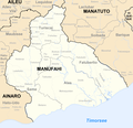
Maps
The Manufahi community

list
The administration office of Alas

The Fatuberlio Administration Office
| Administration Office Fatuberlio | |||||||
|
|||||||
| Suco Bubussuso | |||||||
| places | position | height | places | position | height | ||
| Aituha | 8 ° 54 ′ 43 ″ S, 125 ° 46 ′ 17 ″ E | 887 m | Bubulora | 8 ° 55 ′ 8 ″ S, 125 ° 46 ′ 27 ″ E | 841 m | ||
| Bubussuso | 8 ° 54 ′ 52 ″ S, 125 ° 47 ′ 0 ″ E | 715 m | Lihu Lau | 8 ° 54 ′ 34 "S, 125 ° 46 ′ 56" E | 770 m | ||
| Orlora | 8 ° 54 ′ 18 ″ S, 125 ° 46 ′ 10 ″ E | 972 m | |||||
| Suco Caicassa | |||||||
| places | position | height | places | position | height | ||
| Ailalec | 9 ° 2 ′ 41 ″ S, 125 ° 57 ′ 41 ″ E | 102 m | Bubur Laletec | 9 ° 2 ′ 45 ″ S, 125 ° 57 ′ 31 ″ E | 102 m | ||
| Caicassa (North) | 8 ° 55 ′ 47 "S, 125 ° 48 ′ 57" E | 608 m | Caicassa (South) | 9 ° 2 ′ 34 "S, 125 ° 57 ′ 34" E | 102 m | ||
| Sucaer Oan | 9 ° 2 ′ 48 ″ S, 125 ° 57 ′ 9 ″ E | 79 m | |||||
| Suco Clacuc | |||||||
| places | position | height | places | position | height | ||
| Clacuc | 9 ° 0 ′ 32 ″ S, 126 ° 0 ′ 41 ″ E | 102 m | Fatubese | 9 ° 1 ′ 47 ″ S, 125 ° 59 ′ 51 ″ E | 93 m | ||
| Fatuboec | 9 ° 1 ′ 53 ″ S, 125 ° 59 ′ 53 ″ E | 93 m | Fatumotin | 9 ° 2 ′ 1 ″ S, 125 ° 59 ′ 42 ″ E | 103 m | ||
| Haleborliuk | 9 ° 0 ′ 21 ″ S, 126 ° 0 ′ 46 ″ E | 89 m | Haslulucmodoc | 9 ° 0 ′ 38 ″ S, 126 ° 0 ′ 41 ″ E | 102 m | ||
| Kicras | 9 ° 4 ′ 0 ″ S, 126 ° 1 ′ 0 ″ E | 21 m | Mane hat | 9 ° 1 ′ 7 ″ S, 126 ° 0 ′ 12 ″ E | 111 m | ||
| Saluquim | 9 ° 0 ′ 42 ″ S, 126 ° 0 ′ 17 ″ E | 102 m | Uebicas | 9 ° 0 ′ 55 ″ S, 126 ° 0 ′ 22 ″ E | 97 m | ||
| Welaluhu | 9 ° 1 ′ 46 ″ S, 125 ° 59 ′ 41 ″ E | 103 m | |||||
| Suco Fahinehan | |||||||
| places | position | height | places | position | height | ||
| Ainessi | 8 ° 55 ′ 21 ″ S, 125 ° 45 ′ 33 ″ E | 908 m | Daramata | 8 ° 57 ′ 29 ″ S, 125 ° 44 ′ 28 ″ E | 611 m | ||
| Daurata | 8 ° 55 ′ 42 ″ S, 125 ° 45 ′ 38 ″ E | 908 m | Kakai | 8 ° 59 ′ 51 ″ S, 125 ° 43 ′ 47 ″ E | 339 m | ||
| Orilo | 8 ° 56 ′ 3 ″ S, 125 ° 45 ′ 6 ″ E | 867 m | Patukilat | 8 ° 54 ′ 5 ″ S, 125 ° 45 ′ 43 ″ E | 1089 m | ||
| Riamori | 8 ° 55 ′ 27 ″ S, 125 ° 45 ′ 13 ″ E | 944 m | |||||
| Suco Fatucahi | |||||||
| places | position | height | places | position | height | ||
| Cledic | 9 ° 2 ′ 6 ″ S, 125 ° 59 ′ 20 ″ E | 103 m | Fatuberlio | 8 ° 56 ′ 54 ″ S, 125 ° 52 ′ 13 ″ E | 527 m | ||
| Fatucahi | 9 ° 2 ′ 4 ″ S, 125 ° 59 ′ 19 ″ E | 103 m | |||||
Same administration office
| Same administration office | |||||||
|
|||||||
| Suco Babulo | |||||||
| places | position | height | places | position | height | ||
| Babulo | 9 ° 1 ′ 25 ″ S, 125 ° 39 ′ 22 ″ E | 246 m | Lapuro | 9 ° 1 ′ 36 ″ S, 125 ° 39 ′ 19 ″ E | 246 m | ||
| Lia-nai | 9 ° 0 ′ 31 ″ S, 125 ° 37 ′ 57 ″ E | 457 m | Maibouti | 9 ° 0 ′ 48 ″ S, 125 ° 38 ′ 25 ″ E | 332 m | ||
| Manikun | 9 ° 0 ′ 41 ″ S, 125 ° 37 ′ 44 ″ E | 578 m | Nunu-Fu | 9 ° 1 ′ 12 ″ S, 125 ° 38 ′ 40 ″ E | 332 m | ||
| Raimera | 9 ° 0 ′ 38 "S, 125 ° 38 ′ 53" E | 348 m | Searema | 9 ° 1 ′ 3 ″ S, 125 ° 38 ′ 36 ″ E | 332 m | ||
| Turon | 9 ° 2 ′ 11 "S, 125 ° 39 ′ 47" E | 210 m | Uma-liurai | 9 ° 1 ′ 11 ″ S, 125 ° 39 ′ 12 ″ E | 301 m | ||
| Suco Betano | |||||||
| places | position | height | places | position | height | ||
| Bemetan | 9 ° 9 ′ 23 "S, 125 ° 43 ′ 34" E | 59 m | Betano | 9 ° 9 ′ 52 ″ S, 125 ° 43 ′ 30 ″ E | 2 m | ||
| Lalica | 9 ° 9 ′ 0 ″ S, 125 ° 42 ′ 25 ″ E | 88 m | Leo-Ai 1 | 9 ° 8 ′ 49 ″ S, 125 ° 40 ′ 38 ″ E | 41 m | ||
| Leo-Ai 2 | 9 ° 8 ′ 27 ″ S, 125 ° 41 ′ 52 ″ E | 90 m | Rai-Fussa | 9 ° 8 ′ 43 "S, 125 ° 42 ′ 11" E | 90 m | ||
| Riatu | 9 ° 5 ′ 30 ″ S, 125 ° 41 ′ 35 ″ E | 268 m | Selihassan | 9 ° 9 ′ 12 ″ S, 125 ° 46 ′ 0 ″ E | 102 m | ||
| Sessurai | 9 ° 6 ′ 21 ″ S, 125 ° 41 ′ 45 ″ E | 191 m | |||||
| Suco Dai-Sua | |||||||
| places | position | height | places | position | height | ||
| Aidaludo | 9 ° 0 ′ 26 ″ S, 125 ° 37 ′ 9 ″ E | 649 m | Babulu | 9 ° 4 ′ 19 ″ S, 125 ° 41 ′ 19 ″ E | 268 m | ||
| Dai-sua | 9 ° 4 ′ 40 ″ S, 125 ° 41 ′ 13 ″ E | 165 m | Leço-Lau | 9 ° 4 ′ 51 ″ S, 125 ° 41 ′ 2 ″ E | 157 m | ||
| Loti | 9 ° 4 ′ 57 ″ S, 125 ° 41 ′ 21 ″ E | 284 m | Ria-Tu (North) | 9 ° 0 ′ 22 ″ S, 125 ° 36 ′ 31 ″ E | 700 m | ||
| Ria-Tu (South) | 9 ° 5 ′ 30 ″ S, 125 ° 41 ′ 35 ″ E | 268 m | |||||
| Suco Grotu | |||||||
| places | position | height | places | position | height | ||
| Coli Dassi | 9 ° 1 ′ 31 ″ S, 125 ° 35 ′ 55 ″ E | 546 m | Grotu | 9 ° 2 ′ 1 ″ S, 125 ° 36 ′ 3 ″ E | 464 m | ||
| Leo Dato | 9 ° 2 ′ 14 ″ S, 125 ° 36 ′ 4 ″ E | 464 m | |||||
| Suco Holarua | |||||||
| places | position | height | places | position | height | ||
| Betuala | 8 ° 56 ′ 15 "S, 125 ° 36 ′ 52" E | 1451 m | Blaro | 8 ° 55 ′ 7 ″ S, 125 ° 39 ′ 43 ″ E | 967 m | ||
| Carbulau | 8 ° 57 ′ 15 ″ S, 125 ° 39 ′ 4 ″ E | 666 m | Datina | 8 ° 56 ′ 2 ″ S, 125 ° 37 ′ 57 ″ E | 1123 m | ||
| Deunai | 8 ° 54 ′ 24 ″ S, 125 ° 39 ′ 43 ″ E | 941 m | Fahiluhan | 8 ° 56 ′ 10 ″ S, 125 ° 37 ′ 34 ″ E | 1205 m | ||
| Fatuco | 8 ° 58 ′ 11 ″ S, 125 ° 39 ′ 44 ″ E | 408 m | Hatu-Rae | 8 ° 59 ′ 16 ″ S, 125 ° 39 ′ 56 ″ E | 359 m | ||
| Holarua | 8 ° 59 ′ 8 ″ S, 125 ° 39 ′ 33 ″ E | 418 m | Orema | 8 ° 56 ′ 15 ″ S, 125 ° 39 ′ 20 ″ E | 747 m | ||
| Palitehu | 8 ° 56 ′ 51 ″ S, 125 ° 40 ′ 29 ″ E | 523 m | Russo | 8 ° 56 ′ 13 ″ S, 125 ° 40 ′ 37 ″ E | 667 m | ||
| Tirilolo | 8 ° 58 ′ 6 ″ S, 125 ° 39 ′ 47 ″ E | 348 m | Urufu | 8 ° 58 ′ 25 ″ S, 125 ° 39 ′ 55 ″ E | ? | ||
| Suco Letefoho | |||||||
| places | position | height | places | position | height | ||
| Ailuli | 8 ° 59 ′ 36 ″ S, 125 ° 40 ′ 6 ″ E | 359 m | Akadiruhun | 9 ° 0 ′ 48 ″ S, 125 ° 39 ′ 19 ″ E | 278 m | ||
| Cato Lada | 8 ° 58 ′ 59 ″ S, 125 ° 37 ′ 36 ″ E | ? | Cotalala | 8 ° 59 ′ 56 "S, 125 ° 38 ′ 58" E | 384 m | ||
| Ladiqui | 9 ° 0 ′ 0 ″ S, 125 ° 41 ′ 1 ″ E | 255 m | Malus hun | 8 ° 59 ′ 41 ″ S, 125 ° 39 ′ 4 ″ E | ? | ||
| Manico 1 | 9 ° 0 ′ 1 ″ S, 125 ° 38 ′ 46 ″ E | 384 m | Manico 2 | 9 ° 0 ′ 2 ″ S, 125 ° 38 ′ 28 ″ E | 425 m | ||
| Rai-Ubo | 8 ° 59 ′ 30 ″ S, 125 ° 39 ′ 23 ″ E | 411 m | Ria-Lau | 9 ° 0 ′ 34 ″ S, 125 ° 39 ′ 7 ″ E | 348 m | ||
| Sabou | 9 ° 0 ′ 11 ″ S, 125 ° 36 ′ 34 ″ E | ? | Seed | 9 ° 0 ′ 12 ″ S, 125 ° 38 ′ 49 ″ E | 384 m | ||
| Tomanamo | 8 ° 59 ′ 16 ″ S, 125 ° 37 ′ 42 ″ E | 621 m | |||||
| Suco Rotuto | |||||||
| Manufahi | 8 ° 59 ′ 41 ″ S, 125 ° 35 ′ 43 ″ E | 951 m | |||||
| Suco Tutuluro | |||||||
| places | position | height | places | position | height | ||
| Ailau | 8 ° 57 ′ 1 ″ S, 125 ° 42 ′ 15 ″ E | 515 m | Batas | 8 ° 56 ′ 14 "S, 125 ° 42 ′ 20" E | 620 m | ||
| Bubolau | 8 ° 57 ′ 25 ″ S, 125 ° 42 ′ 21 ″ E | 458 m | Dalun | 8 ° 59 ′ 8 ″ S, 125 ° 41 ′ 36 ″ E | 340 m | ||
| Hastetuc | 8 ° 55 ′ 40 ″ S, 125 ° 41 ′ 23 ″ E | 831 m | Sosemera | 8 ° 58 ′ 54 ″ S, 125 ° 41 ′ 33 ″ E | 340 m | ||
The Turiscai Administrative Office
| Turiscai Administrative Office | |||||||
|
|||||||
| Suco Aitemua | |||||||
| places | position | height | places | position | height | ||
| Furac Lau | 8 ° 51 ′ 58 ″ S, 125 ° 43 ′ 3 ″ E | 1051 m | Laclo | 8 ° 50 ′ 38 ″ S, 125 ° 41 ′ 24 ″ E | 1236 m | ||
| Suco Beremana | |||||||
| places | position | height | places | position | height | ||
| Beremana | 8 ° 51 ′ 21 ″ S, 125 ° 43 ′ 4 ″ E | 1148 m | Dalubo | 8 ° 51 ′ 30 ″ S, 125 ° 43 ′ 4 ″ E | 1148 m | ||
| Fahilebo | 8 ° 50 ′ 50 ″ S, 125 ° 43 ′ 12 ″ E | 1234 m | |||||
| Suco Caimauc | |||||||
| places | position | height | places | position | height | ||
| Bussacoa | 8 ° 49 ′ 5 ″ S, 125 ° 42 ′ 21 ″ E | 1254 m | Fohua | 8 ° 49 ′ 15 ″ S, 125 ° 41 ′ 53 ″ E | 1451 m | ||
| Lemano | 8 ° 48 ′ 53 "S, 125 ° 42 ′ 22" E | 1254 m | Railete | 8 ° 49 ′ 3 ″ S, 125 ° 41 ′ 54 ″ E | 1451 m | ||
| Risso | 8 ° 49 ′ 10 ″ S, 125 ° 42 ′ 15 ″ E | 1254 m | |||||
| Suco Fatucalo | |||||||
| places | position | height | places | position | height | ||
| Lisuata | 8 ° 45 ′ 47 "S, 125 ° 45 ′ 53" O | 883 m | |||||
| Suco Foholau | |||||||
| places | position | height | places | position | height | ||
| Fatulelo | 8 ° 51 ′ 24 ″ S, 125 ° 45 ′ 12 ″ E | 1220 m | Tarabula | 8 ° 51 ′ 7 ″ S, 125 ° 44 ′ 57 ″ E | 1226 m | ||
| Suco Lessuata | |||||||
| places | position | height | places | position | height | ||
| Namoluli | 8 ° 46 ′ 0 ″ S, 125 ° 45 ′ 33 ″ E | 732 m | |||||
| Suco Liurai | |||||||
| places | position | height | places | position | height | ||
| Bilimano | 8 ° 49 ′ 54 ″ S, 125 ° 43 ′ 46 ″ E | 1274 m | Fohonaru | 8 ° 49 ′ 58 ″ S, 125 ° 43 ′ 38 ″ E | 1328 m | ||
| Fanolelo | 8 ° 49 ′ 9 ″ S, 125 ° 44 ′ 42 ″ E | 1176 m | Marcoluli | 8 ° 49 ′ 45 ″ S, 125 ° 44 ′ 21 ″ E | 1246 m | ||
| Titilauai | 8 ° 48 ′ 47 "S, 125 ° 44 ′ 52" E | 1212 m | Turiscai Lau | 8 ° 49 ′ 41 ″ S, 125 ° 43 ′ 53 ″ E | 1225 m | ||
| Suco Manumera | |||||||
| places | position | height | places | position | height | ||
| Assumata | 8 ° 49 ′ 24 ″ S, 125 ° 42 ′ 41 ″ E | 1431 m | Cotalaulara | 8 ° 49 ′ 3 ″ S, 125 ° 42 ′ 48 ″ E | 1242 m | ||
| Faturedalau | 8 ° 49 ′ 31 ″ S, 125 ° 42 ′ 17 ″ E | 1431 m | Skin egg | 8 ° 49 ′ 17 "S, 125 ° 40 ′ 36" E | 1463 m | ||
| Toilero | 8 ° 49 ′ 52 "S, 125 ° 41 ′ 48" E | 1371 m | Turiscai | 8 ° 49 ′ 22 "S, 125 ° 42 ′ 27" E | 1431 m | ||
| Suco Matorec | |||||||
| places | position | height | places | position | height | ||
| Orluli | 8 ° 50 ′ 27 ″ S, 125 ° 46 ′ 8 ″ E | 1155 m | |||||
| Suco Mindelo | |||||||
| places | position | height | places | position | height | ||
| Aidila | 8 ° 53 ′ 59 ″ S, 125 ° 43 ′ 15 ″ E | 784 m | Binani | 8 ° 53 ′ 22 "S, 125 ° 42 ′ 55" E | 848 m | ||
| Maubissi | 8 ° 53 ′ 38 ″ S, 125 ° 42 ′ 16 ″ E | 901 m | Orcenaco | 8 ° 52 ′ 37 "S, 125 ° 41 ′ 51" E | 1146 m | ||
| Suco Orana | |||||||
| places | position | height | places | position | height | ||
| Orana | 8 ° 52 ′ 24 ″ S, 125 ° 45 ′ 29 ″ E | 1182 m | |||||
See also
supporting documents
The spelling of the place names follows, if available, the information on the administrative divisions in:
- Jornal da República: Diploma Ministerial n ° 16/2017 , with corrections dated May 9, 2017
The list of localities is created with the following maps:
- Timor-Leste GIS-Portal ( Memento from June 30, 2007 in the Internet Archive )
- UNMIT maps of the districts 2008
If the place names are spelled differently, the information from the GIS portal is followed. The other spellings for individual places can be found in the article on the individual sucos in the country.
The sea heights and coordinates were taken from:
Places listed on Global Gazetteer that are not confirmed by a map will not be included in the list.
Coordinates that are not listed on Global Gazetteer are determined with the help of Google Maps .
The administrative borders within East Timor changed in 2015. This article must therefore be checked and updated if necessary. See New Administrative Boundaries .