List of listed objects in Traiskirchen
The list of listed objects in Traiskirchen contains the 28 listed , immovable objects of the city of Traiskirchen in the Lower Austrian district of Baden .
Monuments
| photo | monument | Location | description | Metadata |
|---|---|---|---|---|
|
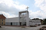
Catholic Parish Church Mariae Namen ObjektID : 78351 |
Franz Broschek-Platz 11 KG location : Möllersdorf |
The church was built in 1967/1968 according to plans by Carl Auböck . Lydia Roppolt (1967) created a large mosaic of Christ in Emmaus and the reliefs of the Cross . |
ObjectID : 78351 Status: § 2a Status of the BDA list: 2020-02-29 Name: Catholic Parish Church Mariae Namen GstNr .: 13 |

|
Find area Hausbergfeld ObjectID : 130301 |
Hausbergfeld location KG: Möllersdorf |
Ceramic fragments from the 13th to 15th centuries, which were recovered from the Hausbergfeld corridor, indicate a medieval settlement. |
ObjektID : 130301 Status : Notification Status of the BDA list: 2020-02-29 Name: Find zone Hausbergfeld GstNr .: 1058/1; 1058/2; 1058/3; 1059/2; 1060; 1065; 1066; 1072/1; 1072/2; 1393 |

|
Shrine Object ID: 78322 |
Karl Adlitzer-Strasse 25 KG location : Möllersdorf |
The wayside shrine bears a picture of St. Fabian, the patron saint of Möllersdorf. The wayside shrine was dismantled in 1967 and moved back to its original location in 2007 from its location in Traiskirchen. |
ObjectID : 78322 Status: § 2a Status of the BDA list: 2020-02-29 Name: Bildstock GstNr .: 1449/2 |

|
Shrine Object ID: 78362 |
Karl Adlitzer-Strasse 51, 53 KG location : Möllersdorf |
The tabernacle shrine bears a stone tablet with the inscription 1652. |
ObjectID : 78362 Status: § 2a Status of the BDA list: 2020-02-29 Name: Bildstock GstNr .: 11/8 |

|
Möllersdorf Castle with Chapel ObjectID : 78352 |
Karl Adlitzer-Strasse 54a KG location : Möllersdorf |
A first system was built around 1690–1700 by Thomas Zachäus Czernin von und zu Chudenitz , came into state ownership in 1780 and was converted into a barracks by Joseph II . Subsequently it became a military hospital, penal institution and from 1927 residential building. |
ObjectID : 78352 Status: § 2a Status of the BDA list: 2020-02-29 Name: Möllersdorf Castle with Chapel GstNr .: 6/41 Schlössl Möllersdorf |

|
City Museum Traiskirchen ObjectID : 78347 |
Wolfstrasse 14–18d KG location : Möllersdorf |
The former cotton spinning mill of the Vöslauer worsted yarn factory was built in 1824 and today houses the Traiskirchen City Museum , which also houses a fire brigade museum and a matador museum. |
ObjectID : 78347 Status: § 2a Status of the BDA list: 2020-02-29 Name: Factory facility GstNr .: 23/15; .38 / 5 Vöslauer worsted yarn factory, Möllersdorf plant |
|
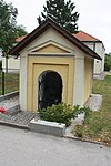
Corridor / path chapel ObjectID : 78380 |
Triester Straße 43–45 KG location : Oeynhausen |
The chapel with a round arch niche bears a memorial plaque from 1825. Due to the elevation of Triester Straße , the chapel is now lower than the surrounding level. |
ObjectID : 78380 Status: § 2a Status of the BDA list: 2020-02-29 Name: Flur- / Wegkapelle GstNr .: 56/1 |

|
Catholic branch church hl. Laurentius ObjektID : 78370 |
KG location : Oeynhausen |
The branch church belongs to the Oberwaltersdorf parish and was originally a simple chapel from 1847. It was consecrated in 1874. In 1964 it was rebuilt and expanded. |
ObjectID : 78370 Status: § 2a Status of the BDA list: 2020-02-29 Name: Kath. Filialkirche hl. Laurentius GstNr .: .30 / 1 |

|
Trinity Column ObjectID : 78296 |
Hauptplatz location KG: Traiskirchen |
The Trinity Column was erected on the main square on the occasion of a plague epidemic in 1713. |
ObjectID : 78296 Status: § 2a Status of the BDA list: 2020-02-29 Name: Dreifaltigkeitssäule GstNr .: 915/6 Plague column Traiskirchen |

|
Catholic branch church hl. Nikolaus ObjectID : 78284 |
Hauptplatz 6 KG location : Traiskirchen |
Simple, free-standing building on the main square, in the core Romanesque. Presented west tower with a steep pyramid spire from 1859. |
ObjectID : 78284 Status: § 2a Status of the BDA list: 2020-02-29 Name: Kath. Filialkirche hl. Nikolaus GstNr .: .99 / 2 Saint Nicholas Church (Traiskirchen) |

|
Evang. Parish Church A. and HB ObjectID : 78297 |
Otto Glöckel-Strasse 16 KG location : Traiskirchen |
Central building under a hipped roof with a facade tower in the south. Built in 1913 according to plans by the architects Siegfried Theiss and Hans Jaksch . |
ObjectID : 78297 Status: § 2a Status of the BDA list: 2020-02-29 Name: Evang. Parish church A. and HB GstNr .: 768/83 Evangelical parish church Traiskirchen |

|
Maria-Hilf-Chapel ObjectID : 78304 |
Pfaffstättner Straße KG location : Traiskirchen |
Representative historicizing building from 1870 under a gable roof. |
ObjectID : 78304 Status: § 2a Status of the BDA list: 2020-02-29 Name: Maria-Hilf-Kapelle GstNr .: 915/20 |

|
Eleven boundary stones ObjectID : 78310 |
Walther von der Vogelweide-Straße 4 KG location : Traiskirchen |
11 former boundary stones in the south of the city park, partly marked with W (ien) S (aloniki) B (ahn). |
ObjectID : 78310 Status: § 2a Status of the BDA list: 2020-02-29 Name: Elf Grenzsteine GstNr .: 946/1 |

|
Shrine Object ID: 78306 |
Wiener Neustädter Straße KG location : Traiskirchen |
Tabernacle shrine on a polygonal column with a pyramid helmet, bears an inscription according to the decree of Ferdinand III , marked 1650. |
ObjectID : 78306 Status: § 2a Status of the BDA list: 2020-02-29 Name: Bildstock GstNr .: 2426 |

|
Residential building former Einkehrgasthof Zur Hl. Dreifaltigkeit ObjektID : 55975 |
Wiener Straße 15 KG location : Traiskirchen |
Long, two-story street wing under a hipped roof. 1889–1918 converted into barracks, largely demolished in 1977, now used as a residential building. |
ObjectID : 55975 Status: § 2a Status of the BDA list: 2020-02-29 Name: Residential building formerly Einkehrgasthof Zur Hl. Dreifaltigkeit GstNr .: .216 / 4 Former Einkehrgasthof Zur Hl. Dreifaltigkeit |

|
Parsonage Object ID: 55976 |
Wiener Straße 28–30 KG location : Traiskirchen |
Two-storey building northwest of the church. Erected in 1746, rebuilt in 1955/56 after being damaged in the Second World War. |
ObjectID : 55976 Status: § 2a Status of the BDA list: 2020-02-29 Name: Pfarrhof GstNr .: .135; .133 |

|
Catholic parish church hl. Margaretha ObjectID : 55977 |
Wiener Straße 28–30 KG location : Traiskirchen |
The original fortified church was destroyed to the ground in the Turkish War in 1683 . With Abbot Gregor Müller of Melk Abbey, the church was rebuilt according to the plans of the architect and builder Mathias Gerl and consecrated on June 12, 1774 by Prince Archbishop Cardinal Migazzi . |
ObjectID : 55977 Status: § 2a Status of the BDA list: 2020-02-29 Name: Catholic parish church hl. Margaretha GstNr .: .134 St. Margareta (Traiskirchen) |

|
Rectory bridge and defensive wall with moat ObjectID : 78281 |
Wiener Straße 28–30 KG location : Traiskirchen |
Arched bridge, flanked by statues of St. John Nepomuk and Sebastian, both marked 1716 on the base. |
ObjektID : 78281 Status: § 2a Status of the BDA list: 2020-02-29 Name: Pfarrhofbrücke and defensive wall with ditch GstNr .: 1010; 1011/1; 1011/2 St. Margareta (Traiskirchen) |

|
Wiener Neustädter Canal ObjectID: 117207 |
KG location : Traiskirchen |
The Wiener Neustädter Canal was put into operation in 1803 and extended up to 63 km. Originally it was planned as far as Trieste . Parts of the route were later converted to railway lines, so that the movement of goods fell sharply from 1879 onwards. |
ObjectID: 117207 Status: Notification Status of the BDA list: 2020-02-29 Name: Wiener Neustädter Kanal GstNr .: 760/3; 760/4 Wiener Neustädter Canal |

|
Parsonage Object ID: 78324 |
Badener Straße, Tribuswinkel 3 Location KG: Tribuswinkel |
The two-storey parsonage is west of the church and used to be a farm yard and its core dates back to the 17th century. It was only converted into a parish hall in 1937. |
ObjectID : 78324 Status: § 2a Status of the BDA list: 2020-02-29 Name: Pfarrhof GstNr .: .34 Pfarrhof Tribuswinkel |
|
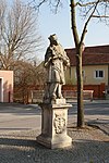
Figure shrine St. Johannes Nepomuk ObjectID : 78343 |
Kirchenplatz 8 KG location : Tribuswinkel |
The statue of St. John Nepomuk is marked with "1722". |
ObjectID : 78343 Status: § 2a Status of the BDA list: 2020-02-29 Name: Figurine picture stick hl. Johannes Nepomuk GstNr .: 10 |
|
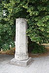
Wayside shrine Römerstein ObjektID : 78346 |
Kirchenplatz 9 KG location : Tribuswinkel |
The Roman stone in front of the parish church is a round pillar with a recent base and blind arcades and was probably a Roman path pillar that was later used as a pillory pillar . |
ObjectID : 78346 Status: § 2a Status of the BDA list: 2020-02-29 Name: Bildstock Römerstein GstNr .: .35 |
|
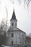
Catholic parish church hl. Wolfgang ObjectID : 55994 |
Kirchenplatz 9 KG location : Tribuswinkel |
Baroque hall church with west choir; Main facade with tower tower in the east. Rebuilt after a fire in 1732, restored from 1967–71. |
ObjectID : 55994 Status: § 2a Status of the BDA list: 2020-02-29 Name: Catholic parish church hl. Wolfgang GstNr .: .35 Church Tribuswinkel |

|
Tribuswinkel Castle (and Park) ObjectID : 33821 |
Traiskirchner Strasse 6–10 KG location : Tribuswinkel |
A former well-fortified moated castle, the core of which is from the 16./17. The turn of the century dates back to the 19th and 20th centuries. Century was remodeled. |
ObjectID : 33821 Status : Notification Status of the BDA list: 2020-02-29 Name: Schloss Tribuswinkel (and Park) GstNr .: .1; 100/1; 104; 102; 103 Tribuswinkel Castle |

|
Marienpfeiler ObjektID : 78344 |
Location KG: Tribuswinkel |
The Marienpfeiler with the inscription 1905 stands in the corner of the church and the rectory. He was moved there from the Sängerhofgasse in 1950.
The Marian column, which has a high base, can be attributed to the first half of the 18th century. |
ObjectID : 78344 Status: § 2a Status of the BDA list: 2020-02-29 Name: Marienpfeiler GstNr .: .34 |

|
Wiener Neustädter Canal ObjectID : 117214 |
Location KG: Tribuswinkel |
The Wiener Neustädter Canal was put into operation in 1803 and extended up to 63 km. Originally it was planned as far as Trieste . Parts of the route were later converted to railway lines, so that the movement of goods fell sharply from 1879 onwards. |
ObjectID : 117214 Status : Notification Status of the BDA list: 2020-02-29 Name: Wiener Neustädter Kanal GstNr .: 160/1; 160/6; 160/7; 344/1; 345; 350; 351/1; 404/3; 404/4; 494/1; 495; 543/1; 543/2; 543/3; 543/15; 543/16; 543/22; 543/24; 543/26; 544/1; 544/5; 544/13; 544/15; 544/16; 544/23; 544/25; 544/27; 544/40; 544/45; 1425/1; 1425/2; .85 / 3 Wiener Neustädter Canal |

|
Corridor / path chapel ObjectID : 78386 |
Georg Skrianz-Platz KG location : Wienersdorf |
Chapel with a round arch niche under a gable and a gable roof, 19th century. |
ObjectID : 78386 Status: § 2a Status of the BDA list: 2020-02-29 Name: Flur- / Wegkapelle GstNr .: 333/28 |

|
Former Freihof or manor house, former malt factory ObjectID : 77004 |
Wienersdorfer Hauptstrasse 7 KG location : Wienersdorf |
Elongated single-storey building from the end of the 19th century, two-storey tower with a round arched portal from the end of the 16th century. Unused today. |
ObjectID : 77004 Status : Notification Status of the BDA list: 2020-02-29 Name: Former Freihof or mansion, former malt factory GstNr .: 53/4 |
literature
- Peter Aichinger-Rosenberger (among others): Lower Austria south of the Danube. Volume 2: M to Z . Dehio-Handbuch , Die Kunstdenkmäler Österreichs, topographic monuments inventory. Berger, Horn / Vienna 2003, ISBN 3-85028-365-8 .
Web links
Commons : Listed objects in Traiskirchen - collection of images, videos and audio files
Individual evidence
- ↑ a b Lower Austria - immovable and archaeological monuments under monument protection. (PDF), ( CSV ). Federal Monuments Office , as of February 14, 2020.
- ^ Sabine Felgenhauer-Schmiedt: The high medieval castle Möllersdorf . In: Contributions to medieval archeology in Austria . No. 2-1986 . Böhlaus, 1986, ISBN 3-205-02030-8 ( univie.ac.at [PDF; 4.0 MB ; accessed on January 7, 2020]).
- ↑ a b c Aichinger-Rosenberger: Lower Austria south of the Danube . P. 2390.
- ↑ § 2a Monument Protection Act in the legal information system of the Republic of Austria .
