from Wikipedia, the free encyclopedia
This list includes lighthouses in the Netherlands .
The lighthouse is called Vuurtoren in Dutch . A second year of construction is given for the stations that were replaced by new buildings.
| Surname
|
province
|
Waters
|
position
|
Year of construction (s)
|
Tower height
|
Fire height
|
Identifier
|
image
|
|
Bornrif
|
Friesland
|
North Sea
|
53 ° 26 '57.3 " N , 5 ° 37' 32.6" E53.44925 5.62573
|
1881
|
55 m
|
58 m
|
Fl (3) W.15s
|

|
|
Brandaris
|
Friesland
|
North Sea
|
53 ° 21 '37.2 " N , 5 ° 12' 51.2" E53.36032 5.21423
|
1594
|
54 m
|
56 m
|
Fl.W.5s
|

|
|
De Ven
|
North Holland
|
IJsselmeer
|
52 ° 44 ′ 31.3 " N , 5 ° 16 ′ 56.1" E52.74202 5.28224
|
1700
|
15 m
|
17 m
|
LFl.W.10s
|

|
|
Delfzijl!Delfzijl lighthouse
|
Groningen
|
Unterems
|
53 ° 19 ′ 58 " N , 6 ° 55 ′ 26" E53.332778 6.923889
|
1888
|
11 m
|
15 m
|
destroyed (1940)
|
|
|
Egg country!Eierland lighthouse
|
North Holland
|
North Sea
|
53 ° 10 '55.6 " N , 4 ° 51" 19.2 " E53.18212 4.85533
|
1864
|
35 m
|
53 m
|
Fl (2) W.10s
|

|
|
Harlingen!Vuurtoren van Harlingen
|
Friesland
|
Southern Wadden Sea
|
53 ° 10 '25.8 " N , 5 ° 24' 42.6" E53.17382 5.41183
|
1922
|
23 m
|
|
deleted (1998)
|

|
|
Hellevoetsluis!Vuurtoren van Hellevoetsluis
|
South Holland
|
Haringvliet
|
51 ° 49 ′ 11 " N , 4 ° 7 ′ 40" E51.81972 4.12777
|
1822
|
18 m
|
17 m
|
Iso.WRG.10s
|

|
|
IJmuiden!IJmuiden Hoog
|
North Holland
|
North Sea
|
52 ° 27 '39.1 " N , 4 ° 34' 58.5" E52.460865 4.582909
|
1878
|
53 m
|
42 m
|
Fl W 5s / FW
|
|
|
IJmuiden!IJmuiden Laag
|
North Holland
|
North Sea
|
52 ° 27 '42.4 " N , 4 ° 34' 28.3" E52.46177 4.57452
|
1878
|
31 m
|
24 m
|
F WR
|

|
|
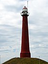
Long Jaap
|
North Holland
|
North Sea
|
52 ° 57 '19.7 " N , 4 ° 43' 35.1" E52.95548 4.72643
|
1822/1878
|
63 m
|
57 m
|
Fl (4) W.20s
|

|
|
Lemmer!Vuurtoren van Lemmer
|
Friesland
|
IJsselmeer
|
52 ° 50 '19.1 " N , 5 ° 42' 27.9" E52.83865 5.70775
|
1887/1993
|
19 m
|
|
deleted (1968)
|

|
|
Maasvlakte!Maasvlakte
|
South Holland
|
Meuse mouth
|
51 ° 58 ′ 12.2 " N , 4 ° 0 ′ 51.4" E51.97005 4.01428
|
1974
|
65 m
|
|
deleted (2008)
|
|
|
Brands!Paard van brands
|
North Holland
|
Markermeer
|
52 ° 27 '35.2 " N , 5 ° 8' 20.9" E52.45978 5.13913
|
1700/1839
|
16 m
|
16 m
|
Oc.W.8s
|

|
|
Nieuwe Sluis
|
Zeeland
|
Westerschelde
|
51 ° 24 '24 .9 " N , 3 ° 31' 16.9" E51.40691 3.52136
|
1867
|
28 m
|
|
deleted (2011)
|

|
|
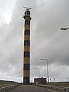
Noordertoren
|
Friesland
|
North Sea
|
53 ° 29 '12.6 " N , 6 ° 8' 47.5" E53.48684 6.14652
|
1854
|
36 m
|
44 m
|
Fl (4) W.20s
|
|
|
Stavoren!Stavoren lighthouse
|
Friesland
|
IJsselmeer
|
52 ° 53 '16.9 " N , 5 ° 21' 27.4" E52.88802 5.3576
|
1884
|
16 m
|
15 m
|
Iso.W.4s
|

|
|
Urk!Vuurtoren van Urk
|
Flevoland
|
IJsselmeer
|
52 ° 39 ′ 40 " N , 5 ° 35 ′ 31.2" E52.66112 5.59201
|
1845
|
19 m
|
27 m
|
Fl.W.5s
|

|
|
Vuurduin
|
Friesland
|
North Sea
|
53 ° 17 '45 " N , 5 ° 3' 29.6" E53.29582 5.05821
|
1836/1909
|
17 m
|
54 m
|
Iso.W.4s
|

|
|
Watum!Watum lighthouse
|
Groningen
|
Unterems
|
53 ° 22 ′ 29.6 " N , 6 ° 53 ′ 23" E53.374894 6.889736
|
1888
|
11 m
|
20 m
|
destroyed (1945)
|

|
|
Westerlichttoren
|
Zeeland
|
North Sea
|
51 ° 42 ′ 32 " N , 3 ° 41 ′ 29.8" E51.70888 3.69161
|
1837
|
53 m
|
58 m
|
Fl (2 + 1) W.15s
|

|
|
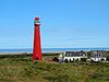
Westhoofd!Westhoofd near Ouddorp
|
South Holland
|
North Sea
|
51 ° 48 '47.5 " N , 3 ° 51' 50.6" E51.81319 3.86406
|
1950
|
52 m
|
56 m
|
Fl (3) W.15s
|

|
|
West Chapel Hoog
|
Zeeland
|
North Sea
|
51 ° 31 '45.1 " N , 3 ° 26" 49.7 " E51.52919 3.44715
|
1817
|
50 m
|
54 m
|
Fl.W.3s
|

|
|
West Chapel Laag
|
Zeeland
|
North Sea
|
51 ° 32 '24.3 " N , 3 ° 26' 12.7" E51.54009 3.43687
|
1875
|
18 m
|
20 m
|
Fl.WRG.10s
|

|
|
Workum!Workum lighthouse
|
Friesland
|
IJsselmeer
|
52 ° 57 '36.8 " N , 5 ° 24' 43.8" E52.96021 5.41216
|
1623/1778
|
9 m
|
|
deleted (1932)
|

|
|
Zuidertoren
|
Friesland
|
North Sea
|
53 ° 28 ′ 53.3 " N , 6 ° 9 ′ 31" E53.48147 6.15862
|
1854
|
35 m
|
|
deleted (1909)
|

|
See also
Web links


.jpg)


