
Lower River Region
| map | |
|---|---|
 Location of the region in Gambia Location of the region in Gambia
|
|
 Lower River Region Lower River Region
|
|
| Basic data | |
| Administrative location | Mansa Konko |
| Districts | 6th |
| Geographical center | 13 ° 24 ′ N , 15 ° 42 ′ W |
| North South expansion | 34 km |
| East-west expansion | 113 km |
| surface | 1,618 km² |
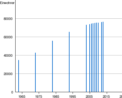
| population | 75,841 (as of 2013) |
| Population density | 47 inhabitants / km² |
| ISO 3166-2 |
GM-L
|
| Telephone code | (+220) 5 |
The Lower River Region (formerly: Lower River Division ) is one of six administrative units of the West African state of Gambia . The region corresponds to the Local Government Area Mansakonko .
geography
The 1618 km² region, with the seat of the administrative unit in Mansa Konko (314 inhabitants), is divided into six districts . With 75,841 inhabitants (2013 calculation) it is the least populated region of Gambia. The region extends south of the Gambia River in the west from the West Coast Region to the Central River Region in the east. The largest town with 10,411 inhabitants is Soma , in the Jarra West district , near Mansa Konko.
Districts
The six districts are: Kiang West , Kiang Central , Kiang East , Jarra West , Jarra Central and Jarra East .
Localities
The ten largest places are:
- Soma , 10,707
- Baro Kunda , 2056
- Sankwia , 1982
- Toniataba , 1900
- Keneba , 1810
- Nioro , 1781
- Kaiaf , 1770
- Sutukung , 1555
- Wellingara Ba, 1525
- Bureng , 1520
population
According to a survey from 1993 ( census at that time ), the Mandinka represented the largest population group with a share of around seven tenths, followed by the Fula and the Wolof. The distribution in detail: 70.3% Mandinka , 20.9% Fula , 2.5% Wolof , 1.3% Jola , 3% Serahule , 0.4% Serer , 0% Aku , 0.8% Manjago , 0 , 1% Bambara and 0.7% other races.
history
In 1968 the North Bank Division was split off from the former Lower River Division .
At the end of 2007, as part of an administrative reform, the former Lower River Division became the Lower River Region .
|
|
politics
The administrative unit is headed by a governor, and Lamin Waa Juwara has held this position since June 2009 .
Individual evidence
- ↑ Lower River Region on bevoelkerungsstatistik.de (no longer available online, last accessed May 2013)
- ^ Population by Ethnicity, by Settlement and Local Government Area. (Gambians Only) ( Memento from November 13, 2012 in the Internet Archive ) PDF file
City of Banjul | Kanifing Municipal (→ GBA ) and the regions: West Coast | Lower River | North Bank | Central River | Upper River