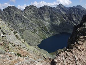
Mięguszowieckie Szczyty
| Mięguszowieckie Szczyty | ||
|---|---|---|
|
View from the Bergsee Meerauge |
||
| height | 2438 m npm | |
| location | Poland , Slovakia | |
| Mountains | High Tatras , Carpathian Mountains | |
| Coordinates | 49 ° 11 '14 " N , 20 ° 3' 36" E | |
|
|
||
The Mięguszowieckie Szczyty (German: Mengsdorfer Spitzen) are a mountain range in the Polish High Tatras in the Lesser Poland Voivodeship and the Bukowina Tatrzańska municipality with a maximum height of 2438 m npm of the Große Mengsdorfer Spitze . The Polish- Slovak border runs along the ridge, which is part of the main Tatra ridge .
Location and surroundings
Below the massif lie the Fischseetal ( Dolina Rybiego Potoku ) and Mengsdorf Valley ( Dolina Mięguszowiecka ) valleys . The massif is bordered on the mountain pass Chałubiński gate (Wrota Chałubińskiego) of the Massif of miedziane the east and the mountain pass Megsdorfer notch ( Czarnostawiańska Przełęcz ) of the massif of Ox Ridge ( wołowy Grzbiet ) to the west. The massif forms the south wall of the Karkessel of the mountain lakes Czarny Staw pod Rysami and Meerauge , to which it falls steeply. On the south side of the massif, the slopes fall flat to the Mengsdorf Great Frog Lake ( Wielki Żabi Staw Mięguszowiecki ).
The ridge of the massif from the Żabia Przełęcz Wyżnia mountain pass in the west to the Wrota Chałubińskiego mountain pass in the west runs as follows:
- Summit Eastern Mengsdorf Peak ( Mięguszowiecki Szczyt Czarny ) 2410 m above sea level
- Wildererjoch mountain pass ( Mięguszowiecka Przełęcz pod Chłopkiem ) 2307 m above sea level
- Summit Middle Mengsdorfer Spitze ( Mięguszowiecki Szczyt Pośredni ) 2393 m above sea level
- Chałubiński Pass ( Mięguszowiecka Przełęcz Wyżnia ) 2330 m above sea level
- Peak Große Mengsdorfer Spitze 2438 m above sea level
- Hinzenseescharte mountain pass ( Hińczowa Przełęcz ) 2323 m above sea level
- Cubryna summit 2376 m above sea level
- Hintere Mönchsscharte mountain pass ( Przełączka pod Zadnim Mnichem ): 2135 m above sea level
- Hinterer Mönch summit ( Zadni Mnich ) 2172 m above sea level
- Summit of the Smrečin Tower ( Ciemnosmreczyńska Turnia ): 2142 m above sea level
- Mountain Pass Tatra peak summit Charter ( Przełączk nad Wrotami ): 2055 m above sea level
- Chałubiński-Koppe peak ( Kopa nad Wrotami ) 2075 m above sea level
as well as upstream to the north
- Mengsdorfer Kanzel summit ( Kazalnica Mięguszowiecka ) 2159 m above sea level
- Mönchkoppe peak ( Mnichowa Kopa ) 2090 m above sea level
- Summit Mönch ( Mnich ) 2068 m above sea level
- Turnia Zwornikowa summit 1962 m above sea level
etymology
The Polish and German names refer to the neighboring Mengsdorfer Valley and to the village Mengusovce , which is called Mięguszowce in Polish and Mengsdorf in German .
Flora and fauna
The Mengsdorfer Spitzen are a retreat for birds of prey, u. a. Golden eagle, but not a strictly protected nature reserve.
tourism
The peaks can be climbed by climbers with the approval of the respective national park administration . The Schronisko PTTK nad Morskim Okiem refuge on the Meerauge mountain lake and the ascent to the Wildererjoch are particularly suitable as a starting point for climbing tours . This is where the partially marked Droga po Głazach high-altitude trail begins .
Web links
supporting documents
- Zofia Radwańska-Paryska, Witold Henryk Paryski, Wielka encyklopedia tatrzańska, Poronin, Wyd. Górskie, 2004, ISBN 83-7104-009-1 .
- Tatry Wysokie słowackie i polskie. Mapa turystyczna 1: 25.000, Warszawa, 2005/06, Polkart, ISBN 83-87873-26-8 .
- Ernst Hochberger. Mountain and hiking guide High Tatras, 4 volumes
panorama


