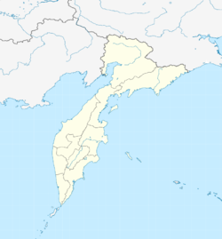
Milkowo (Kamchatka)
| Village
Milkovo
Мильково
|
||||||||||||||||||||||||||||||
|
||||||||||||||||||||||||||||||
|
||||||||||||||||||||||||||||||
Milkowo ( Russian Ми́льково ) is a village (Selo) in the Kamchatka region ( Russia ) with 8,251 inhabitants (as of October 14, 2010).
geography
The place is located in the central part of the Kamchatka Peninsula , in the lowland formed by the Kamchatka River between the Sredinny ridge and Vostochny ridge, on the left bank of the upper middle course of the river. Milkowo is located about 180 kilometers as the crow flies north of the Petropavlovsk-Kamchatsky regional administrative center .
It is the administrative center of the Milkowo Rajon of the same name .
history
Milkowo was founded in the summer of 1743 by five families who had left their home on the Lena in eastern Siberia five years earlier due to the order of Tsarina Anna Ivanovna from 1733 for the Russian settlement of Kamchatka . The first mention of the place can be found in the notes of Stepan Krasheninnikov . In the 18th and 19th centuries, Milkovo was the economic center of this part of the peninsula, 15 kilometers upstream and now abandoned Verkhnekamtschatsk .
On April 15, 1933, the place became the administrative center of a newly created Rajons.
Population development
| year | Residents |
|---|---|
| 1939 | 1.109 |
| 1959 | 2,427 |
| 1970 | 5,066 |
| 1979 | 8,959 |
| 1989 | 12,132 |
| 2002 | 9,243 |
| 2010 | 8,251 |
Note: census data
Culture and sights
In Milkowo is the museum and ethno-cultural center of the Kamchadals .
Economy and Infrastructure
The area around Milkowo is characterized by forestry and agriculture (vegetable and potato cultivation, livestock farming).
The place is on the regional road R474, which leads from Petropavlovsk-Kamchatsky, about 300 km away, further in the central valley of the peninsula, following the river Kamchatka downwards via Kozyrewsk and Klyuchi to Ust-Kamchatsk on the east coast. Four kilometers southwest of Milkowo is a small airport ( ICAO code UHPM ). After the airport had not been served regularly since the 1990s, a decision to close it was made in 2006, but this was revised in 2010.
Individual evidence
- ↑ a b Itogi VPN-2010. Administrativno-territorialʹnoe delenie kraja. (Results of the 2010 census. Administrative-territorial division of the region.) Table 2 (Download from the website of the Territorial Organ of the Kamchatka Region of the Federal Service of State Statistics of the Russian Federation)
- ↑ a b History of the place and the Raion on the official website of the Raion Administration (Russian)
- ↑ a b Milkowo on the website of the Geographical Institute of the RAN (Russian)
- ↑ Information about the museum at museum.ru (Russian)
- ↑ Statute of the federal state enterprise for airports in Kamchatka ( page no longer available , search in web archives ) Info: The link was automatically marked as defective. Please check the link according to the instructions and then remove this notice. ( MS Word ; 73 kB), confirmed by Order No. 300 of the Government of the Russian Federation of May 4, 2010 (Russian)


