Petropavlovsk-Kamchatsky
| city
Petropavlovsk-Kamchatsky
Петропавловск-Камчатский
|
||||||||||||||||||||||||||||||||||||||||||
|
||||||||||||||||||||||||||||||||||||||||||
|
||||||||||||||||||||||||||||||||||||||||||
| List of cities in Russia | ||||||||||||||||||||||||||||||||||||||||||

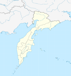
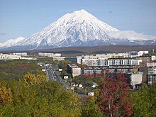
Petropavlovsk-Kamchatsky ( Russian Петропа́вловск-Камча́тский , scientific transliteration : Petropavlovsk-Kamčatskij - translated: Peter and Paul City in Kamchatka) is the capital of the Kamchatka Region in Russia's Far Eastern Federation . Petropavlovsk-Kamchatsky has 179,780 inhabitants (as of October 14, 2010). Here are u. a. scientific institutions for ocean research , fishing industry and geology, as well as shipbuilding industry . A monitoring station of the SDCM system is located on site .
history
Petropavlovsk-Kamchatsky was founded in 1740 and is an important base for the Russian Navy's Pacific Fleet .
On June 29th, July / July 10, 1740 greg. (the day of Peter and Paul ) the navigator Ivan Yelagin was sent by Vitus Bering to explore the natural harbor in Avacha Bay for the Second Kamchatka Expedition. The sheltered location in the bay and the mouth of the Avacha River were the reasons for the development to the most important city of Kamchatka.
On August 18, 1854, in the course of the Crimean War , a British-French ship unit undertook an attack on the city and began the siege of Petropavlovsk-Kamchatsky . The city had been fortified in previous years by Governor Nikolai Muravyov-Amursky . The Russians had only a small garrison of several hundred men and 67 cannons. They faced numerically superior Allied landing forces and 218 ship cannons. After a long bombardment, around 600 soldiers landed south of the city, but after heavy fighting they were repulsed by 230 defenders and forced to retreat. On August 24, another 970 allies landed east of the city, but could not prevail against 360 Russians either. Then the ships left Russian waters. The losses of the Russians amounted to about 100 men, while the losses of the English and French were about five times higher.
Population development
| year | Residents |
|---|---|
| 1897 | 395 |
| 1926 | 1,691 |
| 1939 | 35,373 |
| 1959 | 85,582 |
| 1970 | 153,885 |
| 1979 | 214,977 |
| 1989 | 268,747 |
| 2002 | 198.028 |
| 2010 | 179,780 |
Note: census data
traffic
The Petropavlovsk-Kamchatsky airport is located in Yelizovo .
religion
sons and daughters of the town
- Oleg Erofejew (* 1940), Russian admiral
- Igor Smirnow (* 1941), President of Transnistria (1992–2011)
- Anatolij Mohiljow (* 1955), Ukrainian politician and Minister of the Interior from 2010 to 2011
- Igor Makushev (* 1964), Lieutenant General
- Varvara Zelenskaya (* 1972), ski racer
- Margarita Marbler (* 1975), Austrian freestyle skier
- Jelena Temerewa (* 1976), zoologist and university lecturer
- Grigori Dobrygin (born 1986), actor
- Anatoli Oskin (* 1989), biathlete
- Pavlo Ishchenko (* 1992), Israeli boxer
- Jelena Jakowischina (* 1992), ski racer
Town twinning
Petropavlovsk-Kamchatsky lists the following twin cities :
- Unalaska , United States , since 1990
- Kushiro-shi , Japan , since 1998
- Sevastopol , Ukraine / Russia, since 2009
Climate table
| Petropavlovsk-Kamchatsky | ||||||||||||||||||||||||||||||||||||||||||||||||
|---|---|---|---|---|---|---|---|---|---|---|---|---|---|---|---|---|---|---|---|---|---|---|---|---|---|---|---|---|---|---|---|---|---|---|---|---|---|---|---|---|---|---|---|---|---|---|---|---|
| Climate diagram | ||||||||||||||||||||||||||||||||||||||||||||||||
| ||||||||||||||||||||||||||||||||||||||||||||||||
|
Average monthly temperatures and rainfall for Petropavlovsk-Kamchatsky
Source: Roshydromet , wetterkontor.de
|
|||||||||||||||||||||||||||||||||||||||||||||||||||||||||||||||||||||||||||||||||||||||||||||||||||||||||||||||||||||||||||||||||||||||||||||||||||||||||||||||||||||
Web links
- Official website of the city administration (Russian)
- Petropavlovsk on mojgorod.ru (Russian)
Individual evidence
- ↑ a b Itogi VPN-2010. Administrativno-territorialʹnoe delenie kraja. (Results of the 2010 census. Administrative-territorial division of the region.) Table 2 (Download from the website of the Territorial Organ of the Kamchatka Region of the Federal Service of State Statistics of the Russian Federation)
- ↑ Evgeny Pospelov: Geografitscheskije naswanija Rossii . AST, 2008, ISBN 978-5-17-054966-5 , pp. 349-350.
- ^ Yevgeny Zhukov et al.: Sowetskaya istoritscheskaja enziklopedija: Tom 11 . Sovetskaya enziklopedija, Moscow 1968, pp. 118–119.
- ↑ Макушев Игорь Юрьевич , structure.mil.ru (Russian)
- ↑ Макушев Игорь Юрьевич , eurasian-defence.ru (Russian)


