Tigil (place)
| Village
Tigil
Тигиль
|
||||||||||||||||||||||||||||||
|
||||||||||||||||||||||||||||||
|
||||||||||||||||||||||||||||||
Tigil ( Russian Тиги́ль ) is a village (Selo) in the Kamchatka Region ( Russia ) with 1691 inhabitants (as of October 14, 2010).
geography
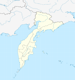
The place is located in the north-western central part of the Kamchatka peninsula about 520 kilometers as the crow flies north of the regional administrative center Petropavlovsk-Kamchatsky on the right bank of the Tigil river of the same name . Tigil is 40 kilometers away from the coast of the Sea of Okhotsk .
Tigil is the administrative center of the Tigil Rajon of the same name . A good quarter of the inhabitants of the place are members of the indigenous population, mainly Korjak and Itelmens .
history
The place was founded by Cossacks in 1747 and named after the river; a little later an ostrog ( Tigilskaja krepost , "Tigil Fortress") was built. Tigil lost its military importance as a Russian base in the subjugation of the indigenous population of the area until the end of the 18th century, but remained the most important Russian settlement in this part of the Kamchatka peninsula until Palana was founded in the 20th century.
On August 21, 1927, the place became the administrative center of a newly created Rajon, which from 1930 was part of the Koryak Autonomous Okrug, which existed until 2007 as an independent federal subject .
Population development
| year | Residents |
|---|---|
| 1939 | 879 |
| 1959 | 1473 |
| 1970 | 2351 |
| 1979 | 3030 |
| 1989 | 3233 |
| 2002 | 2132 |
| 2010 | 1691 |
Note: census data
Culture and sights
The Rajon's local museum has been located in Tigil since 1997.
Economy and Infrastructure
Tigil is the logistic center of an area in which forestry , fishing , fur hunting and reindeer herding are predominantly carried out.
Not far from the town is a small airport ( ICAO code UHPG ), from which there is a connection to Petropavlovsk-Kamchatsky. Tigil is connected to the villages in the southwestern part of the Rajon such as Ust-Chairjusowo as well as to Esso , where there is a connection to the regional road network of the peninsula, via mostly unpaved, all-terrain and partly only passable in winter pistes that are currently being slowly expanded . An all-weather road leads to the settlement of Palana, a good 150 km northeast (capital of the Korjak Autonomous Okrug until 2007).
Individual evidence
- ↑ a b Itogi VPN-2010. Administrativno-territorialʹnoe delenie kraja. (Results of the 2010 census. Administrative-territorial division of the region.) Table 2 (Download from the website of the Territorial Organ of the Kamchatka Region of the Federal Service of State Statistics of the Russian Federation)
- ↑ Tigil ( Memento of the original from October 2, 2015 in the Internet Archive ) Info: The archive link was inserted automatically and has not yet been checked. Please check the original and archive link according to the instructions and then remove this notice. on the official website of the Raion Administration (Russian)
- ↑ a b Tigil on the website of the Geographical Institute of the RAN (Russian)
- ↑ Museum in the official web portal of the regional administration (Russian)
- ↑ АНАВГАЙ - ПАЛАНА: АВТОЗИМНИК ОСОБОГО ЗНАЧЕНИЯ. Retrieved May 13, 2019 (Russian).

