Osernowski
| settlement
Osernowski
Озерновский
|
||||||||||||||||||||||||||||||
|
||||||||||||||||||||||||||||||
|
||||||||||||||||||||||||||||||
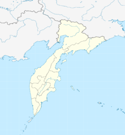
Osernowski ( Russian Озерновский ) is a settlement in the Kamchatka region ( Russia ) with 1793 inhabitants (as of October 14, 2010).
geography
The settlement is located about 230 km as the crow flies southwest of the regional administrative center Petropavlovsk-Kamchatsky on the southwest coast of the Kamchatka peninsula , on the Sea of Okhotsk . It is located on the left (southern) bank of the Osjornaya , which flows from the Kurilensee 40 km to the east . The district of Zaporozhye is located a little upstream on the opposite bank of the river.
Osernowski belongs to Rajon Ust-Bolsheretsk and is the administrative center of Ust-Bolsheretsk approximately 150 kilometers to the south. The municipality Osernovskoye gorodskoje posselenije includes Osernovsky, three settlements upstream of the Osjornaya and its left tributary, Pauschetka: Schumny (9 km to the east), Tjoply (15 km) and Pauschetka (21 km).
history
The place was founded in 1907 not far from an old Itelmen ("Kamchadal") village on the right bank of the river, when the fishing company S. Gruschewski & Co. built a processing factory there, and named after the Osernaya River. In official documents he was also called Unterberger or Unterbergerowka between 1910 and 1917 , after the former governor-general of the Amur region Pawel Unterberger (1842-1921).
Later the settlement was moved to the left bank and one of the first fish canning factories was built there in the Soviet period. In 1948 the place received the status of an urban-type settlement under its current name. Osernowski lost this status in 2010 and has been a settlement ever since.
Population development
| year | Residents |
|---|---|
| 1959 | 5498 |
| 1970 | 2888 |
| 1979 | 3173 |
| 1989 | 3606 |
| 2002 | 2770 |
| 2010 | 1793 |
Note: census data
Attractions
Osernowski is the starting point for a visit to the Kurilensee, which occupies a large caldera that was formed by a massive volcanic eruption about 8,000 years ago and is one of the most important sights on the peninsula. In the vicinity of the lake there are the volcanoes Koshelev , Kambalny and Ilyinskaya Sopka .
Economy and Infrastructure
The main industry is fishing and processing. The Osernaja is an important spawning area for sockeye salmon . The electrical energy and heat supply is ensured by the geothermal power plant Pauschetka (Pauschetskaja GeoES) not far from the settlement of the same name. It was the first of its kind to go into operation in the Soviet Union in 1966, has an output of 12 megawatts and is operated by RusHydro .
There is no year-round drivable connection to the road network of the Kamchatka Peninsula. The place can be reached by helicopter or by sea.
Individual evidence
- ↑ a b Itogi VPN-2010. Administrativno-territorialʹnoe delenie kraja. (Results of the 2010 census. Administrative-territorial division of the region.) Table 2 (Download from the website of the Territorial Organ of the Kamchatka Region of the Federal Service of State Statistics of the Russian Federation)
- ↑ Scheme of the spatial planning of the Ust-Bolscherezk district . Section III, Volume 1 with the basic data; Client: Ust-Bolscherezk district administration. Rostov-on-Don, 2009. p. 19 (Microsoft Word file, Russian; HTML )
- ↑ Website of the geothermal power plant packetka at RusHydro (Russian)
Web links
- Osernowski on the website of the regional administration (in Russian)


