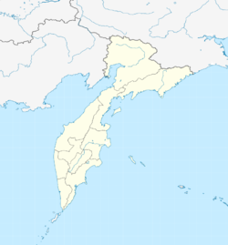
Sobolewo (Kamchatka)
| Village
Sobolevo
Соболево
|
||||||||||||||||||||||||||||
|
||||||||||||||||||||||||||||
|
||||||||||||||||||||||||||||
Sobolewo ( Russian Соболево ) is a village (selo) in the Kamchatka region ( Russia ) with 1773 inhabitants (as of October 14, 2010).
geography
The place is located in the middle of the plain that occupies the western part of the Kamchatka peninsula , on the left bank of the Bolshaya Vorovskaya river a good 10 kilometers above its mouth in the Sea of Okhotsk and about 225 kilometers as the crow flies northwest of the regional administrative center Petropavlovsk-Kamchatsky .
Sobolewo administrative center is the Rajons Sobolewski and only town in the rural community posselenije Sobolewskoje selskoje.
history
According to reports by the geographer Stepan Krascheninnikow from the middle of the 18th century, an Itelmen village called Algu existed in place of the place before 1700 . During the second half of the 18th century, the place developed into one of the focal points of Russian settlement in the western part of the peninsula. The place was known at different times under the names Gyk, Vorowskoje and Monomachowo, until it finally received the official status Selo in 1922 under the current name, derived from the Russian sobol for sable .
In the 1920s to 1940s, Sobolewo and the nearby settlements on the coast developed into centers of the fishing industry. On April 1, 1946, Sobolewo became the administrative seat of a district named after him, which was spun off from the Ust-Bolscherezki rajon .
Population development
| year | Residents |
|---|---|
| 1959 | 1272 |
| 1970 | 2097 |
| 1979 | 2448 |
| 1989 | 2922 |
| 2002 | 1893 |
Note: census data
Attractions
Sobolewo is the starting point for a visit to the Ichinskaja Sopka , the highest volcano in the central part of the peninsula at 3,621 m .
Personalities
- Igor Tajanowski (1936–2009), poet and writer, born in Sobolewo
Economy and Infrastructure
Sobolewo is still the center of the fishing industry, after several serious crises (late 1950s and early 1980s) in the last few decades, but a cautious upswing since around 2000. In the vicinity of the village, agriculture is practiced for the local supply (cattle, potato and vegetable cultivation). The Kschukskoye and (Nizhne-) Kwaktschinskoje natural gas deposits in the area have been discovered since the late 1960s , but their development did not begin until the 1990s. The former has been supplying Sobolewo with gas via a 57 km pipeline since 1999 . The continuation of the line over a total of 392 km to the regional capital Petropavlovsk-Kamchatsky was completed in September 2010.
There is no connection from Sobolewo to the Kamchatka road network; the place cannot be reached by land. Short unpaved roads lead to the southwestern coastal village of Ustyevoe, where a fish processing plant is located, and to the former Kirovsky urban-type settlement , which was abandoned in 1987 , and is also located north of the mouth of the Bolshaya Vorovskaya on the coast.
Sobolewo has a small airport ( ICAO code UHPS ) through which the connection to the regional center is maintained.
Individual evidence
- ↑ a b Itogi VPN-2010. Administrativno-territorialʹnoe delenie kraja. (Results of the 2010 census. Administrative-territorial division of the region.) Table 2 (Download from the website of the Territorial Organ of the Kamchatka Region of the Federal Service of State Statistics of the Russian Federation)
- ↑ a b Sobolewo on the website of the Geographical Institute of the RAN (Russian)
- ↑ Kamchatka on the website of the operator Gazprom (Russian)

