Ossora
| Urban-type settlement
Ossora
Оссора
|
||||||||||||||||||||||||||||||||
|
||||||||||||||||||||||||||||||||
|
||||||||||||||||||||||||||||||||
Ossora ( Russian Оссо́ра ) is an urban-type settlement in the Kamchatka region ( Russia ) with 2133 inhabitants (as of October 14, 2010).
geography
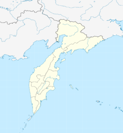
The settlement is located on the northeast coast of the Kamchatka Peninsula to the Karaginski Bay of the Bering Sea , on a spit on the Ossora Bay on the western bank of the strait named after Fyodor Lütke (Litke), which separates the mainland from the offshore island of Karaginski . A little to the north, the river, also called Ossora, flows into the bay. Ossora is about 750 kilometers as the crow flies north-northeast of the regional administrative center of Petropavlovsk-Kamchatsky .
Ossora is the administrative center of Karaginski Rajons , one of the four Rajons of the Koryak Autonomous Okrug , which was an independent federal subject until July 1, 2007 .
history
The settlement emerged from 1937 as a new, more favorably located administrative center in a less swampy area for the Karaginski Rajon, which has existed since 1926 (named after the Karaginski Bay and Island and the Karaga River on its territory and off its coasts ). Before that, until 1930, when an independent Oljutorski district was spun off, the district center was in Tilichiki , then in the village of Karaga . By 1942, Ossora, which was named after the river and bay, was essentially completed. In 1949 urban-type settlement was granted.
Population development
| year | Residents |
|---|---|
| 1959 | 2295 |
| 1970 | 2975 |
| 1979 | 3720 |
| 1989 | 4074 |
| 2002 | 2589 |
| 2010 | 2133 |
Note: census data
Economy and Infrastructure
The main industry is fishing and processing. Potatoes, vegetables and cattle are grown in the vicinity for local needs, and reindeer herding is carried out by the indigenous Korjak population in the Rajon .
Immediately south of Ossora there is a small airport ( ICAO code UHPD ), from which there is a connection to Petropavlovsk-Kamchatsky. A road leads from the settlement in a southerly direction to the village of Karaga, 15 kilometers away, on the south coast of a peninsula to the bay of Karaga adjacent to Ossora Bay. There is no connection to the regional road network, so Ossora can only be reached by air or by sea.
Individual evidence
- ↑ a b Itogi VPN-2010. Administrativno-territorialʹnoe delenie kraja. (Results of the 2010 census. Administrative-territorial division of the region.) Table 2 (Download from the website of the Territorial Organ of the Kamchatka Region of the Federal Service of State Statistics of the Russian Federation)
- ↑ History of the Raion and the Settlement on the official website of the Raion Administration (Russian)
- ↑ a b Ossora on the website of the Geographical Institute of the RAN (Russian)

