Palana
| Urban-type settlement
Palana
Палана
|
||||||||||||||||||||||||||||||||||
|
||||||||||||||||||||||||||||||||||
|
||||||||||||||||||||||||||||||||||
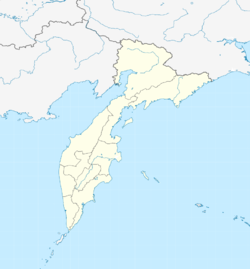
Palana ( Russian Пала́на ) is an urban-type settlement in the Kamchatka region ( Russia ) with 3155 inhabitants (as of October 14, 2010).
geography
The settlement is located in the northwest of the Kamchatka Peninsula , on the right bank of the Palana (river) , about eight kilometers above its mouth in the Shelichov Bay of the Sea of Okhotsk , at the foot of the mountains in the immediate hinterland, which rise to about 300 meters. Palana is located almost 700 kilometers (as the crow flies) north of the regional capital Petropavlovsk-Kamchatsky .
The place is enclosed by the territory of the Tigil Rajon , but forms a rajon-free, independent urban district (Russia) .
| Palana | ||||||||||||||||||||||||||||||||||||||||||||||||
|---|---|---|---|---|---|---|---|---|---|---|---|---|---|---|---|---|---|---|---|---|---|---|---|---|---|---|---|---|---|---|---|---|---|---|---|---|---|---|---|---|---|---|---|---|---|---|---|---|
| Climate diagram | ||||||||||||||||||||||||||||||||||||||||||||||||
| ||||||||||||||||||||||||||||||||||||||||||||||||
history
The village, known since 1876, whose Koryaks and Russians lived from fishing, hunting and collecting berries and wild herbs, had been the center of the Koryak Autonomous Okrug , founded in 1930 , after the administration had been relocated there from the village of Kamenskoye , which is less convenient for traffic .
Industrial fishing and fish processing developed over the course of the 20th century . In 1962 the status of urban-type settlement was given.
Palana remained the administrative center of the Autonomous Okrug until it was united with the Kamchatka Oblast on July 1, 2007 to form the new region of the same name.
Population development
| year | Residents |
|---|---|
| 1939 | 793 |
| 1959 | 924 |
| 1970 | 2735 |
| 1979 | 3687 |
| 1989 | 4343 |
| 2002 | 3928 |
| 2010 | 3155 |
Note: census data
Culture and sights
In Palana there has been a local museum since 1991 with a focus on the history and culture of the indigenous population, the Koryaks, Itelmens , Evens and Chukchi , as well as the nature of the area.
Economy and Infrastructure
In addition to the fishing industry, which has been in crisis since the 1990s, today Palanas primarily plays the role of a supply and cultural center for the entire north-eastern coastal area of the Sea of Okhotsk.
From the Palana a partly difficult winter road leads southwards, initially parallel to the coast, via which Petropavlovsk-Kamchatsky and the village of Esso in the central part of the peninsula - which has a permanent road connection - can be reached. The expansion of the winter road to an all-weather road was completed in 2014 to the Tigil , which is around 150 kilometers to the south , from there you can only continue on the winter road, which is also slowly being expanded.
A few kilometers west of Palana there is a small airport ( ICAO code UHPL ), from which there is a flight connection to the regional capital. A new airport is under construction on the other side of the river to the south of the village and is due to be completed in 2009.
Web links
Individual evidence
- ↑ a b Itogi VPN-2010. Administrativno-territorialʹnoe delenie kraja. (Results of the 2010 census. Administrative-territorial division of the region.) Table 2 (Download from the website of the Territorial Organ of the Kamchatka Region of the Federal Service of State Statistics of the Russian Federation)
- ^ Palana on the website of the Geographical Institute of the RAN
- ↑ Korjakisches Kreisheimatmuseum at museum.ru (Russian)
- ↑ АНАВГАЙ - ПАЛАНА: АВТОЗИМНИК ОСОБОГО ЗНАЧЕНИЯ. Retrieved May 13, 2019 (Russian).
- ↑ Press release ( Memento of the original from July 1, 2007 in the Internet Archive ) Info: The archive link was inserted automatically and has not yet been checked. Please check the original and archive link according to the instructions and then remove this notice. the administration of the Far East Federal District from June 7, 2007 (Russian)


