
Mirabel (Quebec)
| Mirabel | |||
|---|---|---|---|
 Sainte-Scholastique district |
|||
| Location in Quebec | |||
|
|||
| State : |
|
||
| Province : | Quebec | ||
| Administrative region : | Laurentides | ||
| Coordinates : | 45 ° 39 ′ N , 74 ° 6 ′ W | ||
| Height : | 63 m | ||
| Area : | 485.59 km² | ||
| Residents : | 41,957 (as of 2011) | ||
| Population density : | 86.4 inhabitants / km² | ||
| Time zone : | Eastern Time ( UTC − 5 ) | ||
| Municipality number: | 74005 | ||
| Postal code : | J7J, J7N | ||
| Area code : | +1 450 | ||
| Mayor : | Jean Bouchard | ||
| Website : | www.ville.mirabel.qc.ca | ||
 Expansion of the urban area |
|||

Mirabel is a city in the southwest of the Canadian province of Québec . It is located in the Laurentides administrative region , around 50 kilometers northwest of Montreal . Mirabel is a so-called territorial equivalent of a regional municipality, has an area of 485.59 km² and has 41,957 inhabitants (2011). The city is best known as the location of the Montreal-Mirabel Airport .
geography
Mirabel does not have a real center, but is the amalgamation of several small towns and villages that are located apart. The terrain is largely flat, characterized by agricultural use and the airport grounds. Several streams drain the plain in a south-east direction towards the Rivière des Mille Îles . The northern city limits run largely along the Rivière du Nord , in a south-west facing valley at the foot of the Laurentine Mountains .
The administration is located in Sainte-Monique, southeast of the airport. To the south of this is the largest town of Saint-Augustin, on the southwestern edge of the Sainte-Scholastique airport site (the historic center of the region). Domaine-Vert and Saint-Janvier have grown together with the neighboring town of Blainville , and Saint-Antoine has grown together with Saint-Jérôme . Petit-Saint-Charles is located on the south-east of the city, while Saint-Benoît and Saint-Hermas are in the south-west. In the valley of the Rivière du Nord are Saint-Canut and Mirabel-en-Haut.
Neighboring municipalities are Saint-Colomban and Saint-Jérôme in the north, Sainte-Sophie and Sainte-Anne-des-Plaines in the north-west, Blainville in the east, Sainte-Thérèse and Boisbriand in the south-west, Saint-Eustache and Saint-Joseph-du-Lac in the South, Oka and Saint-Placide to the southwest, Saint-André-d'Argenteuil and Lachute .
history
In 1855 the parishes of Saint-Augustin, Saint-Benoît, Saint-Hermas, Saint-Janvier-de-Blainville and Sainte-Scholastique were founded. Saint-Camut followed in 1857 and Sainte-Monique in 1872. Finally, in 1959, the municipality of Saint-Janvier-de-la-Croix was founded. In 1969, the federal and provincial governments agreed to build a new airport for Montreal . In view of the expected increase in population, the eight communities were merged into one city. It was initially called Sainte-Scholastique, but was renamed Mirabel in 1973 after a referendum. This name was used as a designation for a post office from 1880 to 1914. The airport, which opened in 1975, has never developed into a major traffic hub, contrary to forecasts, and is now a prime example of failed infrastructure planning and wasted taxpayers' money.
population
According to the 2011 census, Mirabel had 41,957 inhabitants, which corresponds to a population density of 86.4 inh / km². 95.6% of the population stated French as their main language, the share of English was 1.9%. 0.6% said they were bilingual (French and English), other languages and multiple answers accounted for 1.9%. Only French spoke 61.9%. In 2001, 93.1% of the population were Roman Catholic , 1.6% Protestant and 4.1% non-denominational.
Town hall in Sainte-Monique

Maison Girouard in Saint-Benoît

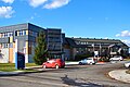
Airport terminal


.Jpg)
Transport and economy
In the eastern part of the urban area runs the Autoroute 15 , the highway between Montreal and Sainte-Agathe-des-Monts . From this the Autoroute 50 branches off , which leads in a westerly direction to Gatineau . The main roads of supraregional importance are Route 117 (Montreal– Mont-Laurier ), Route 148 ( Laval –Gatineau) and Route 158 ( Lachute - Berthierville ). The place Saint-Augustin is on the Montreal – Gatineau railway line, which is currently reserved for the freight traffic of the company Chemins de fer Québec-Gatineau . Several CIT Laurentides bus routes connect the city with the surrounding communities.
Today, Montreal-Mirabel Airport is primarily important for cargo traffic since scheduled air traffic was discontinued in 2004. The airport serves as the production site of the aircraft manufacturer Bombardier Aerospace and the helicopter manufacturer Bell Helicopter , as well as the facility for test flights by Pratt & Whitney Canada .
Town twinning
-
 Châlons-en-Champagne , France, since 2000
Sons and daughters
- Joseph-Eugène Limoges (1879–1965), Roman Catholic clergyman, Bishop of Mont-Laurier, born in Sainte-Scholastique
Web links
- Official Mirabel website (French)
Individual evidence
- ^ Territoire. City of Mirabel, accessed January 27, 2014 (French).
- ↑ Mirabel. Commission de toponymie du Québec, accessed January 27, 2014 (French).
- ↑ Population profile of the municipality of Mirabel. In: 2011 Census. Statistics Canada , 2011, accessed January 27, 2014 (French).
- ↑ Population profile of the municipality of Mirabel. In: 2001 Census. Statistics Canada , 2001, accessed January 27, 2014 (French).