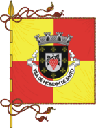
Mondim de Basto
| Mondim de Basto | ||||||
|---|---|---|---|---|---|---|
|
||||||
| Basic data | ||||||
| Region : | Norte | |||||
| Sub-region : | Ave | |||||
| District : | Vila Real | |||||
| Concelho : | Mondim de Basto | |||||
| Coordinates : | 41 ° 25 ′ N , 7 ° 57 ′ W | |||||
| Residents: | 3273 (as of June 30, 2011) | |||||
| Surface: | 15.97 km² (as of January 1, 2010) | |||||
| Population density : | 205 inhabitants per km² | |||||
| Mondim de Basto district | ||||||
|
||||||
| Residents: | 7493 (as of June 30, 2011) | |||||
| Surface: | 172.08 km² (as of January 1, 2010) | |||||
| Population density : | 44 inhabitants per km² | |||||
| Number of municipalities : | 6th | |||||
| administration | ||||||
| Administration address: | Câmara Municipal de Mondim de Basto Largo Conde de Vila Real 4880-236 Mondim de Basto |
|||||
| President of the Câmara Municipal: | Humberto da Costa Cerqueira ( PS ) | |||||
| Website: | municipio.mondimdebasto.pt | |||||
Mondim de Basto is a district ( concelho ) and a vila (small town) in Portugal with 3273 inhabitants (as of June 30, 2011).
history
Finds of ramparts ( Portuguese : Castros ) prove a settlement by Celtiberians until the Romans took the area under Decimus Junius Brutus Callaicus in the 2nd century BC. After the first granting of city rights ( Foral ) by King Sancho I , the place received renewed city rights by Manuel I in 1514 .
In the 18th century, Mondim de Basto became the seat of a newly formed circle due to its regionally known market, its relatively large number of buildings, and its national reputation as a supplier of leather, shoes and tanning materials.
administration
circle
 Mondim de Basto is the seat of a district of the same name. The neighboring areas are (starting clockwise in the north): Ribeira de Pena , Vila Real , Amarante , Celorico de Basto and Cabeceiras de Basto .
The following municipalities ( Freguesias ) are in the Mondim de Basto district:
| local community | Population (2011) |
Area km² |
Density of population / km² |
LAU code |
|---|---|---|---|---|
| Atei | 1,352 | 24.68 | 55 | 170501 |
| Bilhó | 546 | 26.57 | 21st | 170502 |
| Campanhó e Paradança | 721 | 30.03 | 24 | 170509 |
| Ermelo e Pardelhas | 465 | 46.94 | 10 | 170510 |
| Mondim de Basto | 3,273 | 15.97 | 205 | 170505 |
| Vilar de Ferreiros | 1,136 | 27.89 | 41 | 170508 |
| Mondim de Basto district | 7,493 | 172.08 | 44 | 1705 |
Population development
| Population in the Mondim de Basto district (1801–2011) | |||||||||
|---|---|---|---|---|---|---|---|---|---|
| 1801 | 1849 | 1900 | 1930 | 1960 | 1981 | 1991 | 2001 | 2011 | |
| 2725 | 4068 | 7641 | 8398 | 10,328 | 9904 | 9518 | 8573 | 7493 | |
Communal Holidays
- July 25th
Town twinning
economy
The district is considered structurally weak . In 2009, Mondim de Basto was the district with the lowest average wage in Portugal at EUR 616.70 per capita.
The shoe and textile industry, wood processing and quarries are the most important branches of industry in the district, and trade, administration and social institutions are important in the Vila as a middle to upper center . Agriculture, inland fishing and forestry continue to be important in the county.
Web links
- Official website
- Map of the Freguesia Mondim de Basto at the Instituto Geográfico do Exército
Individual evidence
- ↑ www.ine.pt - indicator resident population by place of residence and sex; Decennial in the database of the Instituto Nacional de Estatística
- ↑ a b Overview of code assignments from Freguesias on epp.eurostat.ec.europa.eu
- ↑ www.ine.pt - indicator resident population by place of residence and sex; Decennial in the database of the Instituto Nacional de Estatística
- ↑ www.verportugal.pt , accessed December 30, 2012
- ↑ www.anmp.pt , accessed December 30, 2012
- ↑ www.sol.sapo.pt , accessed December 30, 2012


