Montefortino (brands)
| Montefortino | ||
|---|---|---|

|
|
|
| Country | Italy | |
| region | Brands | |
| province | Fermo (FM) | |
| Coordinates | 42 ° 57 ' N , 13 ° 20' E | |
| height | 638 m slm | |
| surface | 78.3 km² | |
| Residents | 1,108 (Dec. 31, 2019) | |
| Population density | 14 inhabitants / km² | |
| Post Code | 63858 | |
| prefix | 0736 | |
| ISTAT number | 109015 | |
| Popular name | Montefortinesi | |
| Patron saint | Michael | |
| Website | Montefortino | |
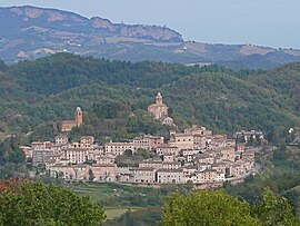
 View of Montefortino |
||
Montefortino (in Fermes dialect: Montefurti ) is an Italian municipality ( comune ) with 1108 inhabitants (as of December 31, 2019) in the province of Fermo in the Marche .
geography
The municipality is located about 41 kilometers southwest of Fermo on the edge of the Monti Sibillini National Park , belongs to the Comunità montana dei Sibillini and borders directly on the provinces of Ascoli Piceno and Macerata . The neighboring communities are Amandola , Bolognola ( MC ), Castelsantangelo sul Nera (MC), Comunanza ( AP ), Montemonaco (AP), Sarnano (MC) and Ussita (MC).
history
The community was already settled in Roman antiquity. The castle complex was built in the 12th century. The place has been an independent municipality since 1084.
Attractions
Web links
Commons : Montefortino - Collection of images, videos and audio files
Individual evidence
- ↑ Statistiche demografiche ISTAT. Monthly population statistics of the Istituto Nazionale di Statistica , as of December 31 of 2019.


