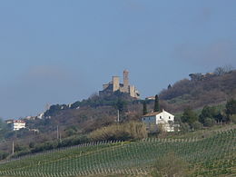
Campofilone
| Campofilone | ||
|---|---|---|

|
|
|
| Country | Italy | |
| region | Brands | |
| province | Fermo (FM) | |
| Coordinates | 43 ° 5 ' N , 13 ° 49' E | |
| height | 202 m slm | |
| surface | 12.11 km² | |
| Residents | 1,934 (Dec. 31, 2019) | |
| Population density | 160 inhabitants / km² | |
| Post Code | 63828 | |
| prefix | 0734 | |
| ISTAT number | 109004 | |
| Popular name | Campofilonesi | |
| Patron saint | Bartholomew | |
| Website | Campofilone | |
Campofilone (in the local dialect: Camfillù , Campfillù or Campufiló ) is an Italian municipality ( comune ) with 1934 inhabitants (as of December 31, 2019) in the province of Fermo in Marche . The municipality is located about 12 kilometers southeast of Fermo on the Adriatic coast and borders the province of Ascoli Piceno . The Aso forms the northern boundary of the municipality .
traffic
Strada Statale 16 Adriatica and the Autostrada A14 (from Bologna to Taranto) run through the municipality along the coastline .
Sons and daughters
- Armando Trasarti (* 1948), Catholic clergyman and bishop of Fano-Fossombrone-Cagli-Pergola
Web links
Commons : Campofilone - collection of images, videos and audio files
Individual evidence
- ↑ Statistiche demografiche ISTAT. Monthly population statistics of the Istituto Nazionale di Statistica , as of December 31 of 2019.


