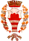
Monterubbiano
| Monterubbiano | ||
|---|---|---|

|
|
|
| Country | Italy | |
| region | Brands | |
| province | Fermo (FM) | |
| Coordinates | 43 ° 5 ' N , 13 ° 43' E | |
| height | 463 m slm | |
| surface | 32.1 km² | |
| Residents | 2,142 (Dec. 31, 2019) | |
| Population density | 67 inhabitants / km² | |
| Post Code | 63825 | |
| prefix | 0734 | |
| ISTAT number | 109022 | |
| Popular name | Monterubbianesi | |
| Patron saint | Nicholas of Tolentino | |
| Website | Monterubbiano | |
Monterubbiano (in the local dialect: Muntrubbià ) is an Italian municipality ( comune ) with 2142 inhabitants (as of December 31, 2019) in the province of Fermo in Marche . The municipality is located about 8.5 kilometers south of Fermo . The Aso forms the southern municipal boundary .
history
The Picenians settled here in the 9th to 3rd centuries BC. From 268 BC to around 1200 AD, it was an independent city or municipality that was destroyed by the Goths in the 5th century.
Parish partnership
Monterubbiano has a partnership with the UK Winster in Derbyshire .
Personalities
- Temistocle Calzecchi-Onesti (1853-1922), physicist
- Angelo Fagiani (1943–2020), Archbishop of Camerino-San Severino Marche
Web links
Commons : Monterubbiano - Collection of images, videos and audio files
Individual evidence
- ↑ Statistiche demografiche ISTAT. Monthly population statistics of the Istituto Nazionale di Statistica , as of December 31 of 2019.


