Montemurlo
| Montemurlo | ||
|---|---|---|

|
|
|
| Country | Italy | |
| region | Tuscany | |
| province | Prato (PO) | |
| Coordinates | 43 ° 56 ' N , 11 ° 2' E | |
| height | 73 m slm | |
| surface | 30.66 km² | |
| Residents | 19.006 (Dec. 31, 2019) | |
| Population density | 620 inhabitants / km² | |
| Post Code | 59013 | |
| prefix | 0574 | |
| ISTAT number | 100003 | |
| Patron saint | Esaltazione della Croce (May 3rd) | |
| Website | Montemurlo | |
 Panorama of Montemurlo |
||
Montemurlo is an Italian municipality with 19,006 inhabitants (as of December 31, 2019) in the province of Prato , in the Tuscany region .
geography
The city of Montemurlo is located about 25 kilometers northwest of the regional capital Florence and 8 kilometers northwest of the provincial capital Prato . The area is 30.7 km². The place is in the climatic classification of Italian communities in zone D, 1 792 GG.
The neighboring municipalities are Agliana ( PT ), Cantagallo , Montale (PT), Prato and Vaiano .
Demographics

Attractions
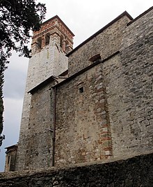
- Pieve di San Giovanni Decollato , Pieve from the 11th century with works by Matteo Rosselli , Francesco Granacci and Jan van der Straet (Giovanni Stradano).
- Oratorio di San Girolamo e Santa Maria Maddalena de 'Pazzi , contains frescoes by Jan van der Straet.
Town twinning
Montemurlo maintains the following cities partnerships :
Sons and daughters of the church
- Umberto Brunelleschi (1879–1949), artist, graphic designer, costume designer and illustrator
- Aldo Bini (1915–1993), racing cyclist
literature
- Emanuele Repetti: MONTE MURLO, o MONTEMURLO nella Valle dell'Ombrone pistojese. In: Dizionario Geografico Fisico Storico della Toscana (1833–1846), online edition of the University of Siena (PDF, Italian)
Web links
Commons : Montemurlo - collection of images, videos and audio files
Individual evidence
- ↑ Statistiche demografiche ISTAT. Monthly population statistics of the Istituto Nazionale di Statistica , as of December 31 of 2019.
- ↑ Website of the Agenzia nazionale per le nuove tecnologie, l'energia e lo sviluppo economico sostenibile (ENEA), accessed on November 2, 2015 (Italian) (PDF; 330 kB)


