Mount Horeb
| Mount Horeb | ||
|---|---|---|
 Municipal Building in Mount Horeb |
||
| Location in Wisconsin | ||
|
|
||
| Basic data | ||
| Foundation : | 1867 | |
| State : | United States | |
| State : | Wisconsin | |
| County : | Dane County | |
| Coordinates : | 43 ° 1 ′ N , 89 ° 44 ′ W | |
| Time zone : | Central ( UTC − 6 / −5 ) | |
|
Inhabitants : - Metropolitan Area : |
7,009 (status: 2010) 568,593 (status: 2010) |
|
| Population density : | 832.4 inhabitants per km 2 | |
| Area : | 8.42 km 2 (approx. 3 mi 2 ) | |
| Height : | 380 m | |
| Postal code : | 53572 | |
| Area code : | +1 608 | |
| FIPS : | 55-54725 | |
| GNIS ID : | 1569817 | |
| Website : | www.mounthorebwi.info | |
| Mayor : | David Becker (President) | |
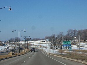
 Entrance to Mount Horeb |
||
Mount Horeb is a municipality (with the status " Village ") in Dane County in the US -amerikanischen State Wisconsin . In 2010 , Mount Horeb had 7,009 residents.
Mount Horeb is part of the Madison metropolitan area .
geography
Mount Horeb is located in south-central Wisconsin, in the south-western suburb of the capital, Madison . The intersection of the three states of Wisconsin, Iowa and Illinois is located on the Mississippi and lies 108 km west-southwest.
The geographical coordinates of Mount Horeb are 43 ° 00'31 "north latitude and 89 ° 44'18" west longitude. Mount Horeb covers an area of 8.42 km².
The center of Madison is 33.2 km east-northeast. Other neighboring towns are Black Earth (16.4 km north), Cross Plains (16.8 km northeast), Verona (18.2 km east), Blue Mounds (8.3 km west) and Vermont (12 km north-northwest).
The nearest major cities are Green Bay (265 km northeast), Milwaukee (169 km east), Chicago (255 km southeast), and Rockford (126 km southeast).
traffic
US Highways 18 and 151 run along the southern outskirts on a shared four-lane section . Wisconsin State Highways 78 runs through the town center in a north-south direction . All other roads are subordinate country roads, some unpaved roads and inner-city connecting roads.
The Ice Age National Scenic Trail , a long-distance hiking trail belonging to the National Scenic Trails, and the Military Ridge State Trail, a rail trail for hikers and cyclists on the route of a former railway line of the Chicago and North Western Railway , leads through the urban area . In winter, the hiking trail can also be used with snowmobiles.
The nearest airport is Dane County Regional Airport in Madison (47.2 km east-northeast).
population
According to the 2010 census , Mount Horeb lived 7,009 people in 2,696 households. The population density was 832.4 people per square kilometer. Statistically, 2.56 people lived in each of the 2,696 households.
The racial the population was composed of 96.0 percent white, 0.8 percent African American, 0.2 percent Native American, 0.6 percent Asian and 0.5 percent from other ethnic groups; 1.8 percent were descended from two or more races. Hispanic or Latino of any race was 1.7 percent of the population.
29.5 percent of the population were under 18 years old, 59.1 percent were between 18 and 64 and 11.4 percent were 65 years or older. 52.1 percent of the population was female.
The average annual income for a household was 67,063 USD . The per capita income was $ 28,853. 6.9 percent of the population lived below the poverty line.
Known residents
- Herman Bjorn Dahle (1855–1920) - Member of the US House of Representatives (1899–1903) - died in Mount Horeb
Individual evidence
- ↑ a b American Fact Finder. Retrieved November 28, 2013
- ↑ Distance information according to Google Maps. Accessed on November 28, 2013
- ^ Wisconsin Department of Natural Resources - Ice Age National Scenic Trail.Retrieved November 28, 2013
- ^ Wisconsin Department of Natural Resources - Military Ridge State Trail. Retrieved November 28, 2013
- ^ Biographical Directory of the United States Congress - Herman Bjorn Dahle.Retrieved November 28, 2013
- ^ Find a Grave - Herman Bjorn Dahle.Retrieved November 28, 2013
