Cerro Celaque National Park
| Cerro Celaque National Park | ||
|---|---|---|
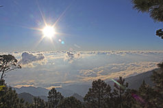
| Sunrise at Cerro Las Minas | ||
|
|
||
| Location: | Honduras | |
| Surface: | 266.31 km² | |
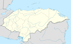
The National Park Celaque ( Spanish : Parque Nacional Montaña de Celaque ) is a national park in the departments of Lempira , Ocotepeque and Copán in western Honduras . The word "celaque" is said to come from the Lenca language and means something like "water box".
Geography, location and description
The national park covers an area of 26,631 ha . In addition to Cerro Las Minas , the highest mountain in Honduras (2,849 meters), Pico Celaque (2,780 meters) is also located in the nature reserve that extends between 975 and 2,849 meters in altitude. Two thirds of the area have an incline of more than 60 degrees and consists of mountains, plateaus and cloud forest . The mountain range offers a varied flora and topography . The Cerro las Minas is surrounded by seven other peaks, which together form a plain from which twelve rivers arise. Worth mentioning are the rivers Arcagual , Blanco, Cospa, Aruco, Grande, Mocal, Negro, which flow partly towards the Atlantic and partly towards the Pacific .
The North American Continental Divide runs through the park .
history
The area was mentioned by the Spaniards in colonial times. In addition, it was and is the habitat of some indigenous people , such as the Lencas , whose language is considered to be as good as extinct. The natural resources of the national park are mainly threatened by population growth and land use pressure , the settlements in and around the park, some of which were already located there in pre-Columbian times. Land use pressure through small-scale agricultural activities, such as bananas - and coffee - plantations led to a variety of slash and burn at high altitudes in the region. The consequences were increased soil erosion , a loss of biological diversity and the livelihoods of the indigenous people there .
The residents of La Campa, a town near the park, formed a grassroots organization to try to stop deforestation . Their goal was achieved in 1987 when the National Congress of Honduras declared the celaque a national park. The national park was proclaimed on August 5, 1987 by Decree No. 87-87. The creation of the park protected around 266 square kilometers on a national level from deforestation , agriculture, external invasion and market-related forest activities.
Co-management
In 2007, the eleven municipalities in and around the park (Comité Local de Áreas Protegidas) and who had signed the co-management agreement decided to improve the coordination for the development of measures in a framework agreement and to legalize it In 2008 the municipal association Mancomunidad de Municipios del Parque Nacional Montaña de Celaque , supported by the GIZ project Prorena (Programa de Fomento al Manejo Sostenible de los Recursos Naturales y Desarollo Económico Local) and the Instituto de Conservación Forestal. Of the eleven municipalities involved, five have territorial shares in the national park and six others benefit indirectly from environmental goods and services, such as B. the water that flows through the rivers out of the national park.
In 2009, the National Congress of Honduras (Congreso Nacional de Honduras) decided on the Procelaque Act on the Promotion and Protection of the Celaque National Park (Decreto 57-2009, Ley de Fomento y Protección del Parque Nacional Montaña de Celaque) that Mapance as the authority was responsible for the protection, management and development of the national park and would be financed by the state. As the executive body of the state for the National System of Protected Areas of Honduras (Sistema Nacional de Áreas Protegidas de Honduras), the ICF assigned the co-management of the park to Mapance .
flora
The diversity of plants is high. The vegetation consists of large conifers, shrubs and grasses that serve as habitats for other species, especially ferns , mosses , bromeliads and orchids . So-called elven forests can be found at altitudes between 1500 and 2500 meters .
So far, three endemic species have been identified, the arial family Oreopanax lempiranus , the red family Rondeletia evansii and Miconia celaquensis .
fauna
The largest occurring in mammals are deer , ocelots , peccaries and coatis and rare pumas and jaguars . The variety of birds is great: woodpeckers, parakeets, toucans and endangered species such as the quetzal . Some endemic species existed there, such as the salamander species : Bolitoglossa celaque , two amphibian species: Leptodactylus silvanimbus and Crougastor anciano , the shrew species : Cryptotis hondurensis , Sorex mccarthyi and Cryptotis celaque, and the beetle species Chrysina pastori .
tourism
Official access to the National Park and the Visitor Center is 8 km from the town of Gracias (Lempira Department). Another official access is planned from El Naranjo . There are other approaches via unmarked paths from San Manuel Colohete , Belén Gualcho and Corquín .
There are more than 30 km of hiking trails from the visitor center . The park has five routes: La Ventana, Liquidámbar, El Gallo, Mirador de la Cascada y Camino al Cielo (which also leads to Cerro las Minas). There are three covered camps on the hiking trails.
present
Due to agricultural interventions mainly in the southern and western part of the mountain, Monte de la Virgen , Belén Gualcho and some villages such as Malcincales, Chimis, Azaharillo, El Cedro and Río Negro, the buffer zone was increasingly degraded by cutting down trees that these communities had surrounded directly. The situation in the village of Chimis is alarming, where farmers have even cut down trees in the core zone.
In the area around Azaharillo, local authorities have given permission to build roads to transport coffee from the fincas in this region . The same is true in Belén Gualcho, where officials, with the intention of developing the Lenca people, authorized the construction of roads and paths to extract the wood from the pine forests of the sector in the buffer zone.
In 1999, Hurricane Mitch hit the national park, killing several people and destroying numerous houses. Three villages had to be abandoned.
Say
There are many legends and fairy tales in and around the park . For example, it is said that if you get fruit from the trees with the intention of eating it outside of the mountain, you will not find your way back. Or that there is a lake on the summit where a rooster made of gold crows and from which you can take boiling tamales . Furthermore, storytellers from these villages spread that the chief Lempira sometimes strolls along the flanks of the mountain, the chief who led the last battle of the Maya against the Spanish conquistadors , and whose luck in the battle was not in good shape at the time.
Web links
supporting documents
- ↑ Description of the Celaque Park on honduras.com (engl.)
- ↑ Lencas in Celaque Park (.pdf pages 6 - 13) (engl.)
- ↑ Prorena at GIZ ( Memento of the original from January 21, 2016 in the Internet Archive ) Info: The archive link was inserted automatically and has not yet been checked. Please check the original and archive link according to the instructions and then remove this notice.
- ↑ Fauna and flora in Celaque Park (engl.)
- ↑ Camping information


