Neded
| Neded | ||
|---|---|---|
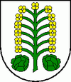
| coat of arms | map | |

|
|
|
| Basic data | ||
| State : | Slovakia | |
| Kraj : | Nitriansky kraj | |
| Okres : | Aľa | |
| Region : | Dolné Považie | |
| Area : | 36.009 km² | |
| Residents : | 3,223 (Dec. 31, 2019) | |
| Population density : | 90 inhabitants per km² | |
| Height : | 111 m nm | |
| Postal code : | 925 85 | |
| Telephone code : | 0 31 | |
| Geographic location : | 48 ° 1 ′ N , 17 ° 58 ′ E | |
| License plate : | SA | |
| Kód obce : | 503932 | |
| structure | ||
| Community type : | local community | |
| Administration (as of November 2018) | ||
| Mayor : | Henrieta Selmecziová | |
| Address: | Obecný úrad Neded Hlavná 844 925 85 Neded |
|
| Website: | www.neded.sk | |
| Statistics information on statistics.sk | ||
Neded (Hungarian Negyed ) is a municipality in western Slovakia . It is located in the Danube lowlands on the right bank of the Váh , 14 kilometers from Kolárovo and 17 kilometers from Šaľa .
The place was first mentioned as Niget in 1113 .
Until 1918 the place in Neutra County belonged to the Kingdom of Hungary , then came to the newly formed Czechoslovakia, but became part of Hungary again due to the First Vienna Arbitration from 1938 to 1945 . Since 1993 it has been part of today's Slovakia. In 1954, parts of the municipality were assigned to the newly formed municipality Dedina Mládeže , which lies south downstream .
In the village there is a church of St. Michael the Archangel from 1780.
The station was closed around 1990 and is only used for seasonal traffic. There are plans to reopen the line to Šaľa and to get newer trains. The line is to be electrified. Are as trains Stadler Flirt 3 run.

