Dedina Mládeže
| Dedina Mládeže | ||
|---|---|---|
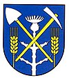
| coat of arms | map | |

|
|
|
| Basic data | ||
| State : | Slovakia | |
| Kraj : | Nitriansky kraj | |
| Okres : | Komarno | |
| Region : | Podunajsko | |
| Area : | 12.781 km² | |
| Residents : | 448 (Dec. 31, 2019) | |
| Population density : | 35 inhabitants per km² | |
| Height : | 110 m nm | |
| Postal code : | 946 03 ( Kolárovo post office ) | |
| Telephone code : | 0 35 | |
| Geographic location : | 47 ° 57 ′ N , 18 ° 0 ′ E | |
| License plate : | KN | |
| Kód obce : | 501107 | |
| structure | ||
| Community type : | local community | |
| Structure of the municipality: | 2 parts of the community | |
| Administration (as of November 2018) | ||
| Mayor : | Gabriela Gönczölová | |
| Address: | Obecný úrad Dedina Mládeže Námestie 4th apríla 8 94603 Dedina Mládeže |
|
| Website: | www.dedinamladeze.sk | |
| Statistics information on statistics.sk | ||
Dedina Mládeže (Hungarian Ifjúságfalva , literally "Village of Youth") is a municipality in western Slovakia . It is located in the Danube lowlands on the right bank of the Waag , 5 km north of the city of Kolárovo .
The place was founded on April 4, 1949 by young volunteers who built the “ Tra Mládeže ” ( Trať Mládeže ) as Družstevná . After it was initially in the area of the city of Kolárovo and parts of the municipal areas of Komoča , Neded and Zemné , the municipality became independent as Dedina Mládeže in 1954 and was to serve as a model in the course of the collectivization of agriculture in the countryside.
In addition to the main town, the municipality also includes the northern settlement of Malý Ostrov ( Kissziget in Hungarian ).

