Hurbanovo
| Hurbanovo | ||
|---|---|---|
| coat of arms | map | |

|
|
|
| Basic data | ||
| State : | Slovakia | |
| Kraj : | Nitriansky kraj | |
| Okres : | Komarno | |
| Region : | Podunajsko | |
| Area : | 59.943 km² | |
| Residents : | 7,397 (Dec. 31, 2019) | |
| Population density : | 123 inhabitants per km² | |
| Height : | 115 m nm | |
| Postal code : | 947 01 | |
| Telephone code : | 0 35 | |
| Geographic location : | 47 ° 53 ' N , 18 ° 12' E | |
| License plate : | KN | |
| Kód obce : | 501140 | |
| structure | ||
| Community type : | city | |
| Urban area structure: | 7 districts | |
| Administration (as of November 2018) | ||
| Mayor : | Peter Závodský | |
| Address: | Mestský úrad Hurbanovo Komárňanská 91 94701 Hurbanovo |
|
| Website: | www.hurbanovo.sk | |
| Statistics information on statistics.sk | ||
Hurbanovo (until 1948 in Slovak "Stará Ďala"; German Altdala , Hungarian Ógyalla ) is a town in Slovakia in Nitriansky kraj .
geography
The city is located at an altitude of 115 m above sea level. and covers an area of 59,943 km². Hurbanovo is located in the climatically warmest area of the Danube Plain to the left of the Žitava River, about 12 km south of Nové Zámky and 15 km north of Komárno .
climate
| Hurbanovo | ||||||||||||||||||||||||||||||||||||||||||||||||
|---|---|---|---|---|---|---|---|---|---|---|---|---|---|---|---|---|---|---|---|---|---|---|---|---|---|---|---|---|---|---|---|---|---|---|---|---|---|---|---|---|---|---|---|---|---|---|---|---|
| Climate diagram | ||||||||||||||||||||||||||||||||||||||||||||||||
| ||||||||||||||||||||||||||||||||||||||||||||||||
|
Average monthly temperatures and rainfall for Hurbanovo
|
|||||||||||||||||||||||||||||||||||||||||||||||||||||||||||||||||||||||||||||||||||||||||||||||||||||||||
population
The number of inhabitants is 8,132. Of these, 50.19% are of Hungarian, 45.52% of Slovak and 0.7% of Czech descent. Another 2.56% belong to the Roma ethnic group, but the actual proportion is significantly higher.
Population development
| year | total | Hungary | Slovaks | Gypsies |
|---|---|---|---|---|
| 1910 | 2585 | 2536 (98.1%) | - | - |
| 1921 | 3025 | 2041 (67.5%) | 765 (25.9%) | 78 (2.6%) |
| 2001 | 8153 | 4092 (50.2%) | 3,177 (45.5%) | 302 (3.7%) |
religion
Religious affiliation in 2001 was:
Districts
The 2 places are divided into 7 parts of the municipality:
- Hurbanovo ( Ógyalla ) - 40.85 km²
- Holanovo ( Hambpuszta )
- Hurbanovo ( Ógyalla )
- Konkol ( Nagykonkoly )
- Vík ( Vékpuszta )
- Zelený Háj ( Zöldállás )
- Bohatá ( Bagota ) - 19.09 km² (incorporated in 1971)
- Bohatá ( Bagota )
- Nová Trstená ( Margitpuszta )
history
The city was first mentioned as Gyalla in 1357 and then later bore the Hungarian name Ógyalla until 1920
In the Kingdom of Hungary , the city belonged to the Comorner County . Ógyalla was the administrative seat of the Udvard chair district .
In January 1919 the city was occupied by the troops of the newly formed Czechoslovakia and in 1920 it was officially given the Slovak name Stará Ďala . In the 1920s, the settlement of Slovak settlers created the Zelený Háj colony .
As a result of the First Vienna Arbitration , it was once again part of Hungary as Ógyalla from 1938 to 1945 . The town was founded in 1948 in honor of the Slovak writer Jozef Miloslav Hurban in Hurbanovo renamed.
On July 9, 2010, the Hungarian-born politician Ladislav Basternák (Hungarian also László Basternák , member of the Hungarian coalition party ), the former mayor of the town, was murdered in the town.
On June 16, 2012, 51-year-old police chief Milan Juhász from neighboring Svätý Peter ran amok in Hurbanovo, killing 3 people. After the crime, he holed up in front of the house of the mayor Margita Zemková , who was not at home at the time , until he was arrested .
Attractions
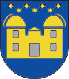
- Hurbanovo Observatory : Among other things, Hurbanovo is known for its astronomical observatory , which was founded in 1871 by Miklós Konkoly-Thege - initially as a private observatory . Today this oldest observatory in Slovakia is run as a people's observatory. The city's coat of arms shows the observatory in schematic form.
Other historical monuments include:
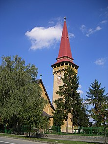
- the Catholic Church of St. Ladislaus
- the reformed church
- the classical mansion
- the hunting lodge
- the Catholic Church of Saint Anne in Bohata
economy
The Zlatý Bažant brewery (in German "Golden Pheasant"), which belongs to the Heineken Group (Heineken Slovensko as), is located in Hurbanovo . Other companies are Nuritech Slovensko sro (a sister company of Samsung ), DS Smith Slovakia (plastic) , Namex sro (food), Terbo sro (manufacturer of plastic packaging), Joalko a Jatka Hurbanovo sro
The factory of the bicycle manufacturer Kenzel is located in Bohata .
traffic
The Hurbanovo station is on the Komárom – Nové Zámky railway line . There are also buses to Nove Zámky and Komárno .
Personalities
sons and daughters of the town
- Besse János Károly (1765–1841), Hungarian researcher
- Mór Jókai (1825–1904), Hungarian writer and journalist
- Árpád Feszty (1856–1914), Hungarian painter
- Jozef Malovec (1933–1998), Slovak composer
- Gabriela Dudeková (* 1968), historian
Acted on site
- Miklós Konkoly-Thege (1842–1916), Hungarian astronomer
See also
Web links
- Official site of the city
- Slovenská ústredná hvezdáreň (observatory)
- Observatory in Hurbanovo (VisitSlovakia)


