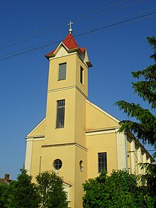
Zlatná na Ostrove
| Zlatná na Ostrove | ||
|---|---|---|
| coat of arms | map | |

|
|
|
| Basic data | ||
| State : | Slovakia | |
| Kraj : | Nitriansky kraj | |
| Okres : | Komarno | |
| Region : | Podunajsko | |
| Area : | 35.310 km² | |
| Residents : | 2,364 (Dec. 31, 2019) | |
| Population density : | 67 inhabitants per km² | |
| Height : | 120 m nm | |
| Postal code : | 946 12 | |
| Telephone code : | 0 36 | |
| Geographic location : | 47 ° 46 ' N , 17 ° 58' E | |
| License plate : | KN | |
| Kód obce : | 501425 | |
| structure | ||
| Community type : | local community | |
| Structure of the municipality: | 3 parts of the community | |
| Administration (as of November 2018) | ||
| Mayor : | Eva Varjúová | |
| Address: | Obecný úrad Zlatná na Ostrove Školská 184 946 12 Zlatná na Ostrove |
|
| Statistics information on statistics.sk | ||
Zlatná na Ostrove (German Golddorf , Hungarian Csallóközaranyos - until 1907 Aranyos ) is a place and a municipality in the Okres Komárno of the Nitriansky kraj in southwest Slovakia , with 2364 inhabitants (December 31, 2019) .
geography
The municipality is located in the south- eastern part of the Great Schüttinsel , a river island of the Danube , which flows immediately south and forms the state border between Slovakia and Hungary. This makes it part of the Slovakian Danube lowlands . In addition to the mainland, the municipality also has a river island ( Veľkolélsky ostrov ) in the Danube, which is also protected by law as part of the Dunajské luhy landscape protection area . Zlatná na Ostrove is 11 kilometers away from Komárno .
Administratively, the municipality is divided into the municipality parts Horná Zlatná (Hungarian Felaranyos ), Veľký Lél (incorporated in 1873, Hungarian Nagylél ) and Zlatná na Ostrove.
history
The place was first mentioned in writing in 1094 as Locus Aureus . The name refers to the earlier gold panning on the Danube.

